MyTopo
Sisseton South Dakota US Topo Map
Couldn't load pickup availability
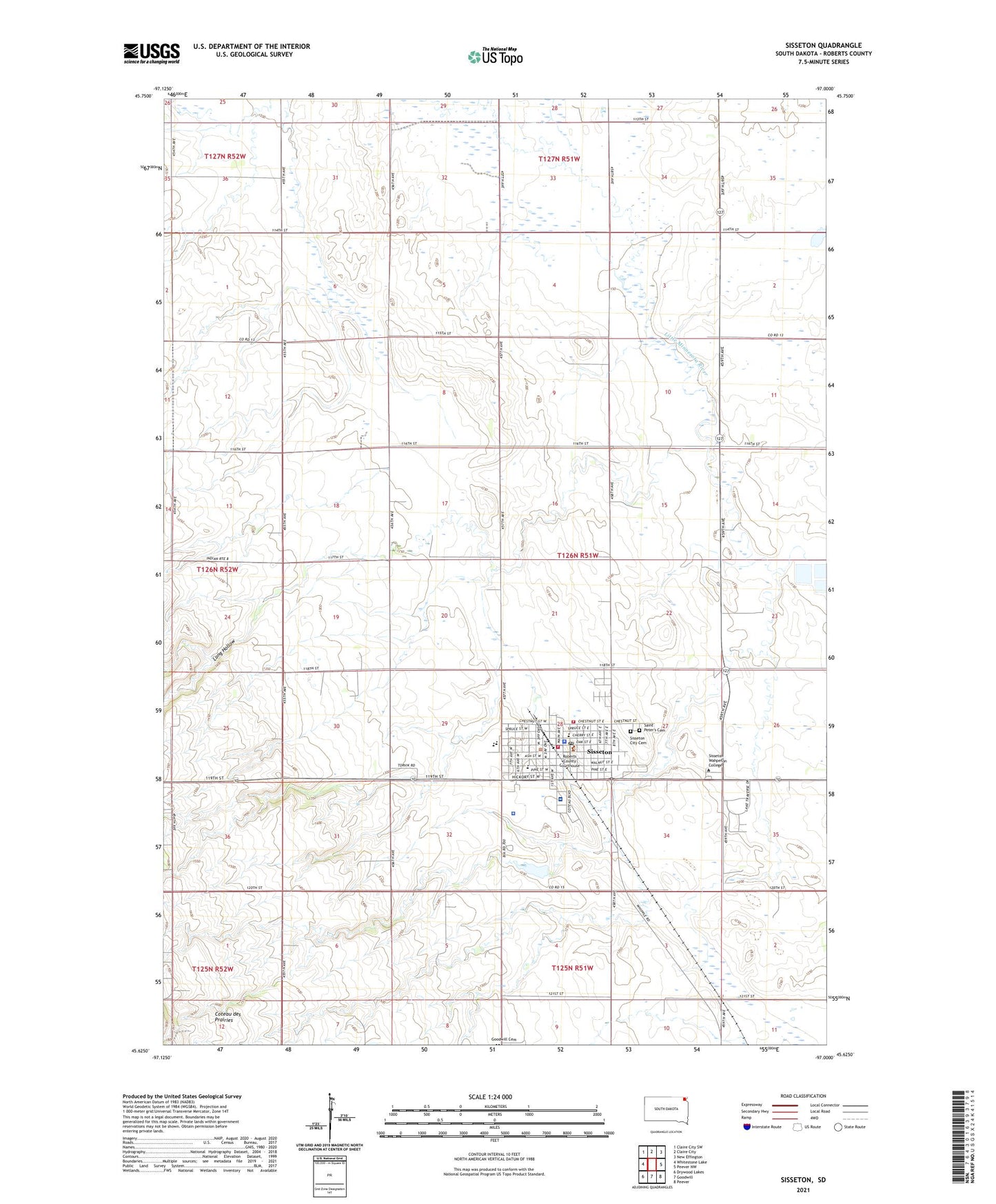
2021 topographic map quadrangle Sisseton in the state of South Dakota. Scale: 1:24000. Based on the newly updated USGS 7.5' US Topo map series, this map is in the following counties: Roberts. The map contains contour data, water features, and other items you are used to seeing on USGS maps, but also has updated roads and other features. This is the next generation of topographic maps. Printed on high-quality waterproof paper with UV fade-resistant inks.
Quads adjacent to this one:
West: Whitestone Lake
Northwest: Claire City SW
North: Claire City
Northeast: New Effington
East: Peever NW
Southeast: Peever
South: Goodwill
Southwest: Drywood Lakes
This map covers the same area as the classic USGS quad with code o45097f1.
Contains the following named places: City of Sisseton, Coteau des Prairies Hospital, Episcopal Indian Church, Grant - Roberts Ambulance Service Sisseton, Lake Traverse Reservation, Long Hollow, Roberts County Courthouse, Roberts County Jail, Roberts County Sheriff's Office, Saint Peter's Cemetery, Saint Peters School, Saron Church, School Number 2, Sisseton, Sisseton - Wahpeton - Oyate Wildland Firefighters, Sisseton City Cemetery, Sisseton City Hall, Sisseton Fire Department, Sisseton High School, Sisseton Memorial Library, Sisseton Middle School, Sisseton Police Department, Sisseton Post Office, Sisseton Public Health Service Hospital, Tekakwitha Dam, Township of Sisseton, Union District School, Valley View Estates, Westside Elementary School, ZIP Code: 57262