MyTopo
Pierre South Dakota US Topo Map
Couldn't load pickup availability
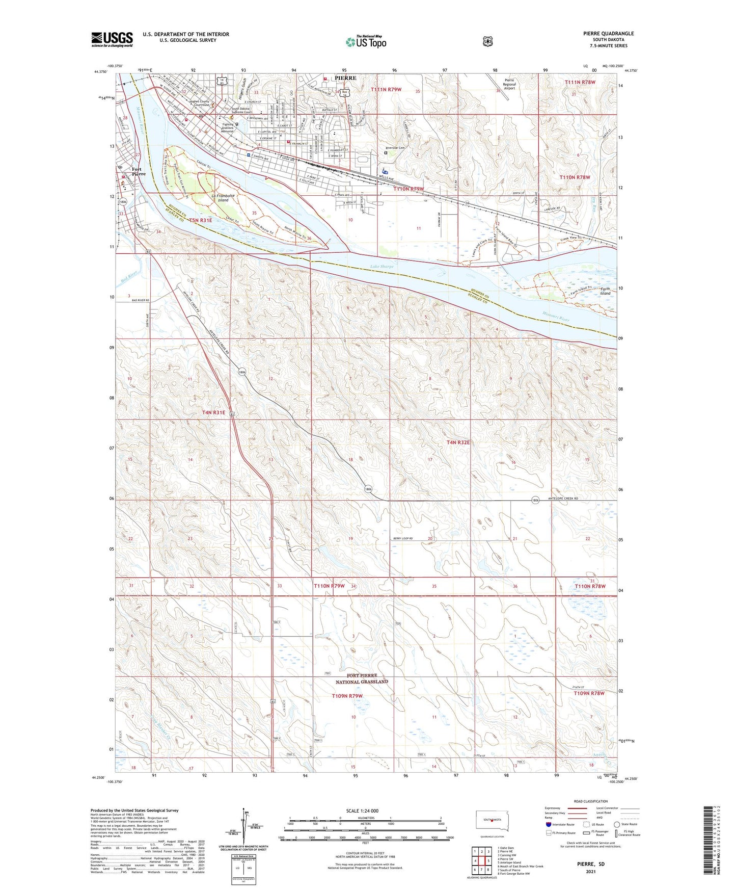
2021 topographic map quadrangle Pierre in the state of South Dakota. Scale: 1:24000. Based on the newly updated USGS 7.5' US Topo map series, this map is in the following counties: Stanley, Hughes. The map contains contour data, water features, and other items you are used to seeing on USGS maps, but also has updated roads and other features. This is the next generation of topographic maps. Printed on high-quality waterproof paper with UV fade-resistant inks.
Quads adjacent to this one:
West: Pierre SW
Northwest: Oahe Dam
North: Pierre NE
Northeast: Canning NW
East: Antelope Island
Southeast: Fort George Butte NW
South: South of Pierre
Southwest: Mouth of East Branch War Creek
Contains the following named places: American Medical Response, Avera Saint Marys Healthcare Hospital, Bad River, Buchanan Elementary School, Capitol Protective Services, City of Pierre, Dry Run, Farm Island, Farm Island Recreation Area, Fighting Stallions Memorial, Fort LaFramboise Number One, Fort Pierre, Fort Pierre Post Office, Fort Pierre Volunteer Fire Department, Fort Sully, Fort Teton, Georgia Morse Middle School, Griffin Park, Hilgers Gulch, Hughes County Courthouse, Hughes County Sheriff, Joe Schomer 1 Dam, Joe Schomer 2 Dam, KCCR-AM (Pierre), KGFX-AM (Pierre), La Framboise Island, Le Framboise Island Recreation Area, Lincoln School, Marion Island, McKinley Elementary School, Museum of the South Dakota State Historical Society, Pierre, Pierre Bridge, Pierre City Hall, Pierre Fire Department Station 2, Pierre Fire Department Station 4, Pierre Indian School, Pierre Main Fire Station, Pierre Marina Recreational Area, Pierre Police Department, Pierre Post Office, Rawlins Municipal Library, Red Plum Dam, Riverside Cemetery, Saint Joseph School, Saint Peter and Paul Catholic Church Cemetery, South Dakota Cultural Heritage Center, South Dakota Highway Patrol District 4 Headquarters, South Dakota Highway Patrol District 9 - State Headquarters, South Dakota National Guard Museum, South Dakota State Archives, South Dakota State Capitol, South Dakota State Library, South Dakota Women's Prison, Stanley County Courthouse, Stanley County Elementary School, Stanley County High School, Stanley County Middle School, Stanley County Sheriff, Sublette and Campbell Post, T F Riggs High School, Verendrye Museum, Washington Elementary School