MyTopo
Fort George Butte NW South Dakota US Topo Map
Couldn't load pickup availability
Also explore the Fort George Butte NW Forest Service Topo of this same quad for updated USFS data
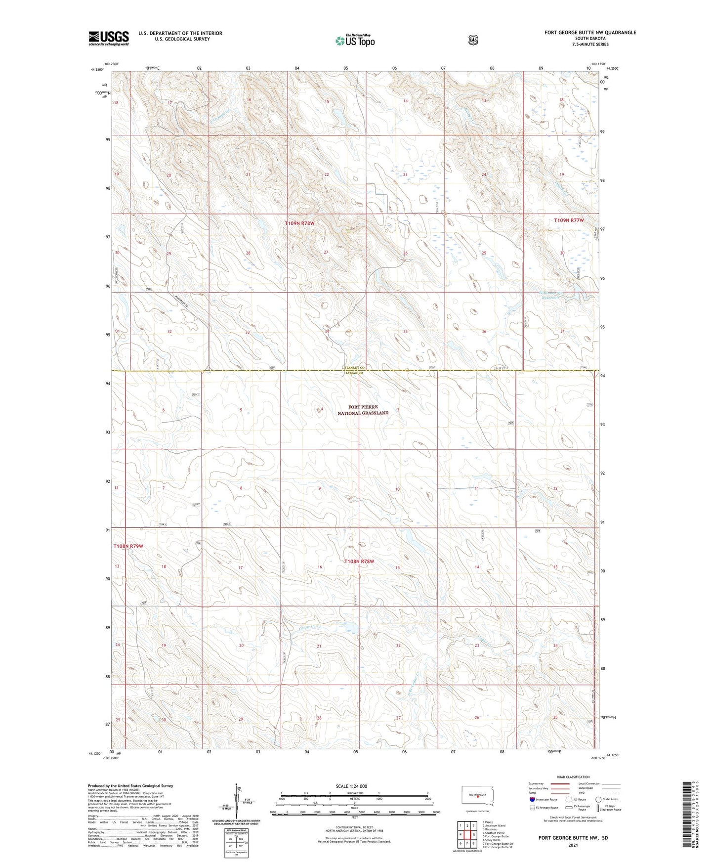
2021 topographic map quadrangle Fort George Butte NW in the state of South Dakota. Scale: 1:24000. Based on the newly updated USGS 7.5' US Topo map series, this map is in the following counties: Lyman, Stanley. The map contains contour data, water features, and other items you are used to seeing on USGS maps, but also has updated roads and other features. This is the next generation of topographic maps. Printed on high-quality waterproof paper with UV fade-resistant inks.
Quads adjacent to this one:
West: South of Pierre
Northwest: Pierre
North: Antelope Island
Northeast: Rousseau
East: Fort George Butte
Southeast: Fort George Butte SE
South: Fort George Butte SW
Southwest: Stony Butte
This map covers the same area as the classic USGS quad with code o44100b2.
Contains the following named places: Cedar Valley School, Nels Dam, Nels Reservoir, South Branch Cedar Creek, Township of Gas Belt, Township of McClure, Unorganized Territory of McClure, Williams 783 Dam, Williams 783 Reservoir, Williams Number 3 Dam, Williams Number 3 Reservoir