MyTopo
Redig South Dakota US Topo Map
Couldn't load pickup availability
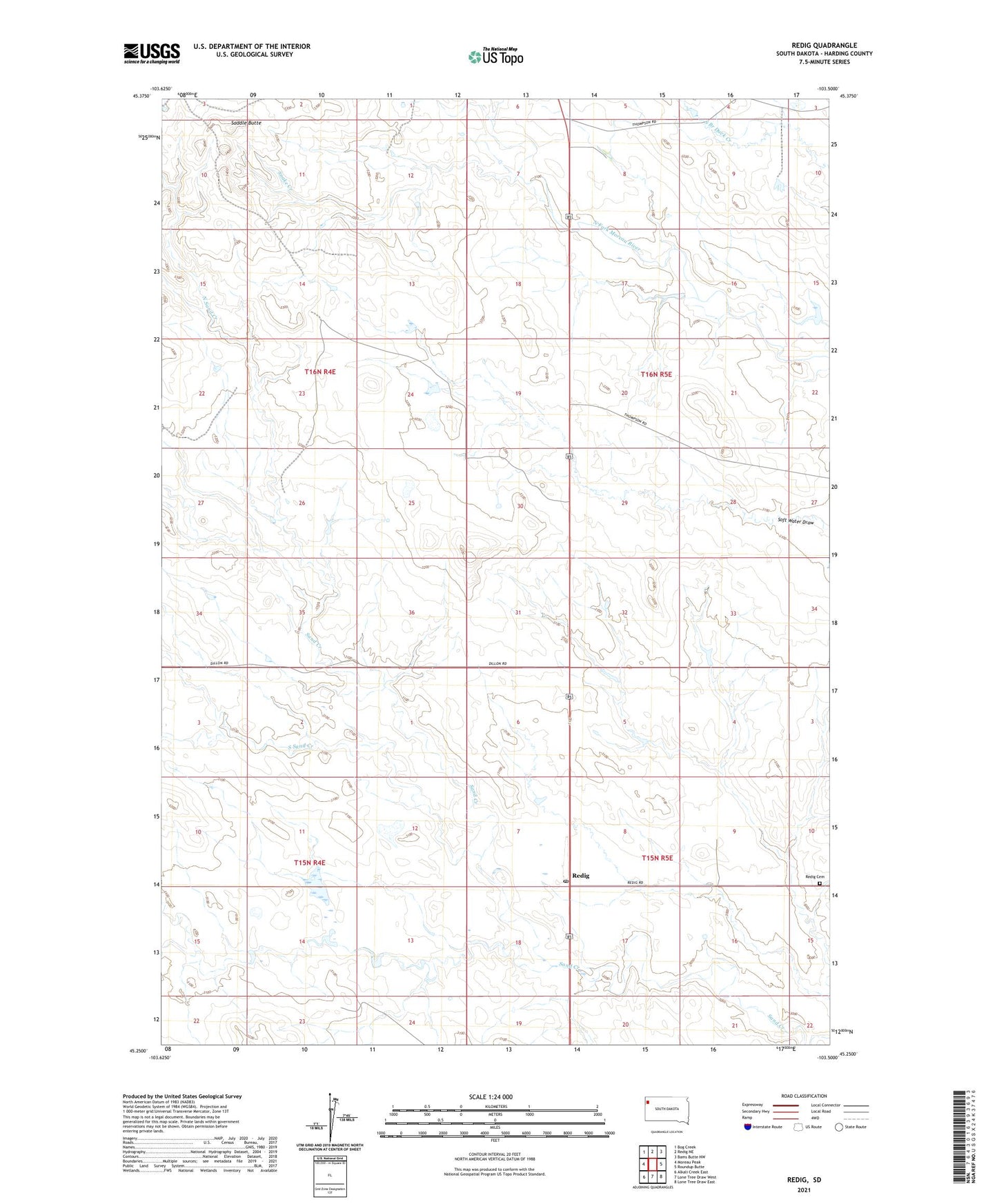
2021 topographic map quadrangle Redig in the state of South Dakota. Scale: 1:24000. Based on the newly updated USGS 7.5' US Topo map series, this map is in the following counties: Harding. The map contains contour data, water features, and other items you are used to seeing on USGS maps, but also has updated roads and other features. This is the next generation of topographic maps. Printed on high-quality waterproof paper with UV fade-resistant inks.
Quads adjacent to this one:
West: Moreau Peak
Northwest: Bog Creek
North: Redig NE
Northeast: Bams Butte NW
East: Roundup Butte
Southeast: Lone Tree Draw East
South: Lone Tree Draw West
Southwest: Alkali Creek East
Contains the following named places: Lloyd Fox Dam Number 3, North Sand Creek, Redig, Redig Cemetery, Redig Post Office, Redig School, Saddle Butte, Snake Creek, South Sand Creek, Ted Matson Dam, Township of Lone Tree, Ward Vanhorn Dam