MyTopo
Roundup Butte South Dakota US Topo Map
Couldn't load pickup availability
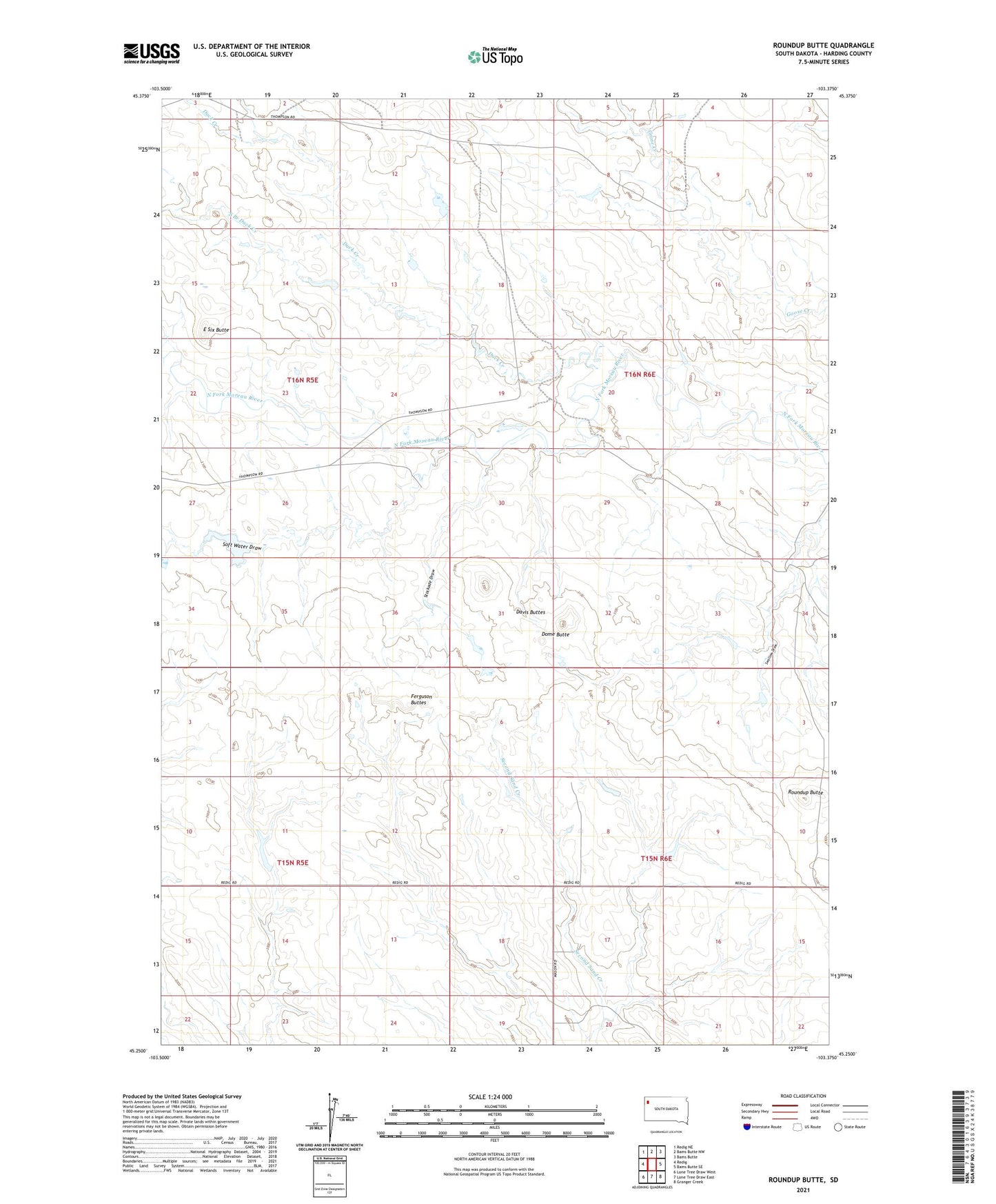
2021 topographic map quadrangle Roundup Butte in the state of South Dakota. Scale: 1:24000. Based on the newly updated USGS 7.5' US Topo map series, this map is in the following counties: Harding. The map contains contour data, water features, and other items you are used to seeing on USGS maps, but also has updated roads and other features. This is the next generation of topographic maps. Printed on high-quality waterproof paper with UV fade-resistant inks.
Quads adjacent to this one:
West: Redig
Northwest: Redig NE
North: Bams Butte NW
Northeast: Bams Butte
East: Bams Butte SE
Southeast: Granger Creek
South: Lone Tree Draw East
Southwest: Lone Tree Draw West
This map covers the same area as the classic USGS quad with code o45103c4.
Contains the following named places: Cother Clanton Dam, Davis Buttes, Dome Butte, Duck Creek, E Six Butte, Ferguson Buttes, Hess Pond Number 1 Dam, Maurice Brengle Dam, Redig Volunteer Fire Department, Roundup Butte, Soft Water Draw, South Branch Duck Creek, Stockade Draw, Township of Poplar Grove, Unorganized Territory of South Harding, ZIP Code: 57776