MyTopo
Rutland South Dakota US Topo Map
Couldn't load pickup availability
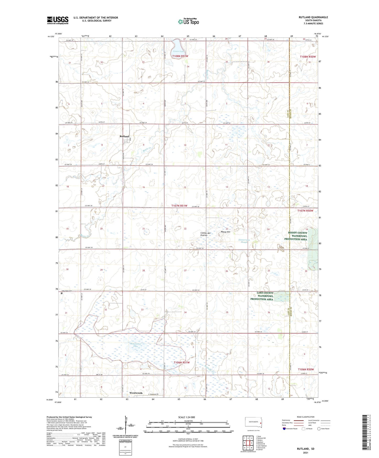
2021 topographic map quadrangle Rutland in the state of South Dakota. Scale: 1:24000. Based on the newly updated USGS 7.5' US Topo map series, this map is in the following counties: Lake, Moody. The map contains contour data, water features, and other items you are used to seeing on USGS maps, but also has updated roads and other features. This is the next generation of topographic maps. Printed on high-quality waterproof paper with UV fade-resistant inks.
Quads adjacent to this one:
West: Madison
Northwest: Sinai
North: Rutland NW
Northeast: Medary
East: Rutland SE
Southeast: Colman
South: Wentworth
Southwest: Lake Madison
This map covers the same area as the classic USGS quad with code o44096a8.
Contains the following named places: Bethel Presbyterian Church, Delmage, Egge Post Office, Green Lake, Lake Park Cemetery, Macey Hill, Milwaukee Lake, Pelican Lake, Rutland, Rutland Elementary School, Rutland High School, Rutland Junior High School, Township of Rutland, Zimmerman Slough, ZIP Codes: 57057, 57075