MyTopo
Savo NE South Dakota US Topo Map
Couldn't load pickup availability
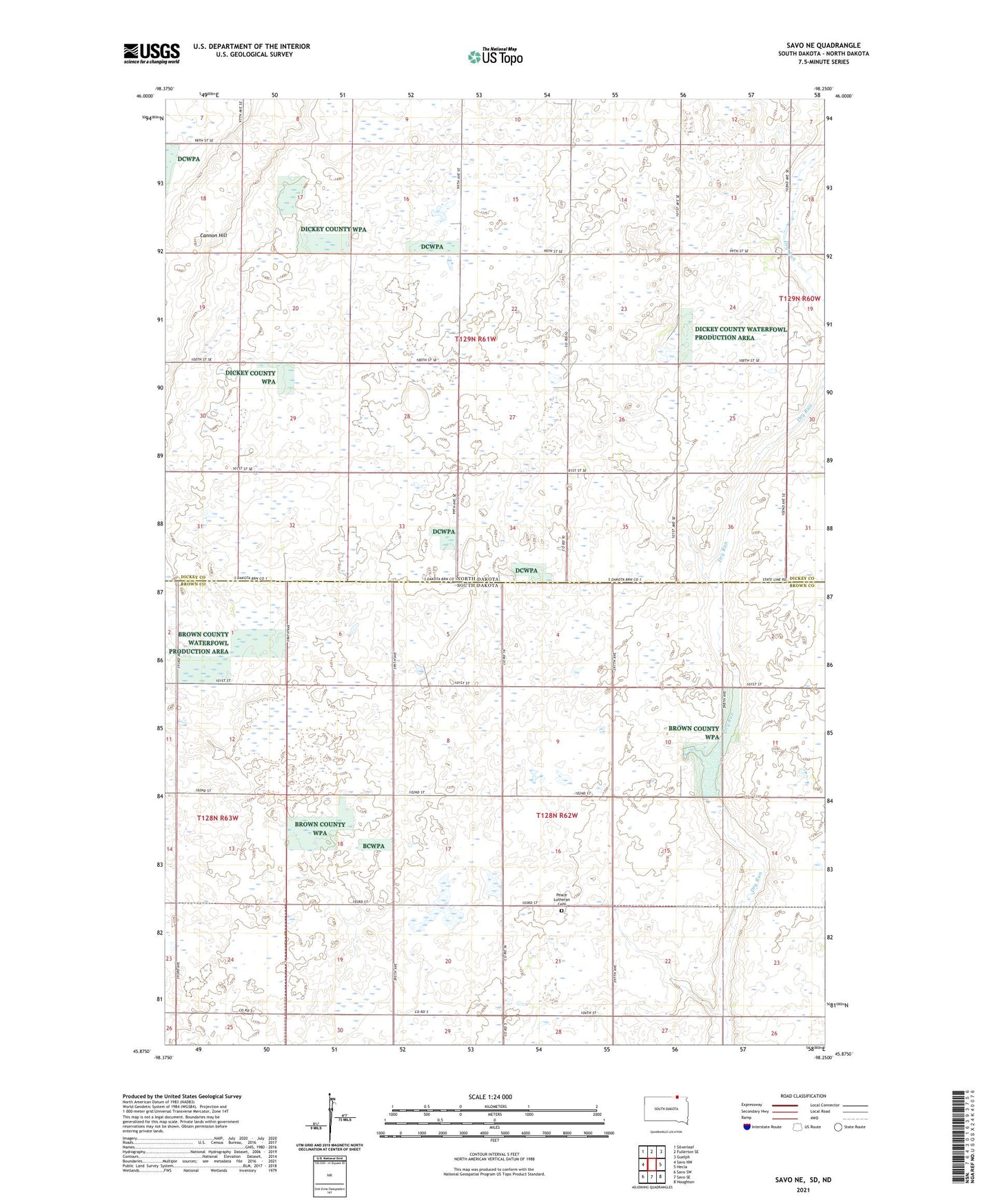
2021 topographic map quadrangle Savo NE in the states of North Dakota, South Dakota. Scale: 1:24000. Based on the newly updated USGS 7.5' US Topo map series, this map is in the following counties: Brown, Dickey. The map contains contour data, water features, and other items you are used to seeing on USGS maps, but also has updated roads and other features. This is the next generation of topographic maps. Printed on high-quality waterproof paper with UV fade-resistant inks.
Quads adjacent to this one:
Northwest: Silverleaf
North: Fullerton SE
Northeast: Guelph
East: Hecla
Southeast: Houghton
South: Savo SE
Southwest: Savo SW
This map covers the same area as the classic USGS quad with code o45098h3.
Contains the following named places: Ada Town Hall, Engle Dam, Engle School, Episcopal Church, Finnish Church, Peace Church, Peace Lutheran Cemetery, Saint Marks Church, Savo Post Office, School Number 2, Township of Ada, Township of Liberty, Weston, Youngman School