MyTopo
Signal Butte South Dakota US Topo Map
Couldn't load pickup availability
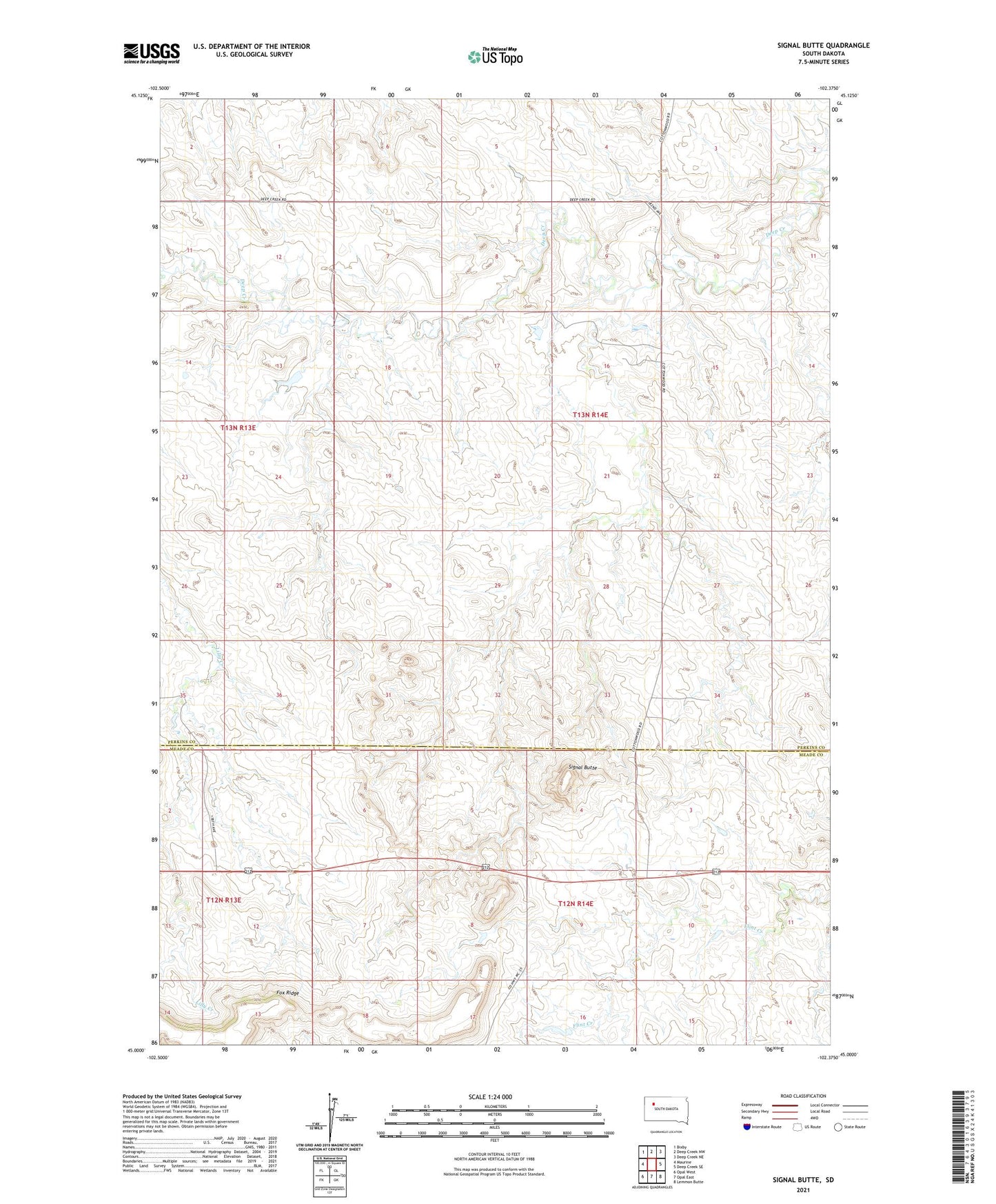
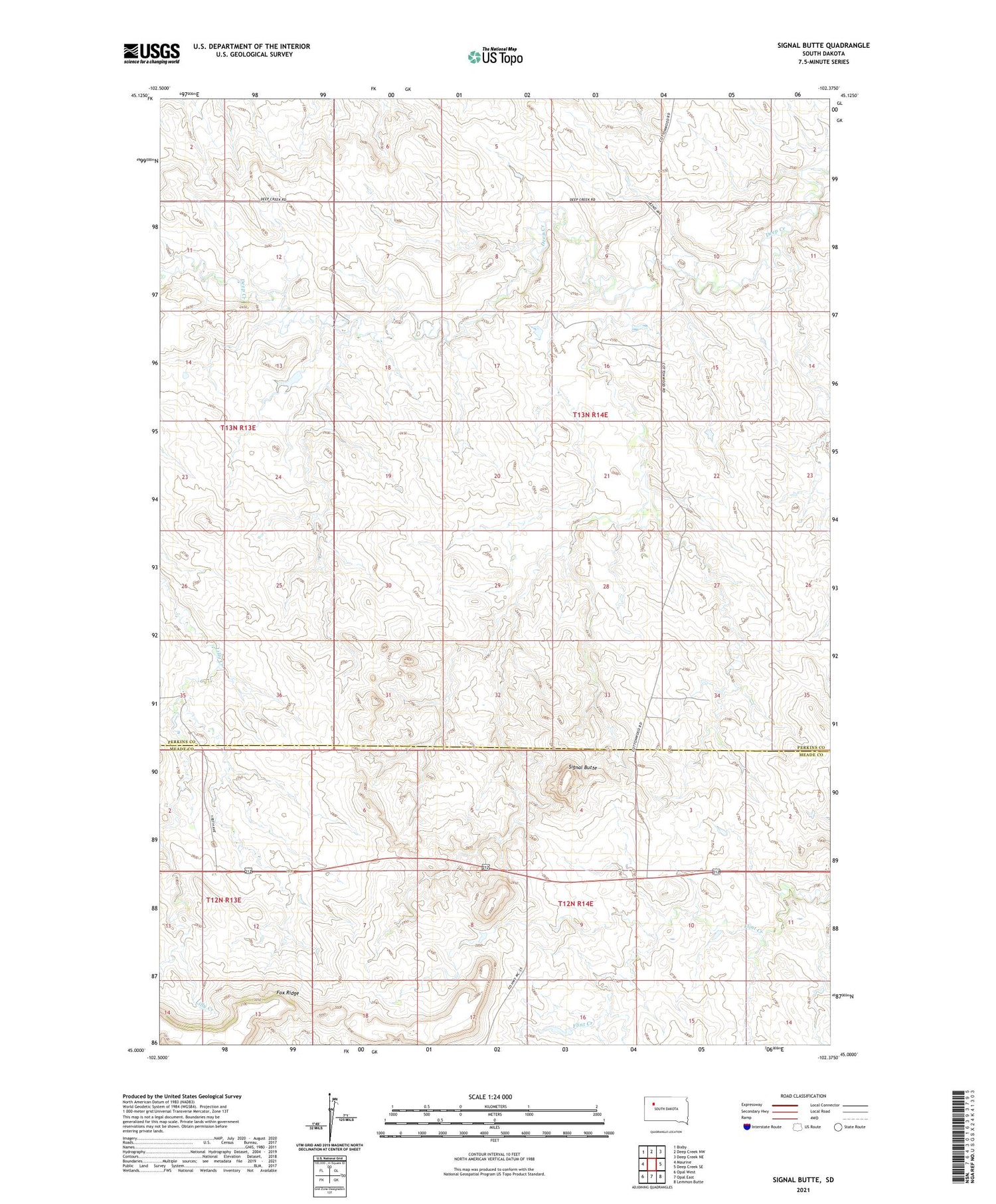
2021 topographic map quadrangle Signal Butte in the state of South Dakota. Scale: 1:24000. Based on the newly updated USGS 7.5' US Topo map series, this map is in the following counties: Perkins, Meade. The map contains contour data, water features, and other items you are used to seeing on USGS maps, but also has updated roads and other features. This is the next generation of topographic maps. Printed on high-quality waterproof paper with UV fade-resistant inks.
Quads adjacent to this one:
West: Maurine
Northwest: Bixby
North: Deep Creek NW
Northeast: Deep Creek NE
East: Deep Creek SE
Southeast: Lemmon Butte
South: Opal East
Southwest: Opal West
Contains the following named places: Cottonwood School, Fox Ridge, Lilly Creek, Signal Butte, Township of Bixby, Unorganized Territory of Bixby, W Grueb Dam, Wilson Ranch Dam