MyTopo
Maurine South Dakota US Topo Map
Couldn't load pickup availability
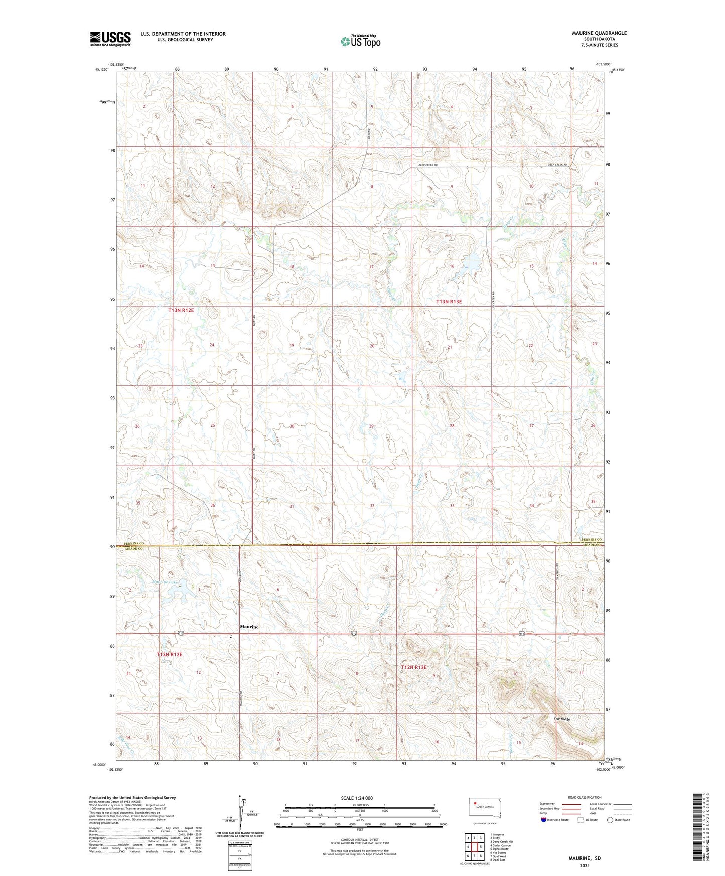
2021 topographic map quadrangle Maurine in the state of South Dakota. Scale: 1:24000. Based on the newly updated USGS 7.5' US Topo map series, this map is in the following counties: Perkins, Meade. The map contains contour data, water features, and other items you are used to seeing on USGS maps, but also has updated roads and other features. This is the next generation of topographic maps. Printed on high-quality waterproof paper with UV fade-resistant inks.
Quads adjacent to this one:
West: Cedar Canyon
Northwest: Imogene
North: Bixby
Northeast: Deep Creek NW
East: Signal Butte
Southeast: Opal East
South: Opal West
This map covers the same area as the classic USGS quad with code o45102a5.
Contains the following named places: D Wood Dam, Fox Ridge School, Maurine, Maurine Elementary School, Maurine Lake, Mildrew School, Ralph Hamptom Dam, West Deep Creek School