MyTopo
Wallace Ranch South Dakota US Topo Map
Couldn't load pickup availability
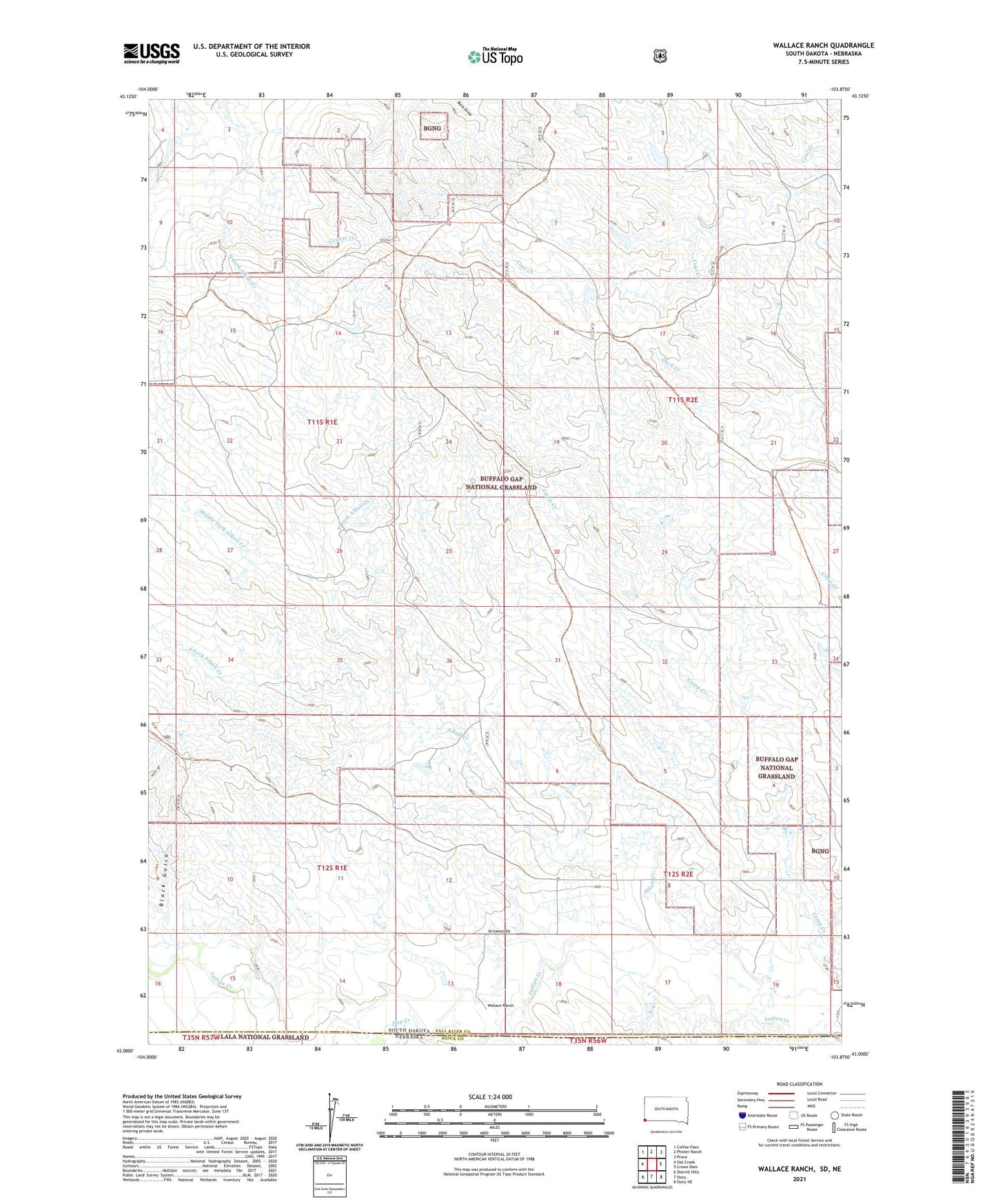
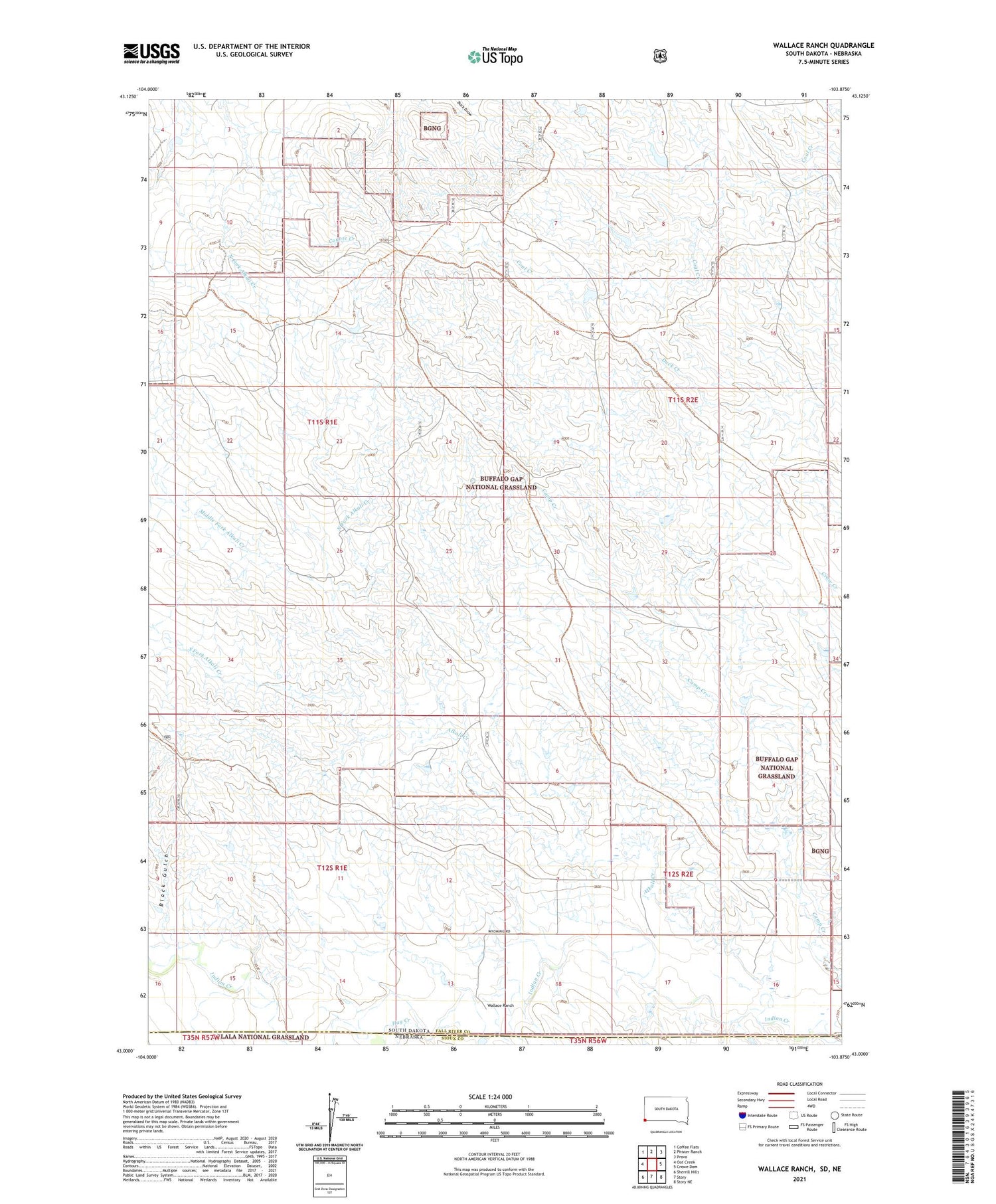
2021 topographic map quadrangle Wallace Ranch in the states of South Dakota, Nebraska. Scale: 1:24000. Based on the newly updated USGS 7.5' US Topo map series, this map is in the following counties: Fall River, Sioux. The map contains contour data, water features, and other items you are used to seeing on USGS maps, but also has updated roads and other features. This is the next generation of topographic maps. Printed on high-quality waterproof paper with UV fade-resistant inks.
Quads adjacent to this one:
West: Oat Creek
Northwest: Coffee Flats
North: Phister Ranch
Northeast: Provo
East: Crowe Dam
Southeast: Story NE
South: Story
Southwest: Sherrill Hills
Contains the following named places: Alkali Creek, Barkley Ranch, Black Gulch, Bomb Range Dam, Camp Creek Dam, Eckard, Eckard Post Office, Hay Creek, Horse Creek, Indian Dam Number 1, Middle Fork Alkali Creek, North Fork Alkali Creek, South Fork Alkali Creek, Wallace Ranch