MyTopo
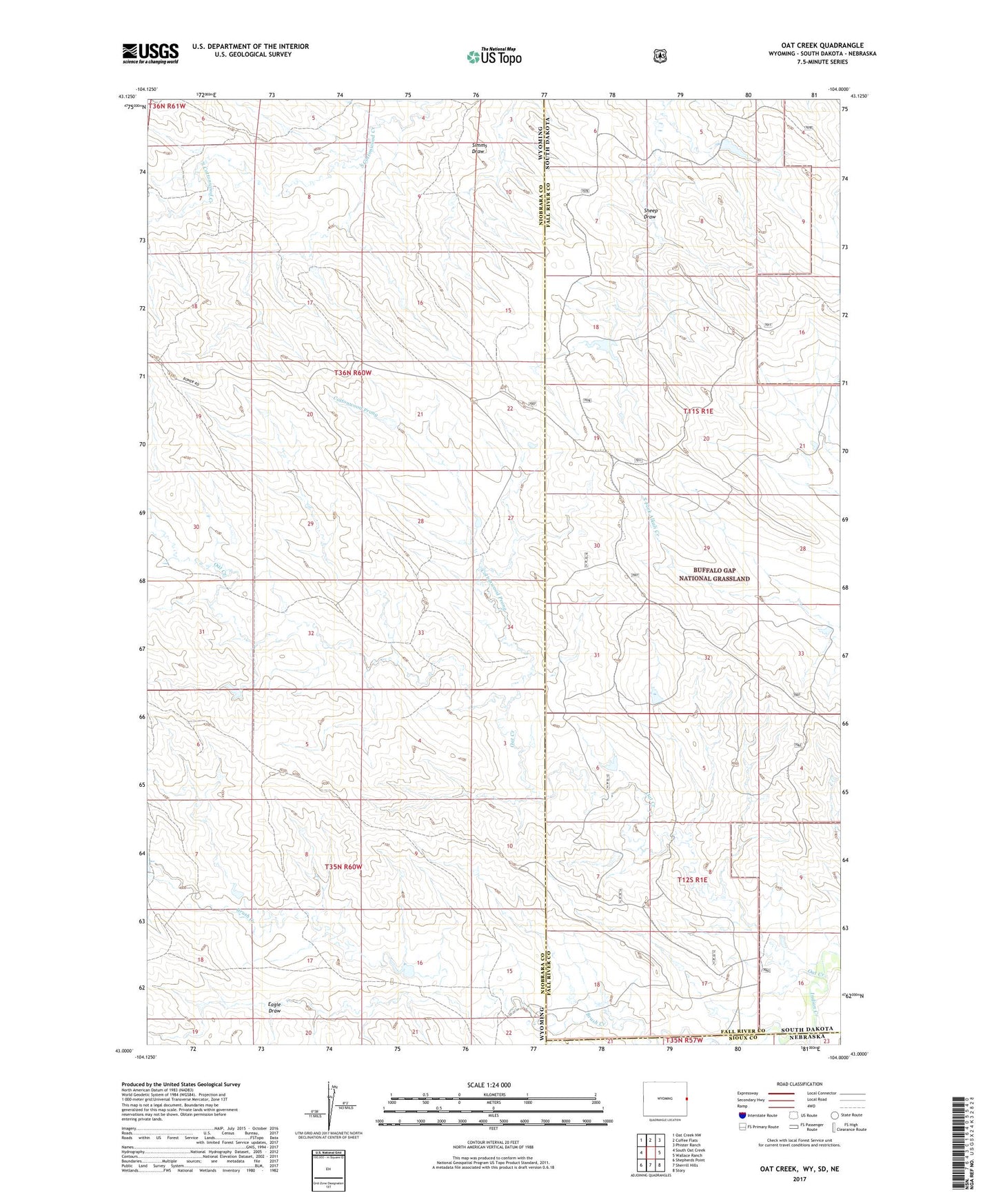
Oat Creek Wyoming US Topo Map
Couldn't load pickup availability
Also explore the Oat Creek Forest Service Topo of this same quad for updated USFS data
2021 topographic map quadrangle Oat Creek in the states of Wyoming, South Dakota, Nebraska. Scale: 1:24000. Based on the newly updated USGS 7.5' US Topo map series, this map is in the following counties: Niobrara, Fall River, Sioux. The map contains contour data, water features, and other items you are used to seeing on USGS maps, but also has updated roads and other features. This is the next generation of topographic maps. Printed on high-quality waterproof paper with UV fade-resistant inks.
Quads adjacent to this one:
West: South Oat Creek
Northwest: Oat Creek NW
North: Coffee Flats
Northeast: Phister Ranch
East: Wallace Ranch
Southeast: Story
South: Sherrill Hills
Southwest: Shepherds Point
This map covers the same area as the classic USGS quad with code o43104a1.
Contains the following named places: Brush Creek, Cottonwood Prong, Eagle Draw, Oat Creek, Pfister Pond Number 3 Dam, Renot Number 1 Dam, Renot Number 1 Reservoir