
MyTopo
Whetstone Bay South Dakota US Topo Map
Couldn't load pickup availability
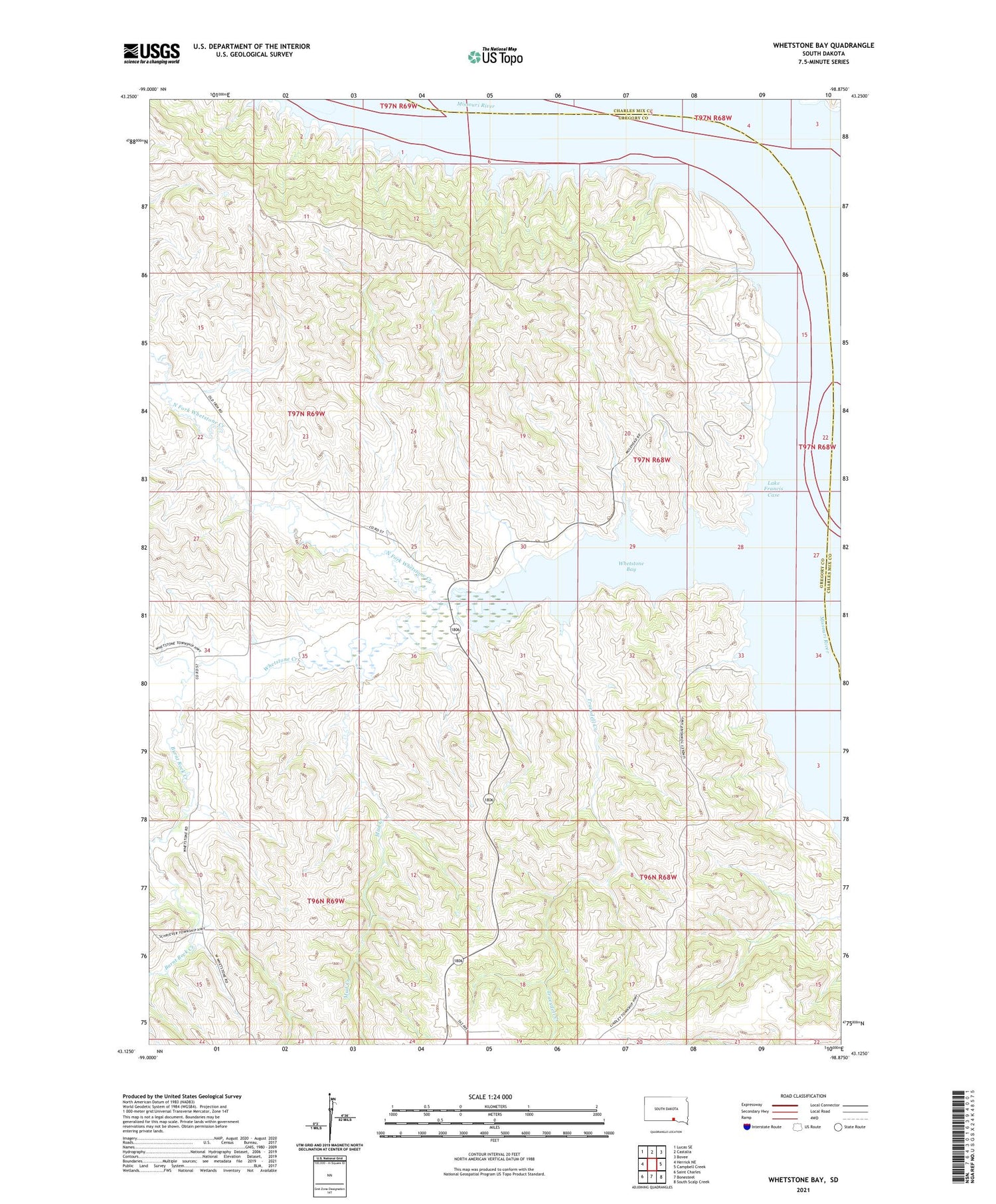
2021 topographic map quadrangle Whetstone Bay in the state of South Dakota. Scale: 1:24000. Based on the newly updated USGS 7.5' US Topo map series, this map is in the following counties: Gregory, Charles Mix. The map contains contour data, water features, and other items you are used to seeing on USGS maps, but also has updated roads and other features. This is the next generation of topographic maps. Printed on high-quality waterproof paper with UV fade-resistant inks.
Quads adjacent to this one:
West: Herrick NE
Northwest: Lucas SE
North: Castalia
Northeast: Bovee
East: Campbell Creek
Southeast: South Scalp Creek
South: Bonesteel
Southwest: Saint Charles
Contains the following named places: Burnt Rock Creek, Jug Bend, Mud Creek, Mulehead Ranch, Mulehead School, North Fork Whetstone Creek, South Fork Whetstone Creek, Township of Gaughen, Township of Whetstone, Truesdell Creek, Whetstone Bay, Whetstone Bay Recreation Area, Whetstone Creek, Whetstone Island, ZIP Code: 57317


