MyTopo
White Horse South Dakota US Topo Map
Couldn't load pickup availability
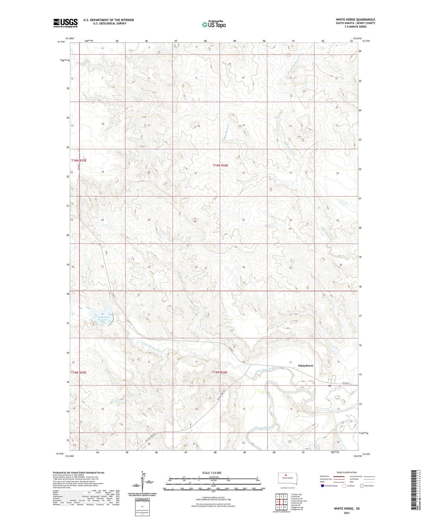
2021 topographic map quadrangle White Horse in the state of South Dakota. Scale: 1:24000. Based on the newly updated USGS 7.5' US Topo map series, this map is in the following counties: Dewey. The map contains contour data, water features, and other items you are used to seeing on USGS maps, but also has updated roads and other features. This is the next generation of topographic maps. Printed on high-quality waterproof paper with UV fade-resistant inks.
Quads adjacent to this one:
West: Little Moreau Lake
Northwest: Timber Lake
North: Glencross
Northeast: Glencross NE
East: Glencross SE
Southeast: Ridgeview NE
South: Ridgeview NW
Southwest: Parade NE
This map covers the same area as the classic USGS quad with code o45100c8.
Contains the following named places: Dog Butte Creek, Little Moreau River, Whitehorse, Whitehorse Catholic Church, Whitehorse Census Designated Place, Whitehorse Lake, Whitehorse Post Office, ZIP Code: 57661