MyTopo
Burgess Falls Tennessee US Topo Map
Couldn't load pickup availability
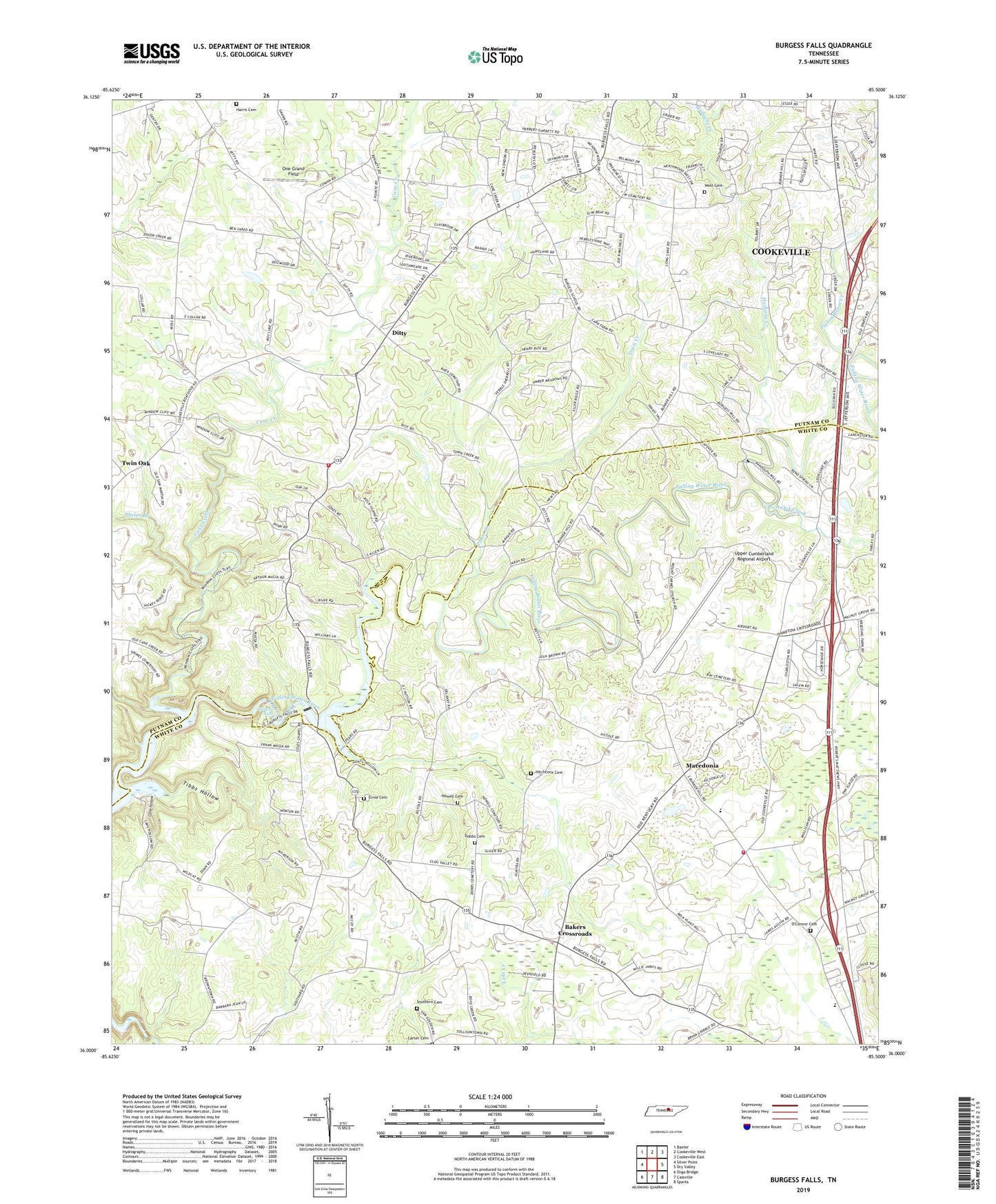
2019 topographic map quadrangle Burgess Falls in the state of Tennessee. Scale: 1:24000. Based on the newly updated USGS 7.5' US Topo map series, this map is in the following counties: White, Putnam. The map contains contour data, water features, and other items you are used to seeing on USGS maps, but also has updated roads and other features. This is the next generation of topographic maps. Printed on high-quality waterproof paper with UV fade-resistant inks.
Quads adjacent to this one:
West: Silver Point
Northwest: Baxter
North: Cookeville West
Northeast: Cookeville East
East: Dry Valley
Southeast: Sparta
South: Cassville
Southwest: Sligo Bridge
Contains the following named places: Almyra Methodist Church, Almyra School, Amber Meadows, Antioch Church, Athens Church, Bakers Crossroads, Bethel Church, Boiling Springs, Boiling Springs Church, Boiling Springs School, Brindley Chapel, Bunker Hill Park, Burgess, Burgess Falls, Burgess Falls Dam, Burgess Falls Lake, Burgess Falls State Natural Area, Burgess School, Bussell, Bussell School, Campbell, Cane Creek, Cane Hollow, Carter Cemetery, Coles Chapel School, Colonial Estates, Colonial Forest, Commissioner District 7, Ditty, Dobbs Cemetery, Elder Ridge School, Elrod Cemetery, Gentry Chapel, Hamptons Crossroads, Hamptons Crossroads Church, Harris Cemetery, Heathwood, Hillrose, Hitchcock Cemetery, Howell Cemetery, Hudgens Creek, Huntland, Lakeland Park, Lovelady Church, Macedonia, Macedonia Baptist Church, Macedonia Division, Macedonia School, Masseys Mill, Mount Carmel Church, NorthEnd Volunteer Fire Department, O'Conner, O'Connor Cemetery, O'Connor Church, One Grand Field, Phelps Branch, Pigeon Roost Creek, Pine Hills, Pistole Church, Post Oak Creek, Putnam County Fire Department Station 13, Samaria, Samaria Church, South Creek, Southern Cemetery, Southtown Village, Taylors Seminary, Tibbs Hollow, Town and Country Estates, Town Creek, Twin Oak, Twin Oak School, Upper Cumberland Regional Airport, West Cemetery, Wilhite, Wilhite School, Window Cliff Estates