MyTopo
Silver Point Tennessee US Topo Map
Couldn't load pickup availability
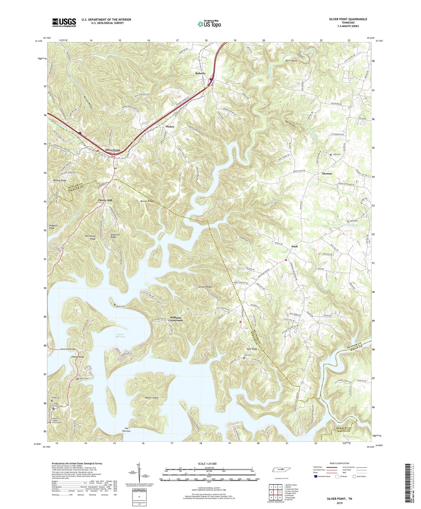
2022 topographic map quadrangle Silver Point in the state of Tennessee. Scale: 1:24000. Based on the newly updated USGS 7.5' US Topo map series, this map is in the following counties: Putnam, DeKalb, White. The map contains contour data, water features, and other items you are used to seeing on USGS maps, but also has updated roads and other features. This is the next generation of topographic maps. Printed on high-quality waterproof paper with UV fade-resistant inks.
Quads adjacent to this one:
West: Center Hill Dam
Northwest: Buffalo Valley
North: Baxter
Northeast: Cookeville West
East: Burgess Falls
Southeast: Cassville
South: Sligo Bridge
Southwest: Smithville
This map covers the same area as the classic USGS quad with code o36085a6.
Contains the following named places: Alum Lick Branch, Anderson Ridge, Bald Hill Church, Bethlehem Church, Burton, Burton Hollow, Burton Hollow Branch, Burton Post Office, Burton Ridge, Camp Relax, Camp Tifha, Carrs Chapel School, Carrs Chapel United Methodist Church, Cherry Hill, Commissioner District 4, Cookville Dock, Davies Island, Dekalb County Fire Department Station 58, Denny Cemetery, District 8, Dry Creek, Dry Fork, Ensor School, Falling Water River, Goff Cemetery, Goff Ridge, Harris Bluff, Herrens Chapel School, Hickey, Hickey Church, Hurricane Bridge, Johnson Chapel Recreation Area, Judd Cemetery, League Chapel Cemetery, League Chapel School, Lilys Chapel, Martin Cemetery, Matthew, Medley Ridge, Mine Lick Creek, Mose Hollow, Nash, Nash Cemetery, Nash Grove Baptist Church, Nash School, Ozion Church, Pedigo Cemetery, Pedigo Ridge, Peter Cave Branch, Pleasant View Church, Putnam County Fire Department Station 14, Putnam County Fire Department Station 33, Putnam County Landfill, Roberts, Rock Castle, Rock Castle Missionary Baptist Church, Rock Castle School, Silver Point, Silver Point Baptist Church, Silver Point Post Office, Silver Point School, Silverpoint School, Taylor Creek, The Narrows, Thomas, Thomas Church, Thomas School, Thousand Pines Tree Farm, Tom Hollow, Tom Hollow Branch, Vickers Ridge, Walker's Chapel Church Cemetery, Wayside Chapel, Whitefield Ridge, Williams Crossroads, ZIP Code: 38544