MyTopo
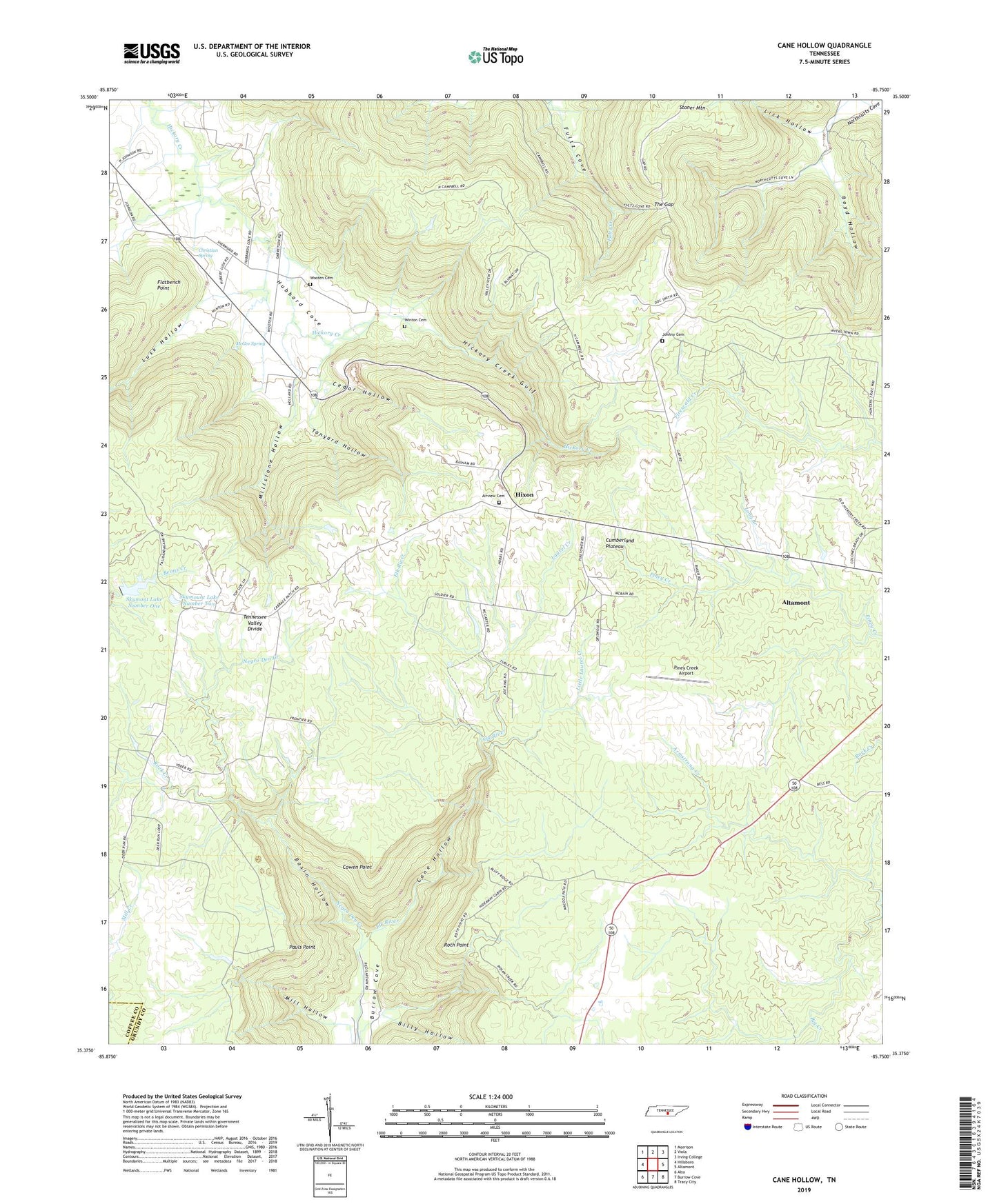
Cane Hollow Tennessee US Topo Map
Couldn't load pickup availability
2019 topographic map quadrangle Cane Hollow in the state of Tennessee. Scale: 1:24000. Based on the newly updated USGS 7.5' US Topo map series, this map is in the following counties: Grundy, Coffee. The map contains contour data, water features, and other items you are used to seeing on USGS maps, but also has updated roads and other features. This is the next generation of topographic maps. Printed on high-quality waterproof paper with UV fade-resistant inks.
Quads adjacent to this one:
West: Hillsboro
Northwest: Morrison
North: Viola
Northeast: Irving College
East: Altamont
Southeast: Tracy City
South: Burrow Cove
Southwest: Alto
Contains the following named places: Airview Cemetery, Airview Church, Altamont Lookout Tower, Basin Hollow, Billy Hollow, Boyd Hollow, Buck Creek, Burrows Mill, Camp Skymont, Cane Hollow, Cedar Hollow, Christian Spring, Counter Pen, Cowen Point, Flatbench Point, Hickory Creek Gulf, Hixon, Hixon School, Hubbards Cove, Hubbards Cove Baptist Church, Indian Camp Creek, Johnny Cemetery, Lick Hollow, Little Laurel Creek, Long Branch, Lusk Hollow, Marvin Chapel, McGee Spring, Mill Hollow, Millstone Hollow, Negro Den Creek, Pauls Point, Piney Creek Airport, Rock Creek, Roth Point, Sanders Chapel, Skymont Lake Dam Number One, Skymont Lake Number One, Skymount Lake Dam Number Two, Skymount Lake Number Two, Stoner Mountain, Tanyard Hollow, The Gap, Tom Campbell Hollow, Winton Cemetery, Wooten Cemetery, ZIP Code: 37301