MyTopo
Hillsboro Tennessee US Topo Map
Couldn't load pickup availability
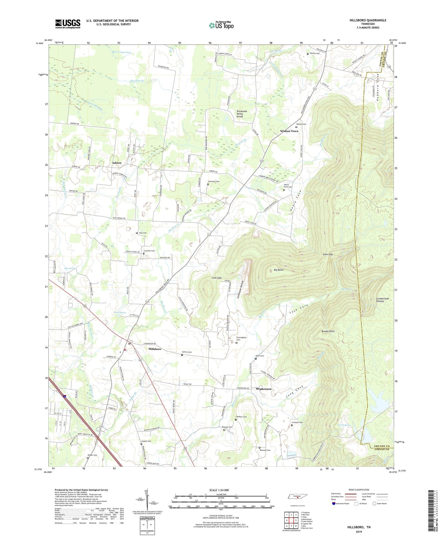
2022 topographic map quadrangle Hillsboro in the state of Tennessee. Scale: 1:24000. Based on the newly updated USGS 7.5' US Topo map series, this map is in the following counties: Coffee, Grundy. The map contains contour data, water features, and other items you are used to seeing on USGS maps, but also has updated roads and other features. This is the next generation of topographic maps. Printed on high-quality waterproof paper with UV fade-resistant inks.
Quads adjacent to this one:
West: Manchester
Northwest: Fredonia
North: Morrison
Northeast: Viola
East: Cane Hollow
Southeast: Burrow Cove
South: Alto
Southwest: Capitol Hill
This map covers the same area as the classic USGS quad with code o35085d8.
Contains the following named places: Asbury, Asbury Church, Asbury School, Austell Cemetery, Beans Creek Church, Big Butte, Blue Spring, Blue Spring Creek, Bray Branch, Brooks Point, Collier Branch, Commissioner District 5, Cowan Spring, Crockett Cemetery, Cumberland Academy, Cumberland Mountain Lake, Cumberland Mountain Lake Dam, Cumberland Mountain Sd Company Lake, Cunningham Cemetery, Emmanuel Church, Gate Gap, Gentry Cemetery, Gum Spring, Henry Cove, Henry Cove Cemetery, Hillsboro, Hillsboro Baptist Church, Hillsboro Census Designated Place, Hillsboro Church of Christ, Hillsboro Cumberland Presbyterian Church, Hillsboro Division, Hillsboro Elementary School, Hillsboro Methodist Church, Hillsboro Post Office, Hillsboro Quarry, Hillsboro Volunteer Fire Department, Lambert Cemetery, Long Cove, Lusk Cove, Lusk Gap, Mount Pleasant Church, Pond Spring, Price Cemetery, Sandy Field, Simmons Cemetery, Spencer Field, Stephenson, Stephenson School, Stillhouse Hollow, Thomas Cemetery, Warren Branch, Wilder Cemetery, Winton Cemetery, Winton Town, Womack Cemetery, Yate Cemetery, Zion Hill Church, ZIP Code: 37342


