MyTopo
Irving College Tennessee US Topo Map
Couldn't load pickup availability
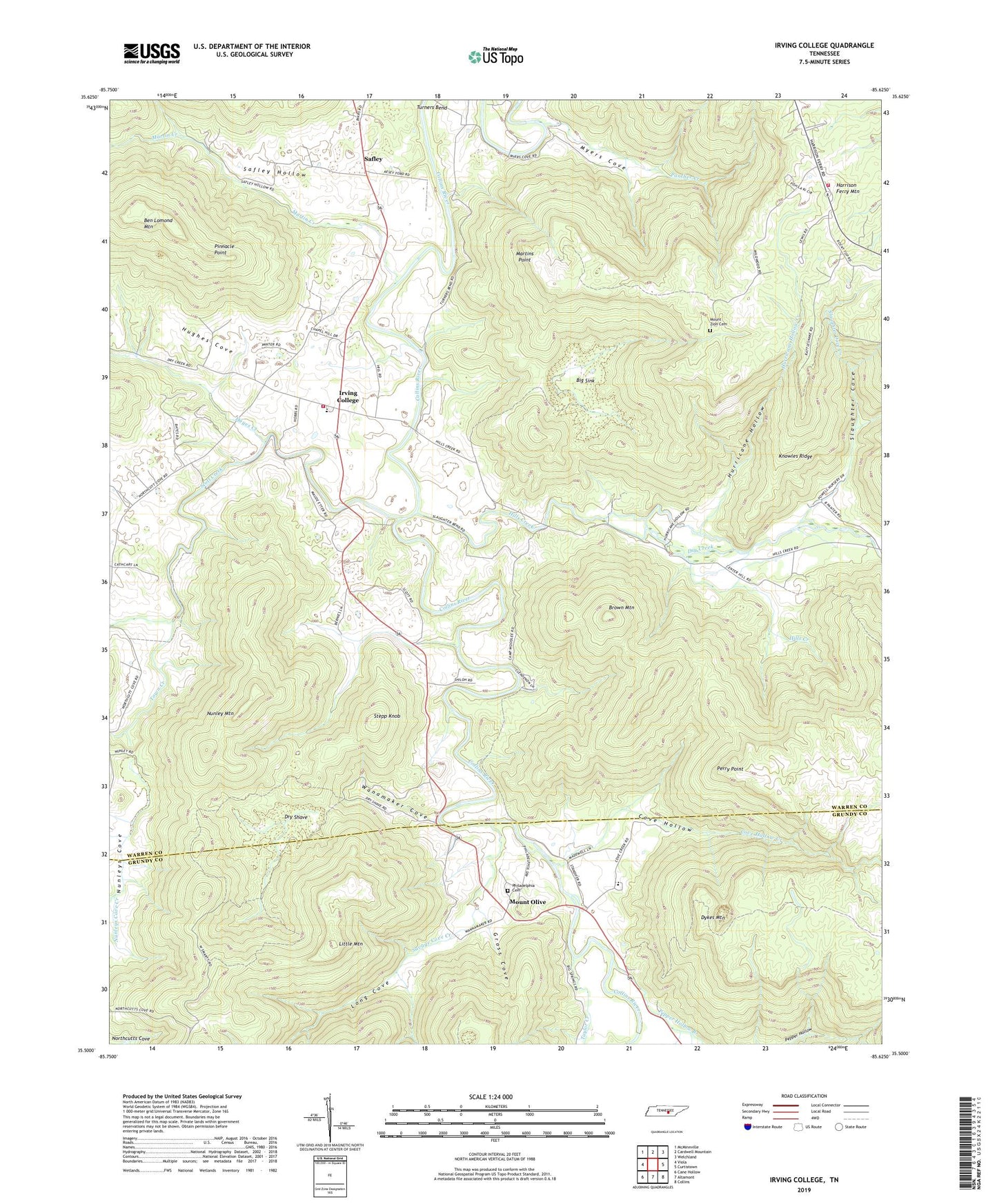
2022 topographic map quadrangle Irving College in the state of Tennessee. Scale: 1:24000. Based on the newly updated USGS 7.5' US Topo map series, this map is in the following counties: Warren, Grundy. The map contains contour data, water features, and other items you are used to seeing on USGS maps, but also has updated roads and other features. This is the next generation of topographic maps. Printed on high-quality waterproof paper with UV fade-resistant inks.
Quads adjacent to this one:
West: Viola
Northwest: McMinnville
North: Cardwell Mountain
Northeast: Welchland
East: Curtistown
Southeast: Collins
South: Altamont
Southwest: Cane Hollow
This map covers the same area as the classic USGS quad with code o35085e6.
Contains the following named places: Armstrong Church, Badger Mine, Big Sink, Brown Mountain, Camp Woodlee, Center Hill, Collins River Volunteer Fire Department, Commissioner District 8, Cove Hollow, Cove Hollow Creek, Dry Creek, Dry Shave, Dykes Mountain, Grissom Quarry, Gross Cove, Harrican, Harrison Ferry Fire Department, Harrison Ferry Mountain, Hayes Creek, Hebron Church, Hills Creek, Hills Mill, Hughes Cove, Hurricane Hollow, Hurricane Hollow Creek, Irving College, Irving College Division, Irving College Elementary School, Isleford, Knowles Ridge, Little Mountain, Long Cove, Martin Creek, Martins Ford, Martins Point, Mount Olive, Mount Olive Church, Mount Zion Cemetery, Myers Cove, Nunley Mountain, Nunleys Cove, Nunleys Cove Church, Nunleys Cove Creek, Panther Creek, Pepper Hollow Branch, Perry Point, Philadelphia Cemetery, Philadelphia Church, Pinnacle Point, Safley, Safley Hollow, Saint Marys Church, Savage Cove Creek, Scott Creek, Senter Hill Church, Shiloh Church, Slaughter Cove, Slaughter Cove Creek, Stepp Knob, Steppsville, Taylor Creek, Town Creek, Wanamaker Cove, White Chapel