MyTopo
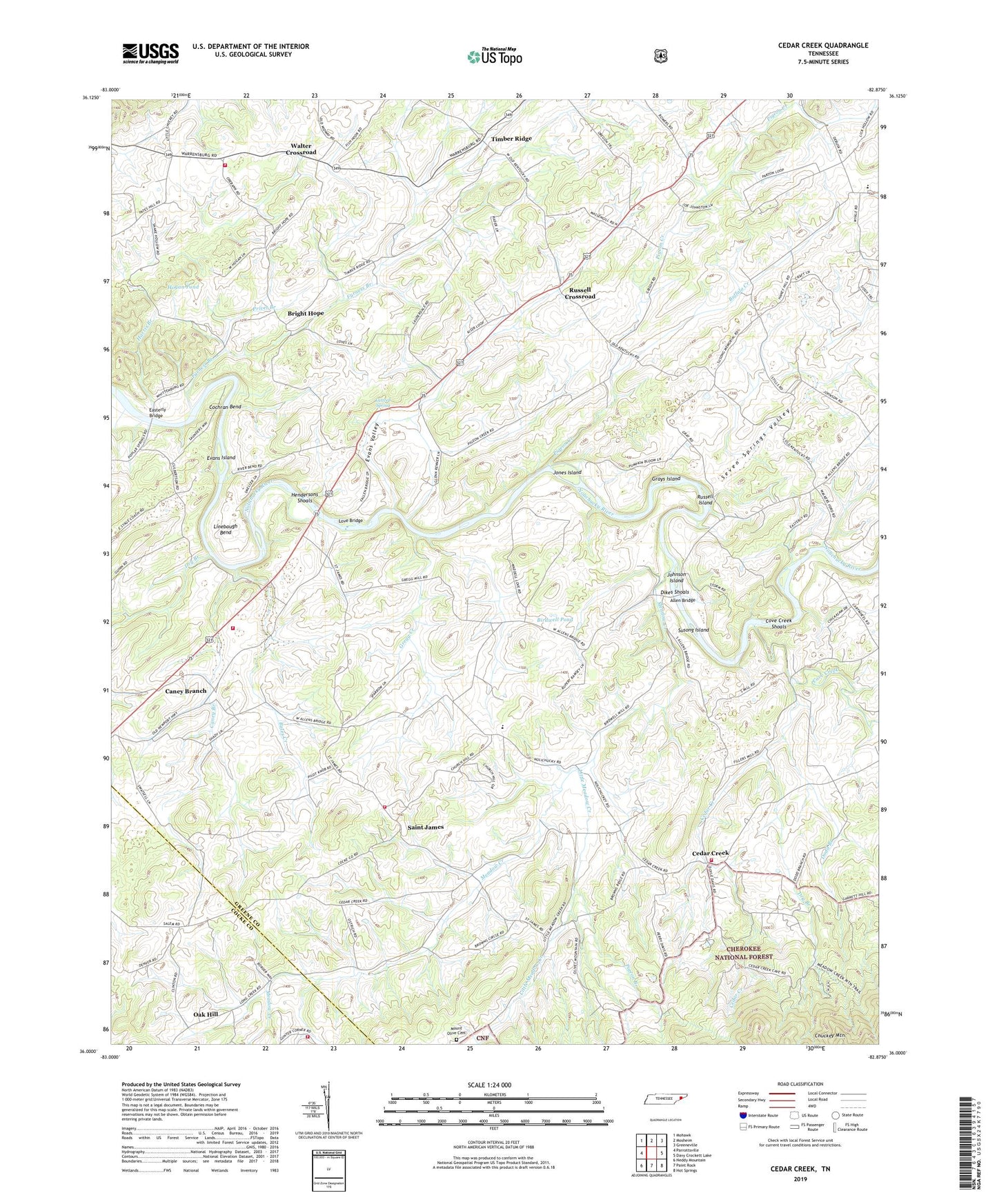
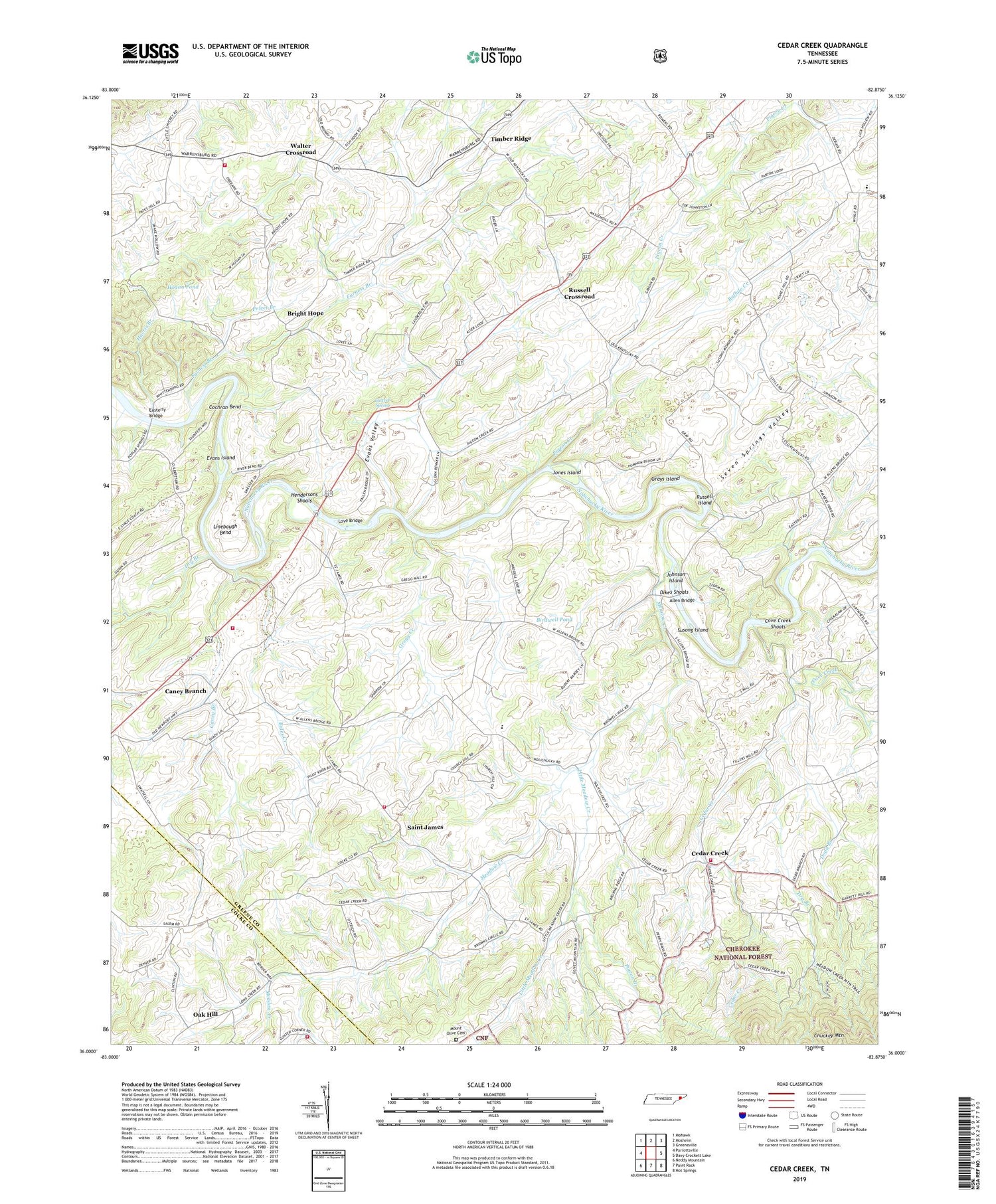
Cedar Creek Tennessee US Topo Map
Couldn't load pickup availability
2019 topographic map quadrangle Cedar Creek in the state of Tennessee. Scale: 1:24000. Based on the newly updated USGS 7.5' US Topo map series, this map is in the following counties: Greene, Cocke. The map contains contour data, water features, and other items you are used to seeing on USGS maps, but also has updated roads and other features. This is the next generation of topographic maps. Printed on high-quality waterproof paper with UV fade-resistant inks.
Quads adjacent to this one:
West: Parrottsville
Northwest: Mohawk
North: Mosheim
Northeast: Greeneville
East: Davy Crockett Lake
Southeast: Hot Springs
South: Paint Rock
Southwest: Neddy Mountain
Contains the following named places: Allen Bridge, Allen Chapel, Allenbridge, Bales Creek, Birdwell Pond, Bright Hope, Bright Hope School, Broyles Chapel, Buffalo Creek, Caney Branch, Caney Branch School, Caney Branch Volunteer Fire Department, Cedar Creek, Cedar Creek School, Cedar Creek Volunteer Fire Department, Cochran Bend, Commissioner District 5, Cove Creek, Cove Creek Shoals, DeBusk, DeBusk School, Dikes Mill, Dikes Shoals, Dodd Branch, Dry Branch, Easterly Bridge, Ebenezer Church, Evans Island, Evans Valley, Farnsworth Ferry, Furness Branch, Grays Island, Gregg Creek, Harris Branch, Hendersons Shoals, Hogan Pond, Hunt Chapel, Johnson Island, Jones Island, Jones Shed Church, Linebaugh Bend, Link HIlls Country Club, Little Chucky, Little Meadow Creek, Long Creek Volunteer Fire Department, Love Bridge, Loves Ferry, Luttrell Spring, Meadow Creek, Meadow Creek Church, Meadow Creek Mill, Mount Airy School, Mount Olive Cemetery, Mount Olive Church, Nolichuckey Elementary School, Oak Grove School, Oak Hill, Ore Bank School, Orebank Volunteer Fire Department, Pigeon Branch, Pigeon Creek, Pinegrove Church, Privet Branch, Pruitt Hill School, Rabbit Hill School, Rader Hill School, Russell Crossroad, Russell Island, Saint James, Saint James Church, Saint James Elementary School, Saint James Volunteer Fire Department, Seven Springs Valley, Sirenburg, Southwest Nolichucky Division, Speedwell Church, Susong Island, Susong Memorial Church, Timber Ridge, Walker Ford, Walker School, Walter Crossroad, Whittenburg Church