
MyTopo
Centertown Tennessee US Topo Map
Couldn't load pickup availability
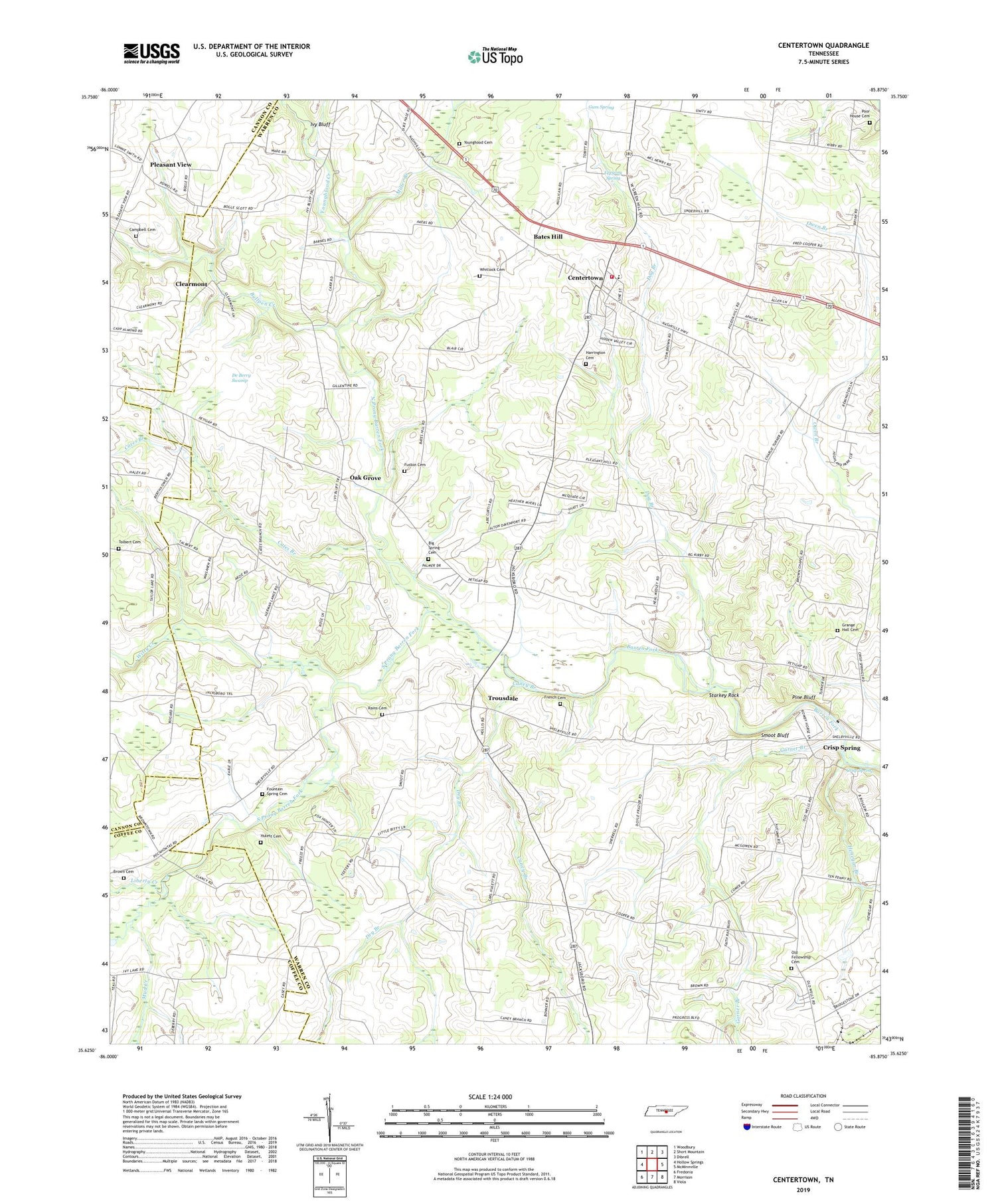
2019 topographic map quadrangle Centertown in the state of Tennessee. Scale: 1:24000. Based on the newly updated USGS 7.5' US Topo map series, this map is in the following counties: Warren, Cannon, Coffee. The map contains contour data, water features, and other items you are used to seeing on USGS maps, but also has updated roads and other features. This is the next generation of topographic maps. Printed on high-quality waterproof paper with UV fade-resistant inks.
Quads adjacent to this one:
West: Hollow Springs
Northwest: Woodbury
North: Short Mountain
Northeast: Dibrell
East: McMinnville
Southeast: Viola
South: Morrison
Southwest: Fredonia
Contains the following named places: A 1 Tree Farm, Barren Fork Church, Bates Hill, Bates Hill Cumberland Presbyterian Church, Bethel Hill Baptist Church, Big Spring Cemetery, Brown Cemetery, Bullpen Creek, Campbell Cemetery, Caney Branch, Caney Branch Church, Cates Branch, Centertown, Centertown Church of Christ, Centertown Community Volunteer Fire Department Station 1, Centertown Division, Centertown Elementary School, Centertown High School, Centertown United Methodist Church, Clearmont, Commissioner District 10, Crisp, Crisp School, Crisp Spring, Cross Roads School, Cummings Chapel School, Cummins Chapel, De Berry Swamp, Dog Branch, Dry Branch, Fountain Spring Cemetery, French Cemetery, Fuston Cemetery, Garner Branch, Grange Hall Cemetery, Grange Hall Chapel, Grange Hall School, Green Hill School, Gregory Spring, Gum Spring, Harrington Cemetery, Henegar Branch, Hulett Cemetery, Ivy Bluff, Ivy Bluff Church, Ivy Bluff School, Kelsy Branch, Liberty Creek, McAfee Branch, Miller Branch, Mud Creek, New, Nicholson Springs, North Prong Barren Fork, Oak Grove, Oakgrove School, Old Fellowship Cemetery, Pine Bluff, Pleasant Hill Church, Pleasant View, Pleasant View Baptist Church, Pleasant View School, Poor House Cemetery, Rains Cemetery, Smoot Bluff, South Prong Barren Fork, Starkey Rock, Tolbert Cemetery, Town of Centertown, Trousdale, Trousdale Church of Christ, Unity Church, Whitlock Cemetery, Wilson Chapel, Witty Creek, Youngblood Cemetery, Youngblood Creek


