MyTopo
Coble Tennessee US Topo Map
Couldn't load pickup availability
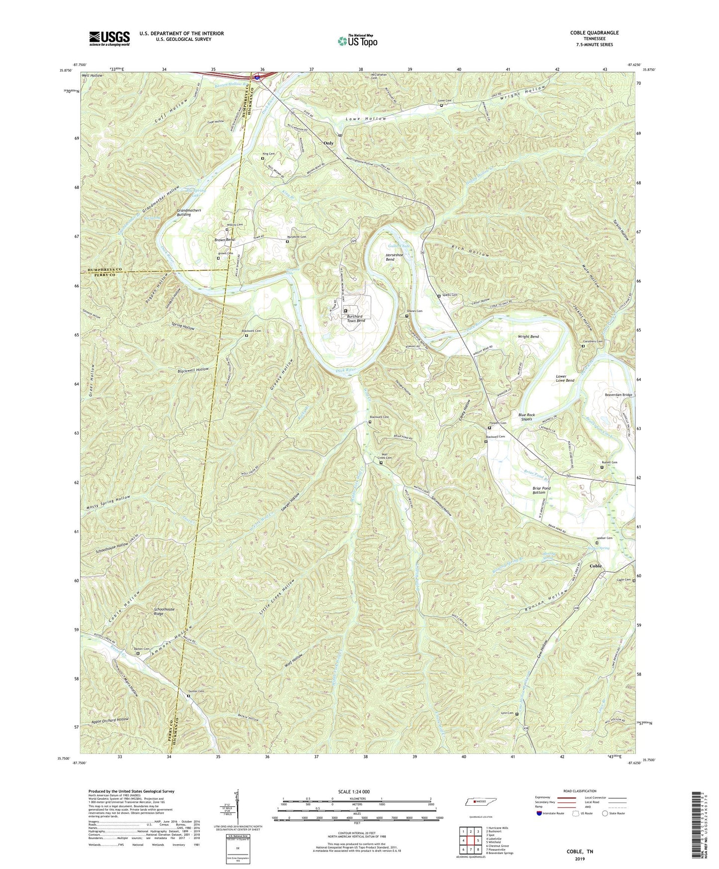
2019 topographic map quadrangle Coble in the state of Tennessee. Scale: 1:24000. Based on the newly updated USGS 7.5' US Topo map series, this map is in the following counties: Hickman, Perry, Humphreys. The map contains contour data, water features, and other items you are used to seeing on USGS maps, but also has updated roads and other features. This is the next generation of topographic maps. Printed on high-quality waterproof paper with UV fade-resistant inks.
Quads adjacent to this one:
West: Lobelville
Northwest: Hurricane Mills
North: Bucksnort
Northeast: Spot
East: Whitfield
Southeast: Beaverdam Springs
South: Pleasantville
Southwest: Chestnut Grove
Contains the following named places: Alexander Ford, Ammons Hollow, Barber Cemetery, Barren Hollow, Beaverdam Bridge, Beaverdam Creek, Beckie Hollow, Big Spring, Big Spring Lake, Big Spring Lake Number Two, Big Spring Lake Number Two Dam, Blackwell Cemetery, Blackwell Hollow, Blowing Spring, Blowing Spring Branch, Blue Rock Shoals, Briar Pond Bottom, Briar Pond Branch, Brown Bend, Brown Cemetery, Burchard Ford, Burchard Town Bend, Cagle Cemetery, Caney Hollow, Carothers Cemetery, Carter Hollow, Coble, Coble Hollow, Coble School, Cow Hollow, Cow Hollow Branch Stream, Cude Hollow, Cuff Hollow, East Fork Wolf Creek, Flowers Cemetery, Grandmother Branch, Grandmother Ford, Grandmother Hollow, Grandmothers Building, Greasy Hollow, Gullet Chute, Gunter Cemetery, Happy Hollow Creek, Horseshoe Bend, Jacklot Hollow, King Branch, King Cemetery, Limekiln Hollow, Little Creek Hollow, Little Piney Creek, Lowe Cemetery, Lowe Hollow, Lower Lowe Bend, Lynn Cemetery, Macedonia School, Marrs Hollow, Meetinghouse Hollow, Middle Fork Wolf Creek, Mount Zion Church, Mule Hollow, Murphree Cemetery, Murphree Eddy, Only, Only Post Office, Only School, Perogue Ford, Perogue Hollow, Pigpen Hollow, Powell Hollow, Rich Hollow, Rocky Branch, Runion Hollow, Russell Cemetery, Russell Creek Church, Sawyer Hollow, Schoolhouse Ridge, Shanes Cemetery, Sparks Cemetery, Spicewood Hollow, Spring Hollow, Strickland/Smalley Field Airport, Turney Center for Youthful Offenders, Turney Center Industrial Complex, Walker Cemetery, Walker Spring, West Fork Wolf Creek, Wilkins Cemetery, Wolf Creek, Wolf Creek Cemetery, Wolf Creek Church, Wolf Hollow, Wright Bend, Wright Hollow, ZIP Code: 37140