MyTopo
Lobelville Tennessee US Topo Map
Couldn't load pickup availability
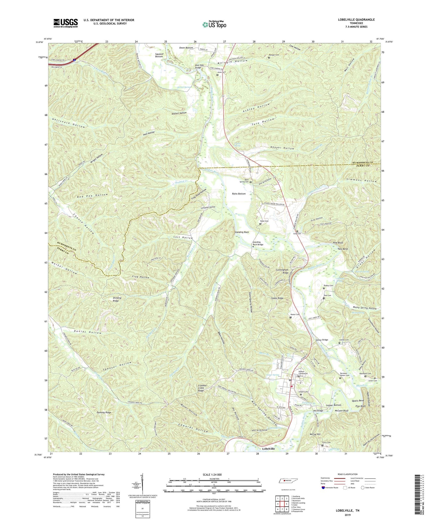
2022 topographic map quadrangle Lobelville in the state of Tennessee. Scale: 1:24000. Based on the newly updated USGS 7.5' US Topo map series, this map is in the following counties: Perry, Humphreys. The map contains contour data, water features, and other items you are used to seeing on USGS maps, but also has updated roads and other features. This is the next generation of topographic maps. Printed on high-quality waterproof paper with UV fade-resistant inks.
Quads adjacent to this one:
West: Daniels Landing
Northwest: Hustburg
North: Hurricane Mills
Northeast: Bucksnort
East: Coble
Southeast: Pleasantville
South: Chestnut Grove
Southwest: Pine View
This map covers the same area as the classic USGS quad with code o35087g7.
Contains the following named places: Ashley Hollow, Baker Hollow, Bass Mill, Blackwell Cemetery, Blue Hole Bridge, Bone Spring Cemetery, Bone Spring Hollow, Bone Spring School, Buffalo Church, Chance Hollow, City of Lobelville, Crooked Creek Ridge, Cunningham Ridge, Curry Cemetery, Daley Hollow, Daniel Hollow, Davidson Hester Cemetery, Dividing Ridge, Dodson Cemeteries, Dudley Cemetery, Dumony Ridge, Edwards Branch, Edwards Hollow, Ferguson Branch, Frog Hollow, Frog Pond Hollow, Gilmer Bridge, Gilmer Cemetery, Gray Cemetery, Gray Hollow, Greer Cemetery, Greer Hollow, Hall Hollow, Hester Cemetery, Hooper Hollow, Horner Spring, Ike Hollow, Jaybird Hollow, Jones Cemetery, Lagoon Branch, Lancaster Hollow, Ledbetter Spring, Leeper Bottom, Leeper Cemetery, Leeper Spring, Lobelville, Lobelville Division, Lobelville Elementary School, Lobelville Post Office, Lobelville Volunteer Fire Department, Lobeville Lookout Tower, Lost Creek, Lott Hollow, Malugin Cemetery, Malugin Hollow, Marrs Branch, McCann Bluff, McCoy Hill, Mill Bridge, Mossy Spring, Mossy Spring Hollow, Mud Spring Hollow, Niblett Hollow, Pine Bluff, Poole Cemetery, Poole Lake, Pruette Branch, Pruette Spring, Qualls Bend, Rains Bottom, Red Bank Creek, Red Pea Hollow, Russell Creek, Schoolhouse Hollow, Seedtick Creek, Simmons Creek, Simmons Hollow, Snake Ridge, Spencer Hollow, Spout Spring, Spout Spring Hollow, Squeeze Bottom, Standing Rock, Standing Rock Bridge, Stone Quarry Hollow, Tate Bend, Tate Cemetery, Tate Hollow, Terrapin Creek, Terrapin School, Warren Spring, Water Hollow, WPCT-FM (Lobelville), Wright Hollow, ZIP Code: 37097