MyTopo
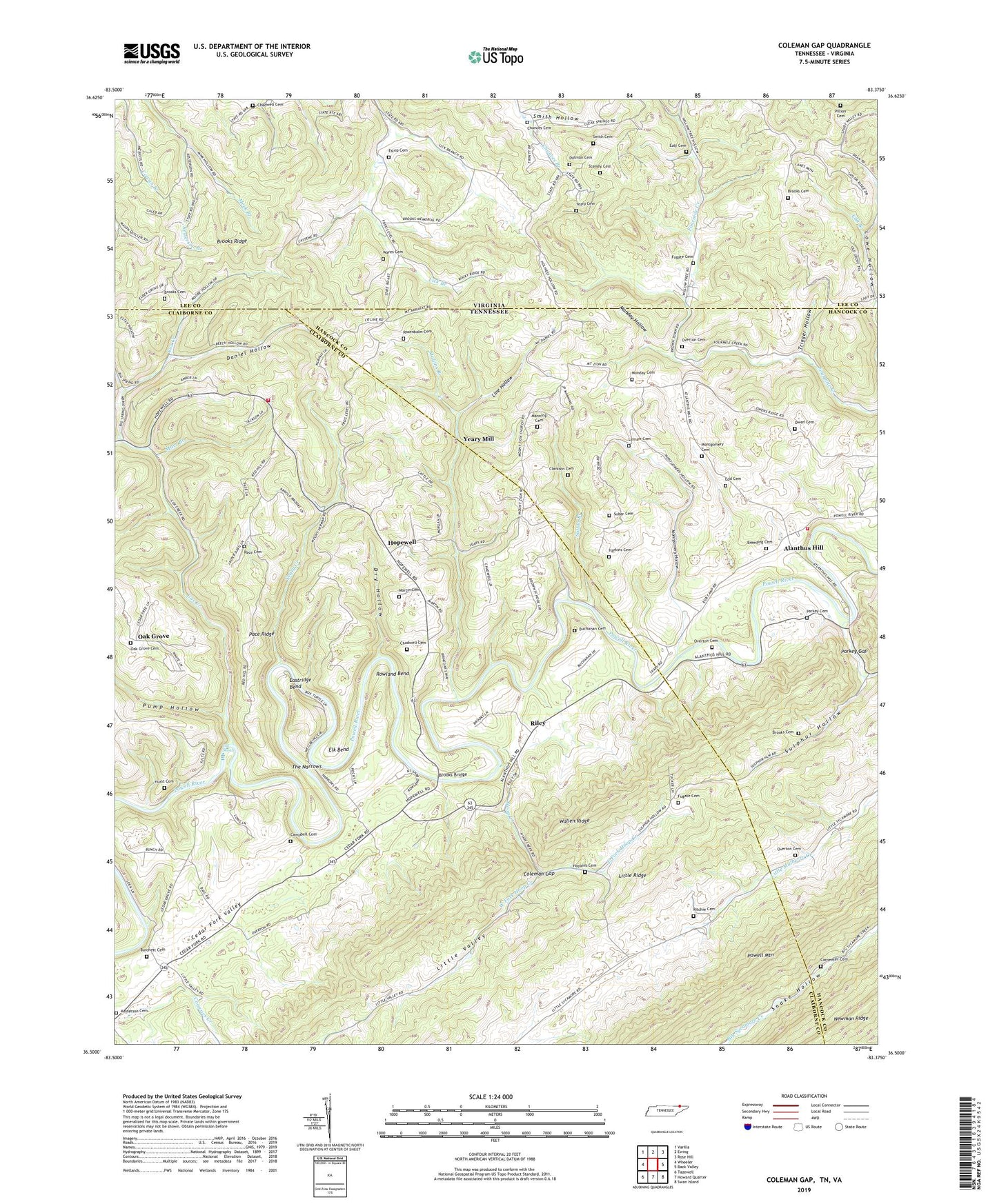
Coleman Gap Tennessee US Topo Map
Couldn't load pickup availability
2019 topographic map quadrangle Coleman Gap in the states of Tennessee, Virginia. Scale: 1:24000. Based on the newly updated USGS 7.5' US Topo map series, this map is in the following counties: Claiborne, Hancock, Lee. The map contains contour data, water features, and other items you are used to seeing on USGS maps, but also has updated roads and other features. This is the next generation of topographic maps. Printed on high-quality waterproof paper with UV fade-resistant inks.
Quads adjacent to this one:
West: Wheeler
Northwest: Varilla
North: Ewing
Northeast: Rose Hill
East: Back Valley
Southeast: Swan Island
South: Howard Quarter
Southwest: Tazewell
Contains the following named places: Alanthus Hill, Alanthus Hill Volunteer Fire Department, Alanthus School, Big Spring Union, Big Spring Union Baptist Church, Big Spring Union School, Breeding Cemetery, Brooks Bridge, Brooks Cemetery, Brooks Ferry, Brooks Ridge, Browns School, Buchanan Cemetery, Buchanan Ford, Burchett Cemetery, Campbell Cemetery, Carpenter Cemetery, Cedar Fork Valley, Cedar Grove Church, Chadwell Cemetery, Chances Cemetery, Chestnut Grove Church, Clarkson Cemetery, Coleman Gap, Coonsies Creek, Cox Creek, Cox Shoals, Daniel Hollow, Dean School, Dillman Cemetery, Dry Hollow, Ealy Cemetery, East Fork Hoop Creek, Eastridge Bend, Edd Branch, Edd Cemetery, Elk Bend, Estep Cemetery, Estep Hollow, Ewing Church, Fugate Cemetery, Fugate Ford, Gibson Hall, Gibson Hall School, Harkins Cemetery, Hoop Creek, Hoop Creek Baptist Church, Hoop Creek School, Hopewell, Hopewell Baptist Church, Hopewell School, Hopkins Cemetery, Hurst Cemetery, Hurst Ford, Keslerson Branch, Kesterson Cemetery, Lemarr Cemetery, Line Hollow, Little Valley School, Manning Cemetery, Marr Branch, Martin Cemetery, Monday Cemetery, Monday Hollow, Montgomery Cemetery, Montgomery Hollow, Mount Zion Church, Mulberry Creek, Mullins Branch, New Salem Church, New Salem School, North Claiborne Volunteer Fire Department Station 2, Oak Grove, Oak Grove Baptist Church, Oak Grove Cemetery, Oak Grove School, Overton Cemetery, Owen Cemetery, Pace Cemetery, Pace Ridge, Parkey Cemetery, Parkey Gap, Pillion Cemetery, Powell Mountain, Pump Hollow, Red Hill, Red Hill Baptist Church, Red Hill Number One School, Riley, Riley Memorial Baptist Church, Riley School, Ritchie Cemetery, Rob Camp, Rob Camp Ford, Rosenbalm Cemetery, Rowland Bend, Smith Cemetery, Smith Chapel, Smith Hollow, Stanley Cemetery, Suber Cemetery, Sulphur Hollow, Sulphur Hollow School, Sutton Branch, The Narrows, Trigger Hollow, Wares Cemetery, West Fork Hoop Creek, Yeary Cemetery, Yeary Creek, Yeary Mill, Yeary School, Yellow Springs, Yellow Springs Church