MyTopo
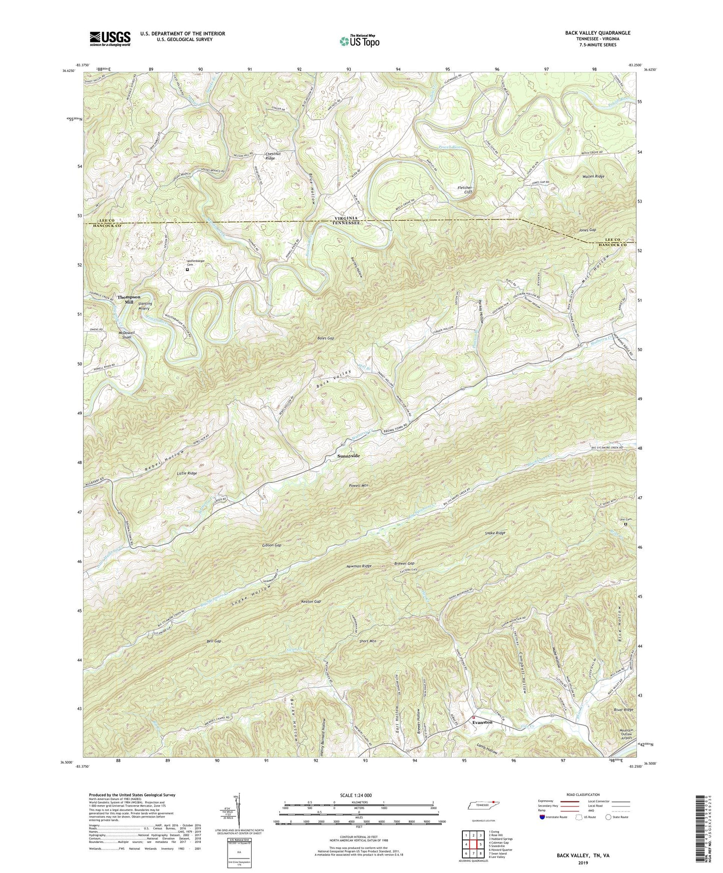
Back Valley Tennessee US Topo Map
Couldn't load pickup availability
2022 topographic map quadrangle Back Valley in the states of Tennessee, Virginia. Scale: 1:24000. Based on the newly updated USGS 7.5' US Topo map series, this map is in the following counties: Hancock, Lee. The map contains contour data, water features, and other items you are used to seeing on USGS maps, but also has updated roads and other features. This is the next generation of topographic maps. Printed on high-quality waterproof paper with UV fade-resistant inks.
Quads adjacent to this one:
West: Coleman Gap
Northwest: Ewing
North: Rose Hill
Northeast: Hubbard Springs
East: Sneedville
Southeast: Lee Valley
South: Swan Island
Southwest: Howard Quarter
Contains the following named places: Back Valley, Baldwin Ford, Bales Ford, Bales Gap, Barley Ford, Bartley Hollow, Beech Grove Church, Beech Grove School, Bell Gap, Big Sycamore Church, Blue Hollow, Brewer Chapel, Brewer Gap, Brewer Hollow, Brier Creek Church, Campbell Hollow, Camps Volunteer Fire Department, Chestnut Ridge, Commissioner District 5, Earl Hollow, Evanston, Fairview Church, Flea Creek, Fletcher Cliff, Fletcher Ford, Fourmile Creek, Gibson Gap, Jones Gap, Keaton Gap, Lexi Cemetery, Little Mulberry Church, Little Mulberry Creek, Lowe Hollow, Mabe Hollow, Martin Creek, Martin Creek Church, Martin Creek School, Mathis Mill, McDowell Shoal, Mill Branch, Mill Hollow, Mount Davidson School, Mountain Outlaw Airport, Mulberry Gap, Mulberry Gap Elementary School, Painter Branch, Parkey Hollow, Powell Valley Division, Ramsey, Ramsey School, Rebel Hollow, Rice Hollow, Rosedale Church, Sandy Springs Church, Sandy Springs School, Seal Mathis, Seal Mathis Community Center, Seal Mathis Elementary School, Short Mountain, Slanting Misery, Snake Ridge, Snodgrass Ford, Speaks Branch, Sunnyside, Sunnyside School, Sycamore School, Thomas Chapel, Thompson Mill, Turner Hollow, Vanhuss Grove Church, Wolfenbarger Cemetery, Wolfenbarger Church, Yellow Creek


