MyTopo
Cottontown Tennessee US Topo Map
Couldn't load pickup availability
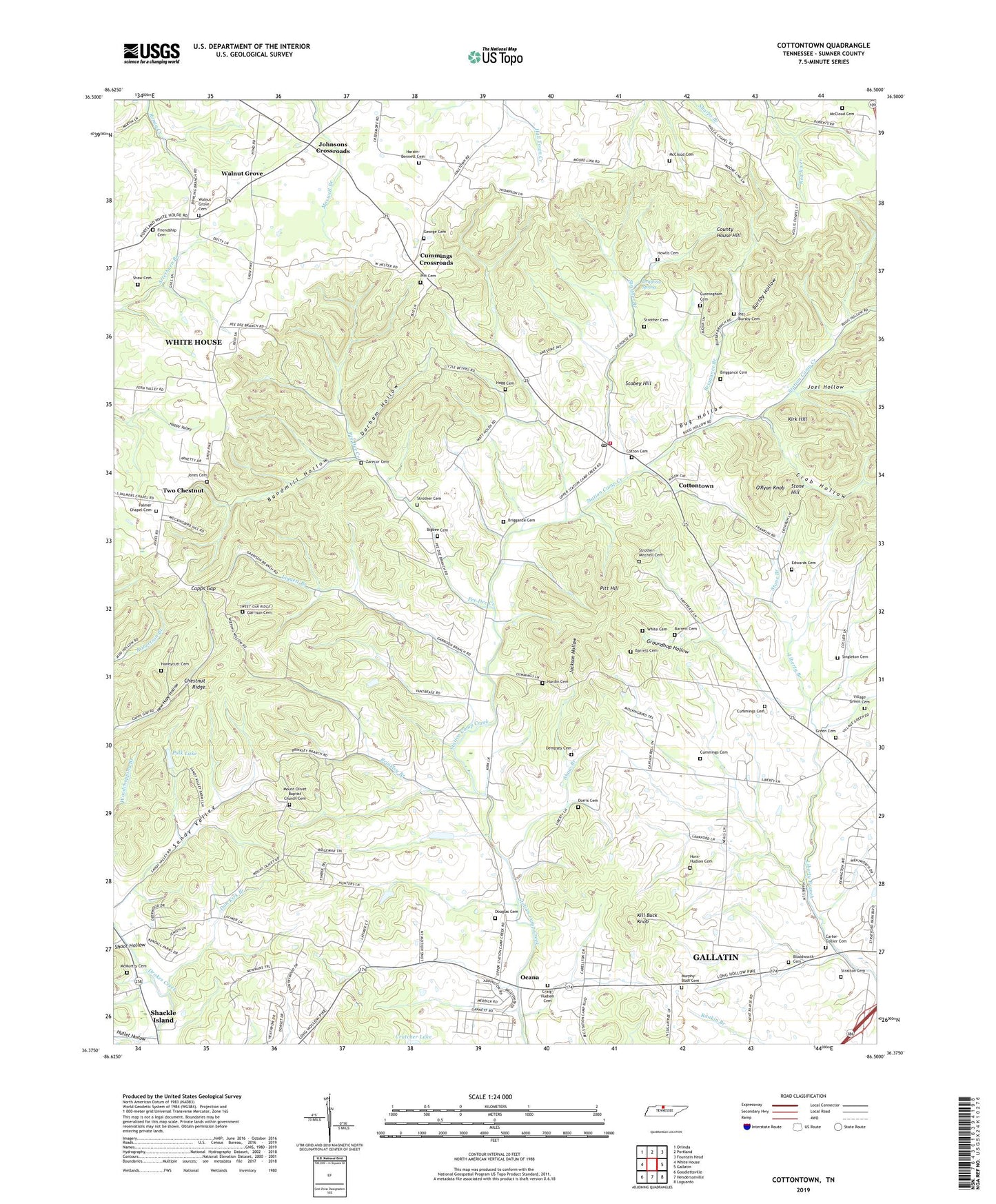
2019 topographic map quadrangle Cottontown in the state of Tennessee. Scale: 1:24000. Based on the newly updated USGS 7.5' US Topo map series, this map is in the following counties: Sumner. The map contains contour data, water features, and other items you are used to seeing on USGS maps, but also has updated roads and other features. This is the next generation of topographic maps. Printed on high-quality waterproof paper with UV fade-resistant inks.
Quads adjacent to this one:
West: White House
Northwest: Orlinda
North: Portland
Northeast: Fountain Head
East: Gallatin
Southeast: Laguardo
South: Hendersonville
Southwest: Goodlettsville
Contains the following named places: Bandmill Hollow, Barrett Cemetery, Bigbee Cemetery, Bloodworth Cemetery, Briggance Branch, Briggance Cemetery, Brinkley Branch, Bug Hollow, Bursby Hollow, Capps Gap, Carter-Collier Cemetery, Chestnut Ridge, Commissioner District 12, Commissioner District 4, Cotton Cemetery, Cottontown, Cottontown Baptist Church, Cottontown Census Designated Place, Cottontown Church of Christ, Cottontown Fire Department, Cottontown Post Office, Cottontown School, County House Hill, Crab Hollow, Craig-Hudson Cemetery, Crutcher Lake Dam, Cummings Cemetery, Cummings Crossroads, Cunningham Cemetery, Dan Kirk Branch, Dempsey Cemetery, Dorris Cemetery, Douglas Cemetery, Douglas Chapel, Dripping Spring, Durham Hollow, Edwards Cemetery, Fairmont School, Friendship Cemetery, Garrison Cemetery, George Cemetery, Gillespie Prospect, Green Cemetery, Groundhop Hollow, Hardin Cemetery, Hardin-Bennett Cemetery, Hogg Cemetery, Hollis Chapel, Hollis Chapel School, Honeycutt Cemetery, Horn-Hudson Cemetery, Howlis Cemetery, Hutlet Hollow, Jackson Hollow, Joel Hollow, Johnsons Crossroads, Jones Cemetery, Kill Buck Knob, Kirk Hill, Liberty Community Hall, Liberty United Methodist Church, Liggett Branch, Little Bethel Church, McCloud Cemetery, McMurtry Cemetery, Mount Olivet Baptist Church, Mount Olivet Baptist Church Cemetery, Mount Olivet School, Murphy-Bush Cemetery, Ocana, Old Friendship Church, Old Indian Cemetery, O'Ryan Knob, Palmer Chapel, Palmer Chapel Cemetery, Palmer Chapel School, Pee Dee Creek, Pitt Cemetery, Pitt Hill, Pitt-Bursby Cemetery, Polk Lake, Poplar Hollow, Rival, Robertson Prospect, Sandy Valley, Scobey Hill, Shackle Island Census Designated Place, Shaw Branch, Shaw Cemetery, Shoot Hollow, Singleton Cemetery, Station Camp, Station Camp Church, Stone Branch, Stone Hill, Stratton Cemetery, Strother Branch, Strother Cemetery, Strother Church, Strother-Mitchell Cemetery, Sumner County Home, Two Chestnut, Village Green Cemetery, Walnut Grove, Walnut Grove Cemetery, Walnut Grove Census Designated Place, Walnut Grove United Methodist Church, Webb Prospect, White Cemetery, White House Division, Zarecor Cemetery, ZIP Code: 37048