MyTopo
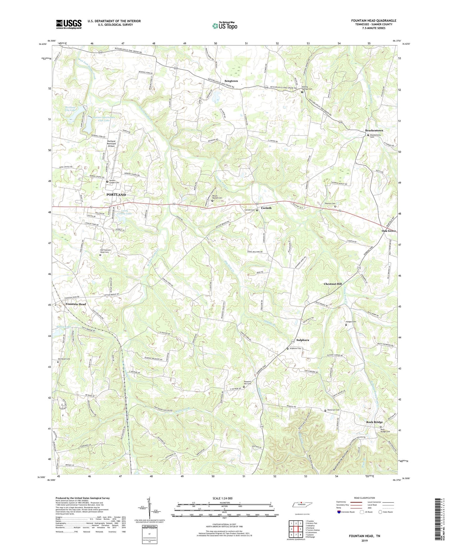
Fountain Head Tennessee US Topo Map
Couldn't load pickup availability
2022 topographic map quadrangle Fountain Head in the state of Tennessee. Scale: 1:24000. Based on the newly updated USGS 7.5' US Topo map series, this map is in the following counties: Sumner. The map contains contour data, water features, and other items you are used to seeing on USGS maps, but also has updated roads and other features. This is the next generation of topographic maps. Printed on high-quality waterproof paper with UV fade-resistant inks.
Quads adjacent to this one:
West: Portland
Northwest: Franklin
North: Hickory Flat
Northeast: Adolphus
East: Turners Station
Southeast: Bethpage
South: Gallatin
Southwest: Cottontown
This map covers the same area as the classic USGS quad with code o36086e4.
Contains the following named places: Antioch Baptist Church, Boiling Springs Cemetery, Boiling Springs Church, Brackentown, Brackentown Cemetery, Brackentown School, Buck Lodge, Buck Lodge School, Caney Fork Creek, Chestnut Hill, Clyde Riggs Elementary School, Corinth, Corinth Cemetery, Corinth School, Dry Fork Creek, Fountain Head, Fountain Head Church of Christ, Highland Academy, Highland Seventh Day Adventist Church, Hillcrest Church, Hodges Cemetery, Larry Collins Dam, Larry Collins Lake, Mount Moriah Cemetery, Mount Moriah Church, Oak Grove, Oak Grove Census Designated Place, Old Brush Cemetery, Old Fountain Head Cemetery, Old Fountain Head Church, Parkers Chapel, Parkers Chapel Cemetery, Parkers Chapel School, Patterson Cemetery, Pipers Chapel, Pleasant Hill Cemetery, Pleasant Hill Church, Portland City Lake, Portland City Lake Dam, Portland Division, Portland Municipal Airport, Rock Bridge, Rock Bridge Baptist Church, Rock Bridge Cemetery, Rock Bridge Church of Christ, Sengtown, Sherron Cemetery, Sulphur Branch, Sulphura, Sulphura Cemetery, Sulphura School, Sumner County Sportsman Club Lake Dam, Sumner Sportsman Club Lake, Wattwood Branch, West Prong Caney Fork Creek, Whitson Branch, Willow Lake, Willow Lake Dam, ZIP Code: 37148


