MyTopo
Fredonia Tennessee US Topo Map
Couldn't load pickup availability
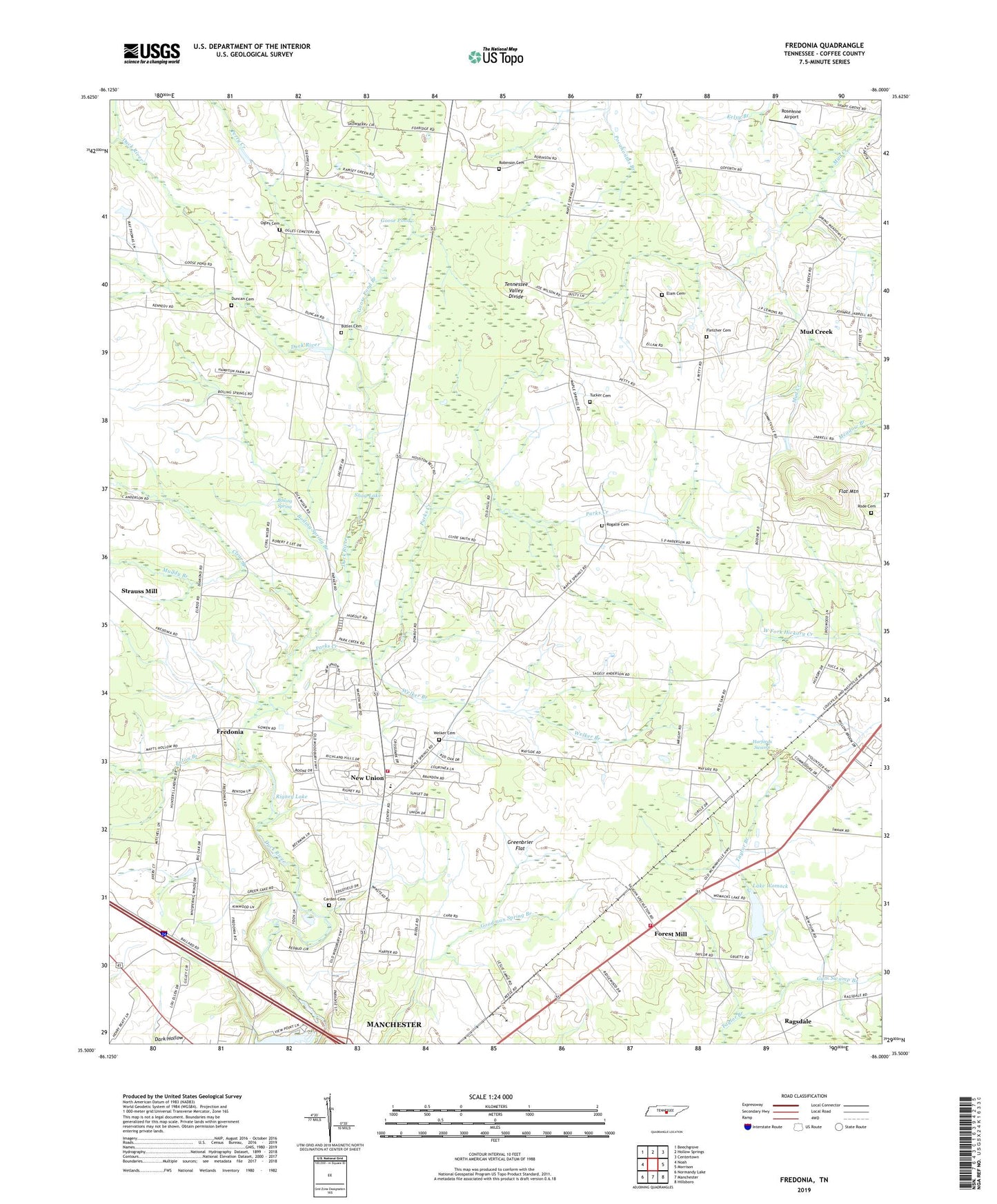
2019 topographic map quadrangle Fredonia in the state of Tennessee. Scale: 1:24000. Based on the newly updated USGS 7.5' US Topo map series, this map is in the following counties: Coffee. The map contains contour data, water features, and other items you are used to seeing on USGS maps, but also has updated roads and other features. This is the next generation of topographic maps. Printed on high-quality waterproof paper with UV fade-resistant inks.
Quads adjacent to this one:
West: Noah
Northwest: Beechgrove
North: Hollow Springs
Northeast: Centertown
East: Morrison
Southeast: Hillsboro
South: Manchester
Southwest: Normandy Lake
Contains the following named places: Boiling Spring, Boiling Spring Branch, Brooksville, Butler Cemetery, Carden Cemetery, Circle J Park, Clear Branch, Commissioner District 8, Commissioner District 9, Duncan Cemetery, East Coffee Elementary School, Eaton Branch, Elam Cemetery, Flat Mountain, Fletcher Cemetery, Forest Mill, Forest Mill Church, Forest Mill School, Forrest Mill Methodist Church, Fredonia, Fredonia Methodist Church, Fredonia School, Goose Pond, Goose Pond Branch, Goose Pond Methodist Church, Goose Pond School, Green Lake, Greenbrier Flat, Gum Swamp Branch, Harfords Swamp, Holly, Lake Womac Dam, Lake Womack, Lumley Stand Church, Lumleys Stand, Manchester Mobile Home Park, Maple Spring School, Med Stat EMS, Mud Creek, Mud Creek Methodist Church, Muddy Branch, New Hope Baptist Church, New Union, New Union Census Designated Place, New Union Church, New Union Church of Christ, New Union Elementary School, New Union Volunteer Fire Department, Ogles Cemetery, Parks Creek, Patmos Chapel, Patmos School, Perry Creek, Ragsdale, Ragsdale School, Rigney Lake, Robinson Cemetery, Rode Cemetery, Rogalle Cemetery, Roseanne Airport, Shay Lake, Strauss Mill, Summitville Volunteer Fire Department, Teal, Tucker Cemetery, Wayside, Welker Branch, Welker Cemetery