MyTopo
Graveston Tennessee US Topo Map
Couldn't load pickup availability
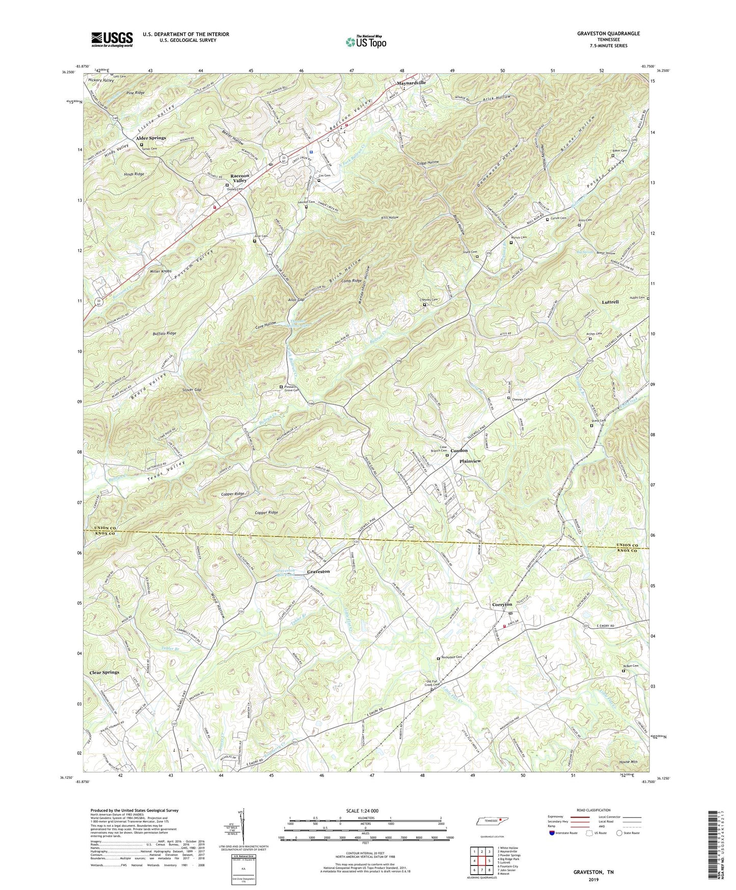
2022 topographic map quadrangle Graveston in the state of Tennessee. Scale: 1:24000. Based on the newly updated USGS 7.5' US Topo map series, this map is in the following counties: Union, Knox. The map contains contour data, water features, and other items you are used to seeing on USGS maps, but also has updated roads and other features. This is the next generation of topographic maps. Printed on high-quality waterproof paper with UV fade-resistant inks.
Quads adjacent to this one:
West: Big Ridge Park
Northwest: White Hollow
North: Maynardville
Northeast: Powder Springs
East: Luttrell
Southeast: Mascot
South: John Sevier
Southwest: Fountain City
This map covers the same area as the classic USGS quad with code o36083b7.
Contains the following named places: Ailor Cemetery, Ailor Gap, Alder Springs, Alder Springs Baptist Church, Alder Springs School, Archer Cemetery, Arick Hollow, Baker Cemetery, Beeler Hollow, Big Spring, Birch Hollow, Black Hollow, Blaine Chapel, Bower Hollow, Bradley Branch, Bruner Hollow, Buffalo Ridge, Bullrun School, Chesney Cemetery, City of Maynardville, City of Plainview, Clapp Hollow, Clear Branch Cemetery, Clear Branch Church, Comb Ridge, Commissioner District 1, Commissioner District 7, Condon, Corryton, Corryton Baptist Church, Corryton Division, Corryton Elementary School, Corryton Post Office, Corum Cemetery, Cove Hollow, Cox Cemetery, Dale Chapel, Damewood Hollow, Dryland Branch, Gibbs Elementary School, Gibbs High School, Gibbs Middle School, Gibbs School, Glendale School, Graveston, Graveston Mill Pond, Hamilton Gap, Hensley Hollow, Horace Maynard High School, House Mountain, Hubbs Cemetery, Johnson Cemetery, Kimberden Farms, Kitts Cemetery, Kitts Hollow, Lett Cemetery, Little Branch, Little Flat Creek Church, Luttrell Elementary School, Maynardville Baptist Church, Maynardville Church, Maynardville Division, Maynardville Elementary School, Maynardville Fire Department, Maynardville Police Department, Maynardville Post Office, McBee Cemetery, Mendenhall Hollow, Miller Chapel, Miller Knobs, New Friendship Church, North Fork Bullrun Creek, Old Flat Creek Cemetery, Ousley Cemetery, Plain View School, Pleasant Grove Cemetery, Pleasant Grove School, Pleasant Valley, Potato Valley, Prospect School, Raccoon Valley, Raccoon Valley School, Rockydale Cemetery, Rockydale Church, Rural / Metro Fire Department Knox County Station 33, Sharp Cemetery, Stover Gap, Tabler Branch, Thunder Hollow Dam, Thunder Hollow Lake, Turner Cemetery, Union Church, Union County Rescue Squad, Union County Sherriff's Department, Wood Hollow, Woodburn, Wyrick Cemetery, ZIP Code: 37779