MyTopo
Henson Gap Tennessee US Topo Map
Couldn't load pickup availability
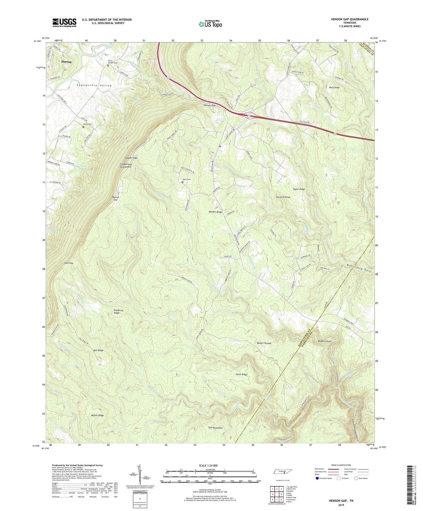
2019 topographic map quadrangle Henson Gap in the state of Tennessee. Scale: 1:24000. Based on the newly updated USGS 7.5' US Topo map series, this map is in the following counties: Sequatchie, Hamilton, Bledsoe. The map contains contour data, water features, and other items you are used to seeing on USGS maps, but also has updated roads and other features. This is the next generation of topographic maps. Printed on high-quality waterproof paper with UV fade-resistant inks.
Quads adjacent to this one:
West: Daus
Northwest: Savage Point
North: Mount Airy
Northeast: Brayton
East: Soddy
Southeast: Daisy
South: Fairmount
Southwest: Ketner Gap
Contains the following named places: Alex Branch, Barker Pounds, Big Brush Creek, Buck Knob, Cain Creek, Center Point Division, Commissioner District 1, Cooper Creek, Corncrib Knob, Cowpen Gap, Davis Cemetery, Davis Chapel, Davis Chapel Cemetery, Dayton Number 3 Mine, Dayton Number 4 Mine, Elder Church, Emmaline Branch, Frederick Ridge, Hall Church, Hall School, Harvey Creek, Henson Creek, Henson Gap, Jack Gap, Kell Ridge, Lewis Cemetery, Lewis Chapel, Lewis Chapel Fire Department, Lewis Chapel School, Maizie Ridge, Middle Creek, Mossy Creek, Mowbray Number 18 Mine, Panther Branch, Point Ridge, Redbird Point, Rogers Branch, Sawmill Creek, Stevenson Branch, Stewart Camp, Taylor Ridge, Walnut Gap