MyTopo
Mount Airy Tennessee US Topo Map
Couldn't load pickup availability
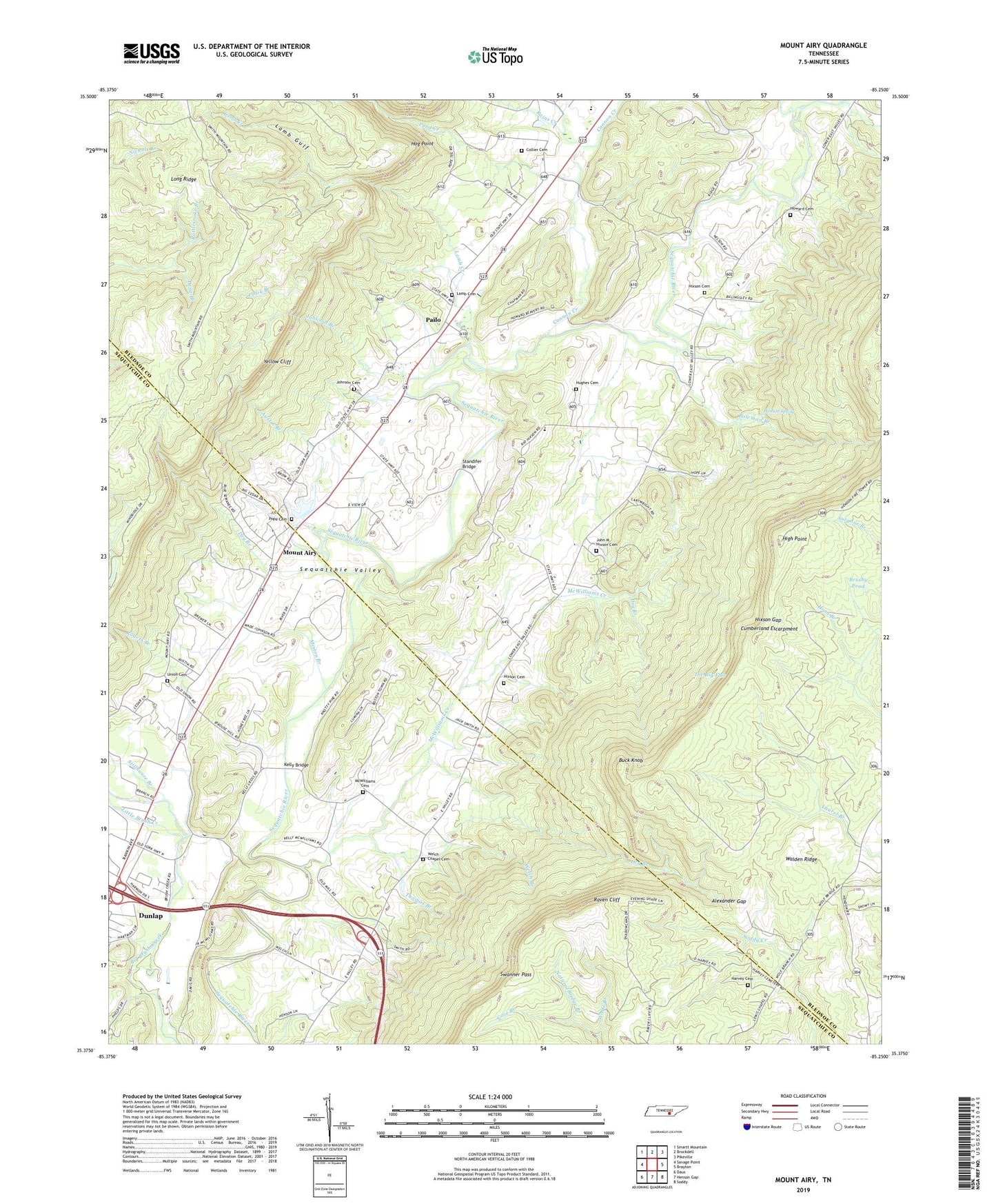
2022 topographic map quadrangle Mount Airy in the state of Tennessee. Scale: 1:24000. Based on the newly updated USGS 7.5' US Topo map series, this map is in the following counties: Bledsoe, Sequatchie. The map contains contour data, water features, and other items you are used to seeing on USGS maps, but also has updated roads and other features. This is the next generation of topographic maps. Printed on high-quality waterproof paper with UV fade-resistant inks.
Quads adjacent to this one:
West: Savage Point
Northwest: Smartt Mountain
North: Brockdell
Northeast: Pikeville
East: Brayton
Southeast: Soddy
South: Henson Gap
Southwest: Daus
This map covers the same area as the classic USGS quad with code o35085d3.
Contains the following named places: Alexander Gap, Austin Branch, Bethel Church, Bethlehem Church, Bowman Branch, Brush Creek Siding, Brushy Pond, Buck Knob, Cannon Creek, Center Point Church, Center Point School, Clark Branch, Collier Cemetery, Commissioner District 3, Commissioner District 6, Cove Branch, Dry Branch, Ebenezer Church, Elm Hill, Elm Hill School, Ewtonville Church, Gates Ford, Harris Ford, Harvey Cemetery, Henson Spring, High Point, Hixson Cemetery, Hixson Gap, Hog Point, Hopewell Church, Howard Walker Cemetery, Hughes Cemetery, John M Hixson Cemetery, Johnson Branch, Johnson Cemetery, Kelly Bridge, Lamb Cemetery, Lamb Creek, Lamb Gulf, Little Brush Creek, McWilliams Cemetery, McWilliams Creek, Minton Branch, Mount Airy, Mount Airy Church, Natural Bridge Branch, Pailo, Pond Creek, Pope Cemetery, Rains Creek, Rattlesnake Branch, Raven Cliff, Rogers Branch, Sequatchie-Bledsoe Vocational Training Center, Standifer Bridge, Stephen Chapel, Stephen Chapel Ford, Stillhouse Branch, Sunnyside School, Swanner Pass, The Big Flat, Thermans Bridge, Thomas Branch, Union Cemetery, Union School, Walker Ford, Welch Branch, Welch Chapel, Welch Chapel United Methodist Church Cemetery, Wolfe Branch, Yellow Cliff