MyTopo
Hillville Tennessee US Topo Map
Couldn't load pickup availability
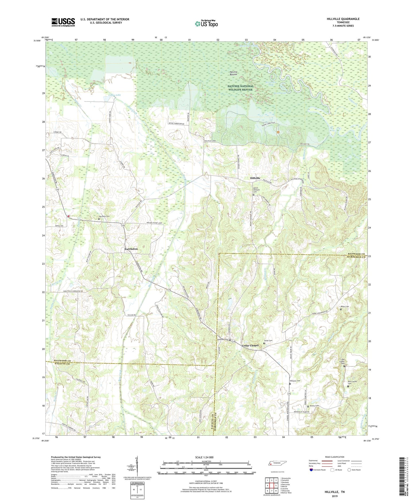
2019 topographic map quadrangle Hillville in the state of Tennessee. Scale: 1:24000. Based on the newly updated USGS 7.5' US Topo map series, this map is in the following counties: Haywood, Hardeman, Fayette. The map contains contour data, water features, and other items you are used to seeing on USGS maps, but also has updated roads and other features. This is the next generation of topographic maps. Printed on high-quality waterproof paper with UV fade-resistant inks.
Quads adjacent to this one:
West: Dancyville
Northwest: Brownsville
North: Sunnyhill
Northeast: Denmark
East: Mercer
Southeast: Bolivar West
South: Whiteville
Southwest: Laconia
Contains the following named places: Big Lake, Big Lake Dam, Brownsville - Haywood County Fire Department District 3, Cedar Chapel, Central Junior High School, Coffee Lake, Eurekaton, Freels Lake, Freels Lake Dam, Good Hope Church, Good Hope School, Harmony Baptist Church Cemetery, Harmony Church, Hatchie Bottom, Hatchie National Wildlife Refuge, Hills Chapel, Hillville, Hillville Division, Horseshoe Cutoff, Horseshoe Lake, Jeffers Creek, Kinney Cemetery, Little Lake, Little Lake Dam, London Creek, Midway Church, Miller Cemetery, Morris Branch, Mount Pleasant Cemetery, Mount Pleasant Church, Mount Tabor Churchs, New Cauley Cemetery, New Lake, New Lake Dam, Old Cauley Cemetery, Pilgrim Rest School, Powell Lake, Reubens School, Richland Creek, Russell Grove Church, Russell Grove School, Sammons Cemetery, Sammons Lake, Sammons Lake Dam, Simons Chapel, Smith Cemetery, The Big Eddy, Williams Cemetery, ZIP Code: 38075