MyTopo
Ketner Gap Tennessee US Topo Map
Couldn't load pickup availability
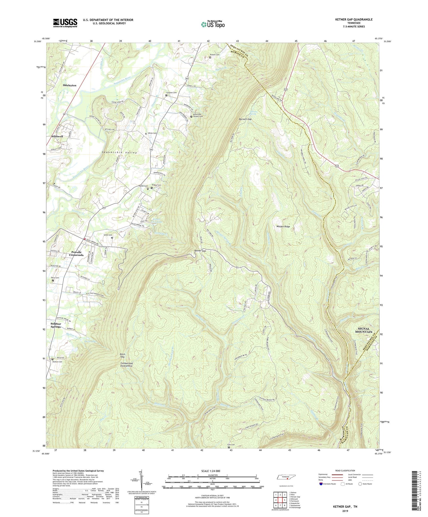
2019 topographic map quadrangle Ketner Gap in the state of Tennessee. Scale: 1:24000. Based on the newly updated USGS 7.5' US Topo map series, this map is in the following counties: Marion, Sequatchie, Hamilton. The map contains contour data, water features, and other items you are used to seeing on USGS maps, but also has updated roads and other features. This is the next generation of topographic maps. Printed on high-quality waterproof paper with UV fade-resistant inks.
Quads adjacent to this one:
West: Whitwell
Northwest: Palmer
North: Daus
Northeast: Henson Gap
East: Fairmount
Southeast: Chattanooga
South: Wauhatchie
Southwest: Sequatchie
Contains the following named places: Baggett and Pickett Mines, Barker Cemetery, Barnes Mine, Big Government Mine, Brock and Pickett Cemetery, Browns Chapel, Browns Chapel School, Burnett Gap, Commissioner District 5, Conner Creek, Crossroads Elementary School, Crossroads Volunteer Fire Department, Daniel Creek, Davis Cemetery, Davis Lake, Ditch Gap, Grace Baptist Church, Grayson Branch, Grayson Cemetery, Graysons Mill, Griffith and Wallace Number 4 Mine, Griffith Creek, Grover Lewis Mine, Hassler Mine, Hickey Mine, Hicks Chapel, Hicks Chapel School, Hilliards Mill, Hudson Branch, Hurricane Creek, Johnson Spring, Kelley Chapel, Ketner Cove Lake, Ketner Cove Lake Dam, Ketner Gap, Lane Number 1 Mine, Lane Number 2 Mine, Lane Number 3 Mine, Lewis Barker Mine, Lewis Creek, Looneys Chapel, Looneys Creek, Lusk Cemetery, Marshall Fork Branch, Meager Spring Branch, Mike Creek, Moore and Turner Mine, Mount Calvary Church, North Suck Creek, Panther Creek, Panther Creek Number 1 Mine, Peacock Branch, Perkins Mine, Pickett Cemetery, Pickett Mine, Powells Crossroads, Riverview Church, Scott and Bowman Number 1 Mine, Scott and Bowman Number 2 Mine, Shelton Cemetery, Shelton Creek, Shirleyton, Short Creek, Smith Cemetery, Smith Number 3 Mine, South Suck Creek, Spurgeon Smith Mine, Suck Creek, Suck Creek Mountain Volunteer Fire Department, Suck Creek School, Sulphur Branch, Sulphur Springs, Sulphur Springs School, Sulphur Springs United Methodist Church, Tate Number 5 Mine, Tate Number 6 Mine, Teague Cemetery, Town of Powells Crossroads, White Cemetery, Wilburn Kilgore Mine