MyTopo
Lambert Tennessee US Topo Map
Couldn't load pickup availability
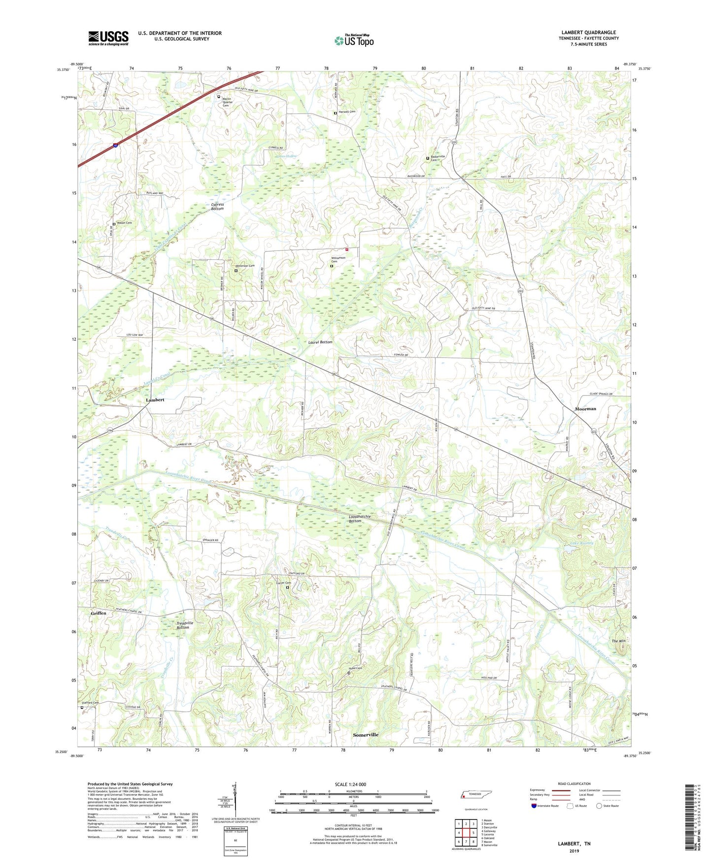
2019 topographic map quadrangle Lambert in the state of Tennessee. Scale: 1:24000. Based on the newly updated USGS 7.5' US Topo map series, this map is in the following counties: Fayette. The map contains contour data, water features, and other items you are used to seeing on USGS maps, but also has updated roads and other features. This is the next generation of topographic maps. Printed on high-quality waterproof paper with UV fade-resistant inks.
Quads adjacent to this one:
West: Gallaway
Northwest: Mason
North: Stanton
Northeast: Dancyville
East: Laconia
Southeast: Somerville
South: Macon
Southwest: Oakland
Contains the following named places: Antioch Church, Baskerville Cemetery, Basswood Creek, Belmont Church, Bernard School, Brewer School, Carter Cemetery, Carter Chapel, Carter School, Commissioner District 3, Cypress Bottom, Fayette County Fire Department / North District 12, Feathers Chapel, Glade Springs School, Green Hollow, Harwell Cemetery, Hill School, Hood Cemetery, Jones Creek, Lake Rooney, Lambert, Lambert School, Laurel Bottom, Laurel Creek Canal, Loosahatchie Bottom, Maclin Quarter Cemetery, Mason Cemetery, Mays School, Moorman, Oak Grove Church, Patterson Cemetery, Pulliams Chapel, Rhea Chapel, Stafford Cemetery, The Mountain, Travelers Rest School, Treadville Bottom, Warren School, Williamson Cemetery, Williamson Church, Winfrey Lake, Winfrey Lake Dam