MyTopo
Mason Tennessee US Topo Map
Couldn't load pickup availability
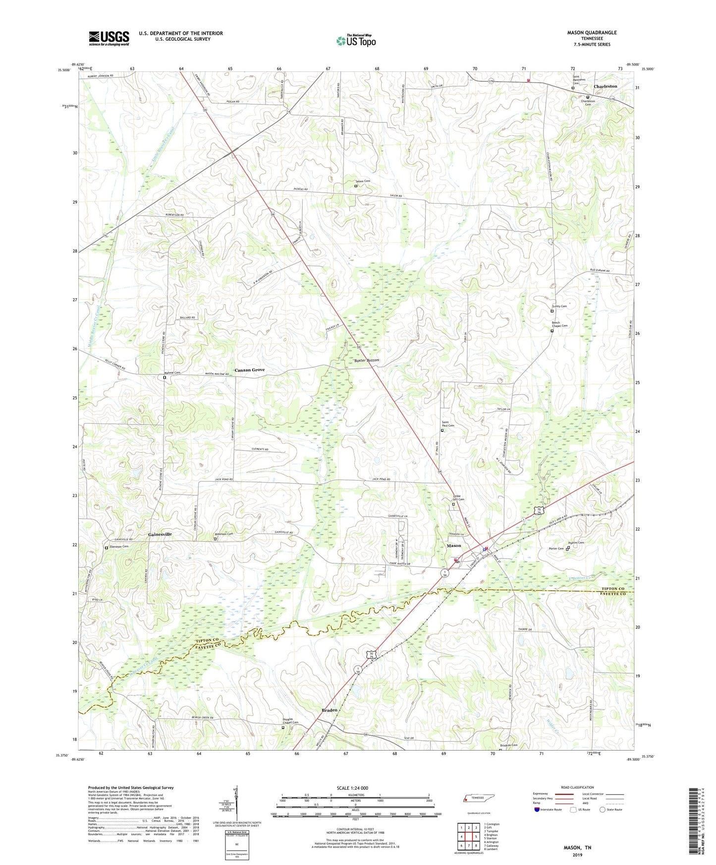
2022 topographic map quadrangle Mason in the state of Tennessee. Scale: 1:24000. Based on the newly updated USGS 7.5' US Topo map series, this map is in the following counties: Tipton, Fayette. The map contains contour data, water features, and other items you are used to seeing on USGS maps, but also has updated roads and other features. This is the next generation of topographic maps. Printed on high-quality waterproof paper with UV fade-resistant inks.
Quads adjacent to this one:
West: Brighton
Northwest: Covington
North: Gift
Northeast: Turnpike
East: Stanton
Southeast: Lambert
South: Gallaway
Southwest: Arlington
This map covers the same area as the classic USGS quad with code o35089d5.
Contains the following named places: Baxter Bottom, Beech Chapel, Beech Chapel Cemetery, Belmont School, Braden, Braden Baptist Church, Braden School, Braden Volunteer Fire Department, Braden-Sinai School, Brodnax Cemetery, Canaan Grove, Canaan Grove Church, Canaan Grove School, Cedar Hill Cemetery, Charleston, Charleston Baptist Church, Charleston Cemetery, Charleston United Methodist Church, Charleston Volunteer Fire Department, Commissioner District 7, Douglas Chapel, Douglas Chapel Cemetery, East Beaver Creek Canal, Ebenezer, Ebenezer Cemetery, Ebenezer Church, Fondren Temple, Gainesville, Gainesville School, Hopewell Church, Little Beaver Creek Canal, Malone Cemetery, Mason, Mason City Hall, Mason Division, Mason Police Department, Mason Post Office, Mason School, Mason Volunteer Fire Department, Middle Beaver Creek Canal, Phelan School, Pipkins Cemetery, Pleasant Grove Church, Porter Cemetery, Robinson Cemetery, Saint Matthews Cemetery, Saint Matthews Church, Saint Matthews School, Saint Paul Cemetery, Saint Paul Church, Salem Cemetery, Salem Church, Salem School, Town of Mason, Trinity Cemetery, Trinity Church, ZIP Code: 38049