MyTopo
Mooring Tennessee US Topo Map
Couldn't load pickup availability
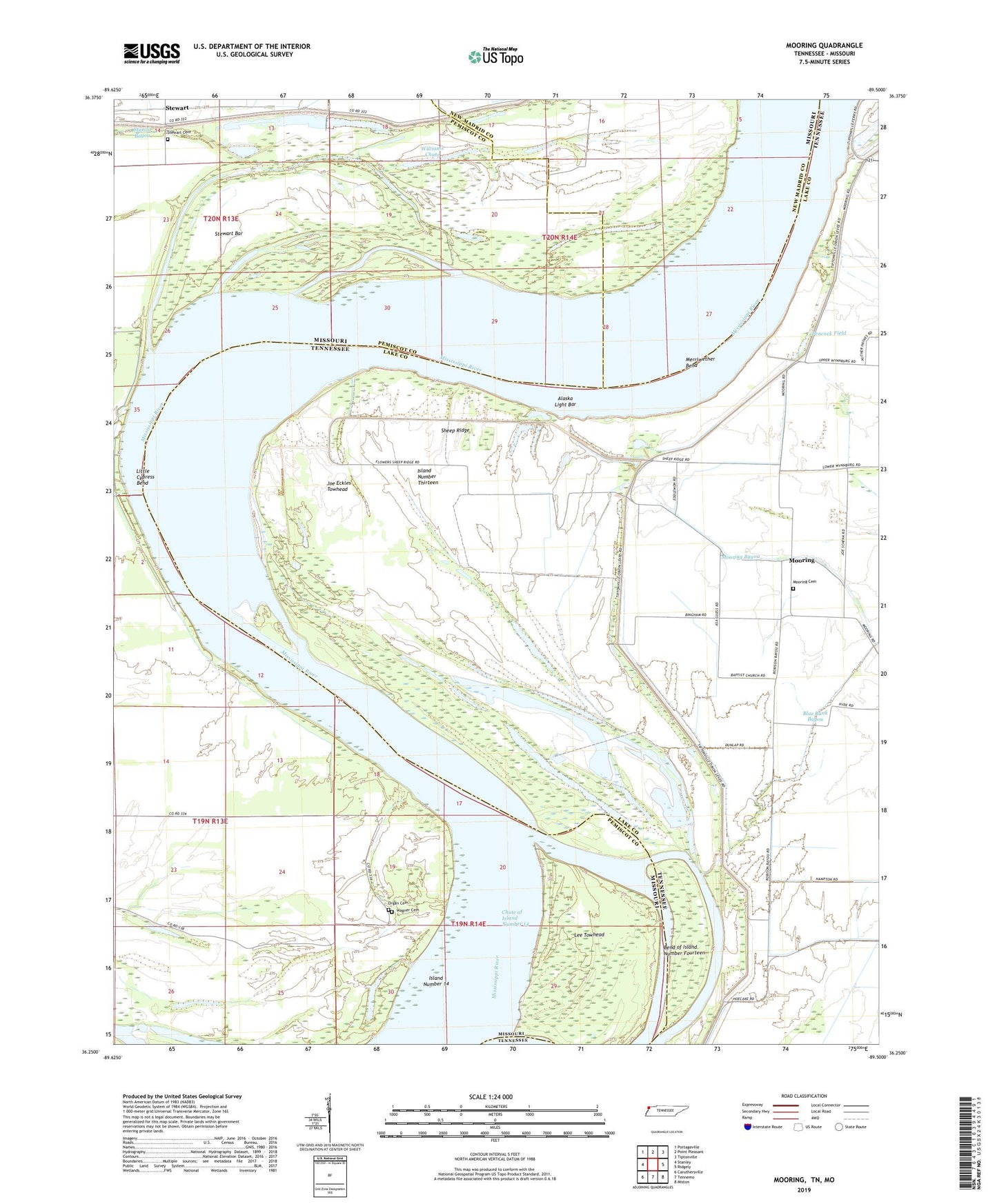
2019 topographic map quadrangle Mooring in the states of Tennessee, Missouri. Scale: 1:24000. Based on the newly updated USGS 7.5' US Topo map series, this map is in the following counties: Lake, Pemiscot, New Madrid. The map contains contour data, water features, and other items you are used to seeing on USGS maps, but also has updated roads and other features. This is the next generation of topographic maps. Printed on high-quality waterproof paper with UV fade-resistant inks.
Quads adjacent to this one:
West: Stanley
Northwest: Portageville
North: Point Pleasant
Northeast: Tiptonville
East: Ridgely
Southeast: Miston
South: Tennemo
Southwest: Caruthersville
Contains the following named places: Alaska Light Bar, Bend of Island Number Fourteen, Bend of Island Number Fourteen Revetment, Bend School, Burnette Church, Burrus Landing, Cherokee Landing, Chute of Island Number 14, Commissioner District 2, Commissioner District 3, Crenshaw Landing, Fourteen Bend, Head of Island Number Thirteen Dikes, Island Number 14, Island Number Thirteen, Joe Eckles Towhead, Kennedy, Lee Towhead, Lee Towhead Revetment, Little Cypress Bend, Merriwether Bend, Merriwether-Cherokee Revetment, Mooring, Mooring Bayou, Mooring Cemetery, Mooring Church, Mooring School, Old Graveyard Slough, Organ Cemetery, Organ School, Peacock Field, Reno Towhead, Riley Landing, Rons Dam, Sheep Ridge, Stewart, Stewart Bar, Stewart Cemetery, Stewart Towhead, Tiptonville Ferry, Township of Butler, Wagner Cemetery, Williams Chute