MyTopo
Tennemo Tennessee US Topo Map
Couldn't load pickup availability
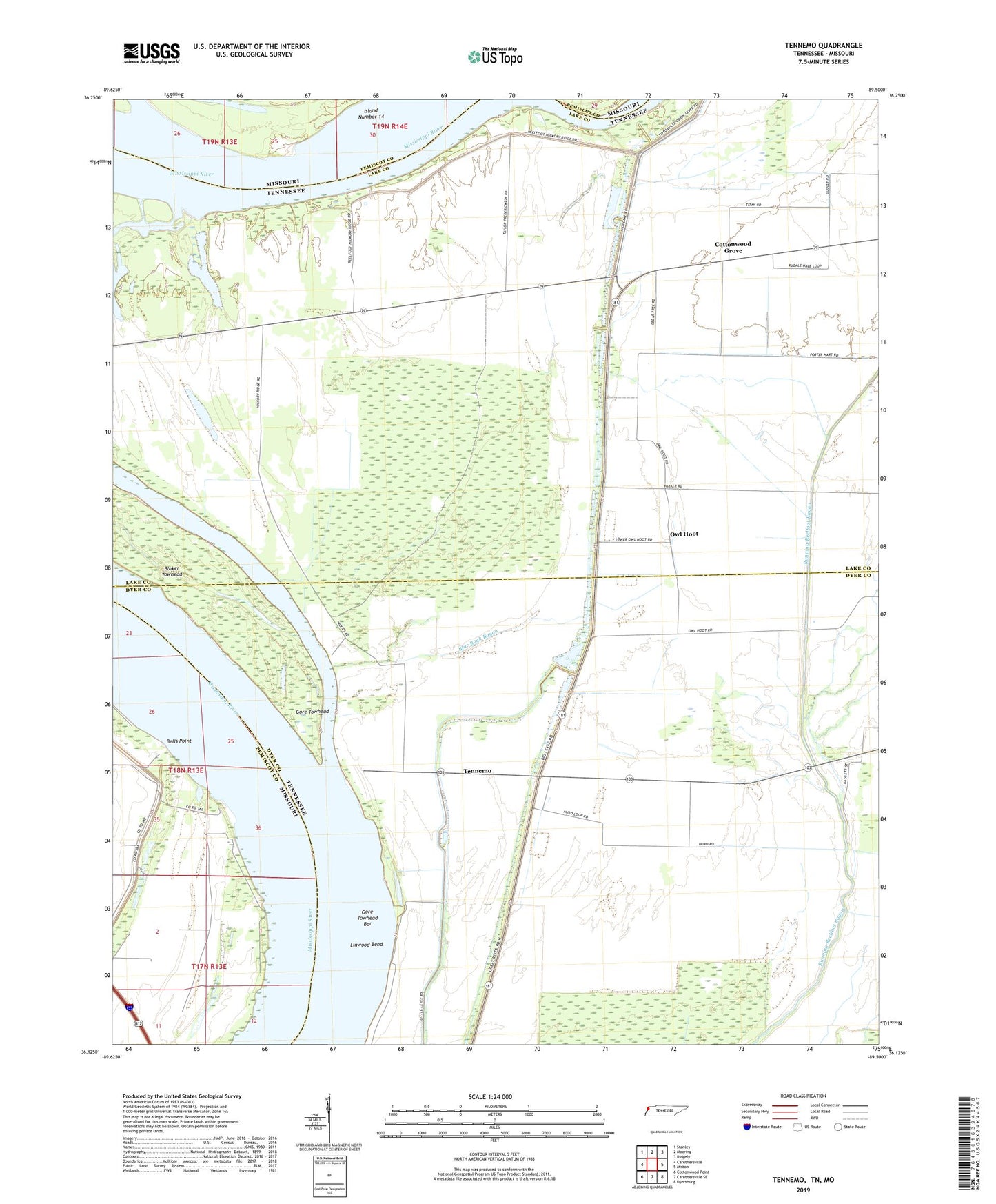
2022 topographic map quadrangle Tennemo in the states of Tennessee, Missouri. Scale: 1:24000. Based on the newly updated USGS 7.5' US Topo map series, this map is in the following counties: Lake, Dyer, Pemiscot. The map contains contour data, water features, and other items you are used to seeing on USGS maps, but also has updated roads and other features. This is the next generation of topographic maps. Printed on high-quality waterproof paper with UV fade-resistant inks.
Quads adjacent to this one:
West: Caruthersville
Northwest: Stanley
North: Mooring
Northeast: Ridgely
East: Miston
Southeast: Dyersburg
South: Caruthersville SE
Southwest: Cottonwood Point
This map covers the same area as the classic USGS quad with code o36089b5.
Contains the following named places: Bells Point, Bells Point Landing, Blaker Towhead, Blaker Towhead Dikes, Blaker Towhead Revetment, Blue Bank Bayou, Chute School, Commissioner District 4, Cotonwood School, Cottonwood Church, Cottonwood Grove, Cottonwood Grove Baptist Church, Dike Number Five, District 18, Fritz Landing, Fritz Revetment, Gore Towhead, Gore Towhead Bar, Grassy Lake, Island Number 16, Linwood Bend, Linwood Landing, Mud Lake, Owl Hoot, Pecks Mill School, Reelfoot Landing, Running Reelfoot Ditch, Seventy-nine Church, Seventy-nine School, Tennemo, Tennemo Bar, Tennemo Landing, Tom Folkes School, ZIP Code: 38080