MyTopo
Miston Tennessee US Topo Map
Couldn't load pickup availability
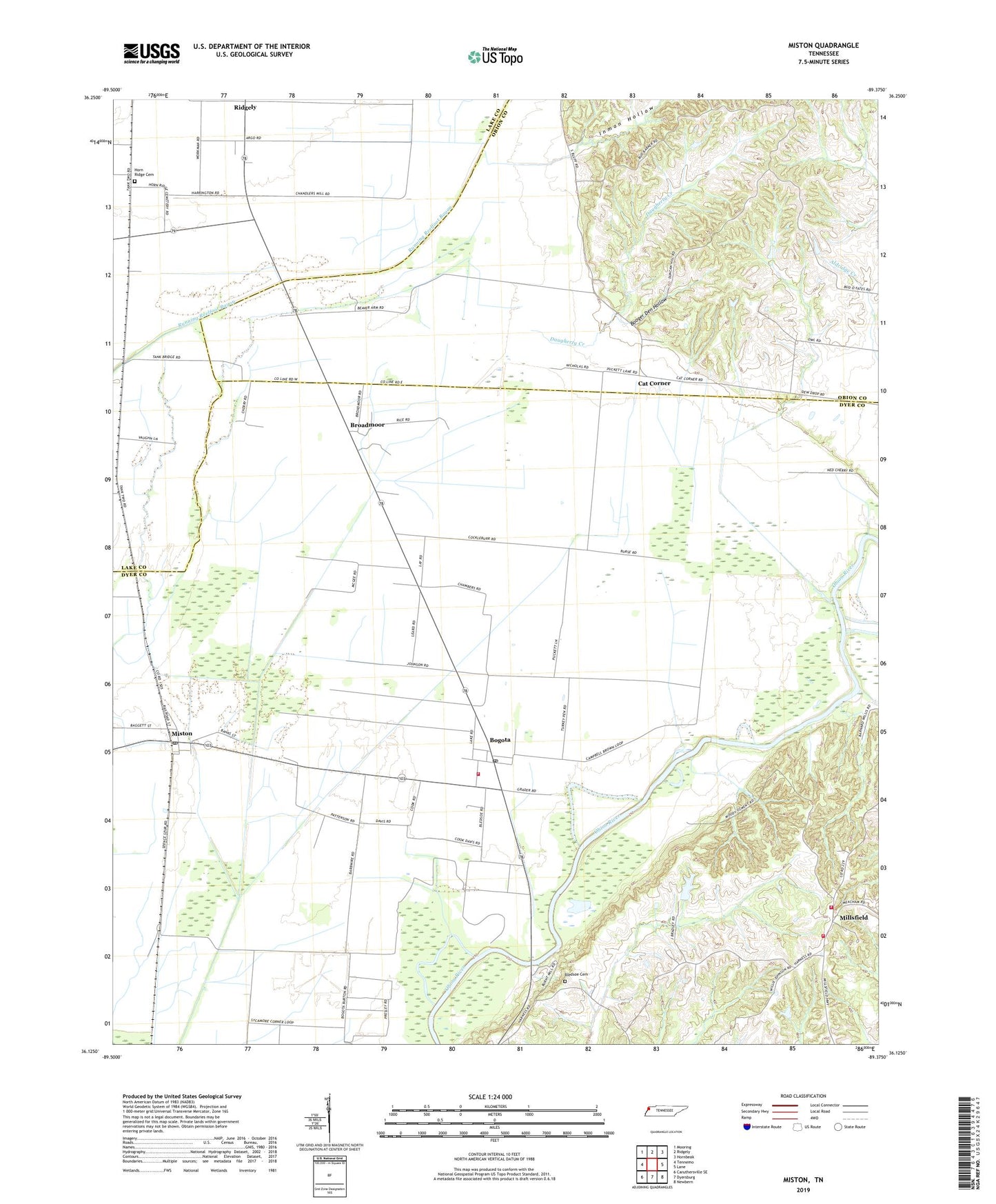
2022 topographic map quadrangle Miston in the state of Tennessee. Scale: 1:24000. Based on the newly updated USGS 7.5' US Topo map series, this map is in the following counties: Dyer, Obion, Lake. The map contains contour data, water features, and other items you are used to seeing on USGS maps, but also has updated roads and other features. This is the next generation of topographic maps. Printed on high-quality waterproof paper with UV fade-resistant inks.
Quads adjacent to this one:
West: Tennemo
Northwest: Mooring
North: Ridgely
Northeast: Hornbeak
East: Lane
Southeast: Newbern
South: Dyersburg
Southwest: Caruthersville SE
This map covers the same area as the classic USGS quad with code o36089b4.
Contains the following named places: Bledsoe Cemetery, Bogota, Bogota Baptist Church, Bogota Census Designated Place, Bogota Elementary School, Bogota Post Office, Bogota Volunteer Fire Department, Booger Den Hollow, Broadmoor, Brown Creek, Bruces Chapel, Bryants Chapel, Calvary, Calvary Church, Cat Corner, Commissioner District 4, Cunningham, Cunningham Church, Cunningham School, Daugherty Creek, District 16, Horn Ridge Cemetery, Hornridge Methodist Church, Inman Hollow, Johnson Creek, Millsfield, Millsfield Fire Department, Millsfield School, Miston, Miston Baptist Church, Miston Census Designated Place, Miston Post Office, Rehoboth Church, Rolling Acres Lake Dam, Rolling Acres Reservoir, Solid Rock Church, United States Forest Service Tennessee Forestry Division, Woodward Chapel, ZIP Code: 38007