MyTopo
Morrison Tennessee US Topo Map
Couldn't load pickup availability
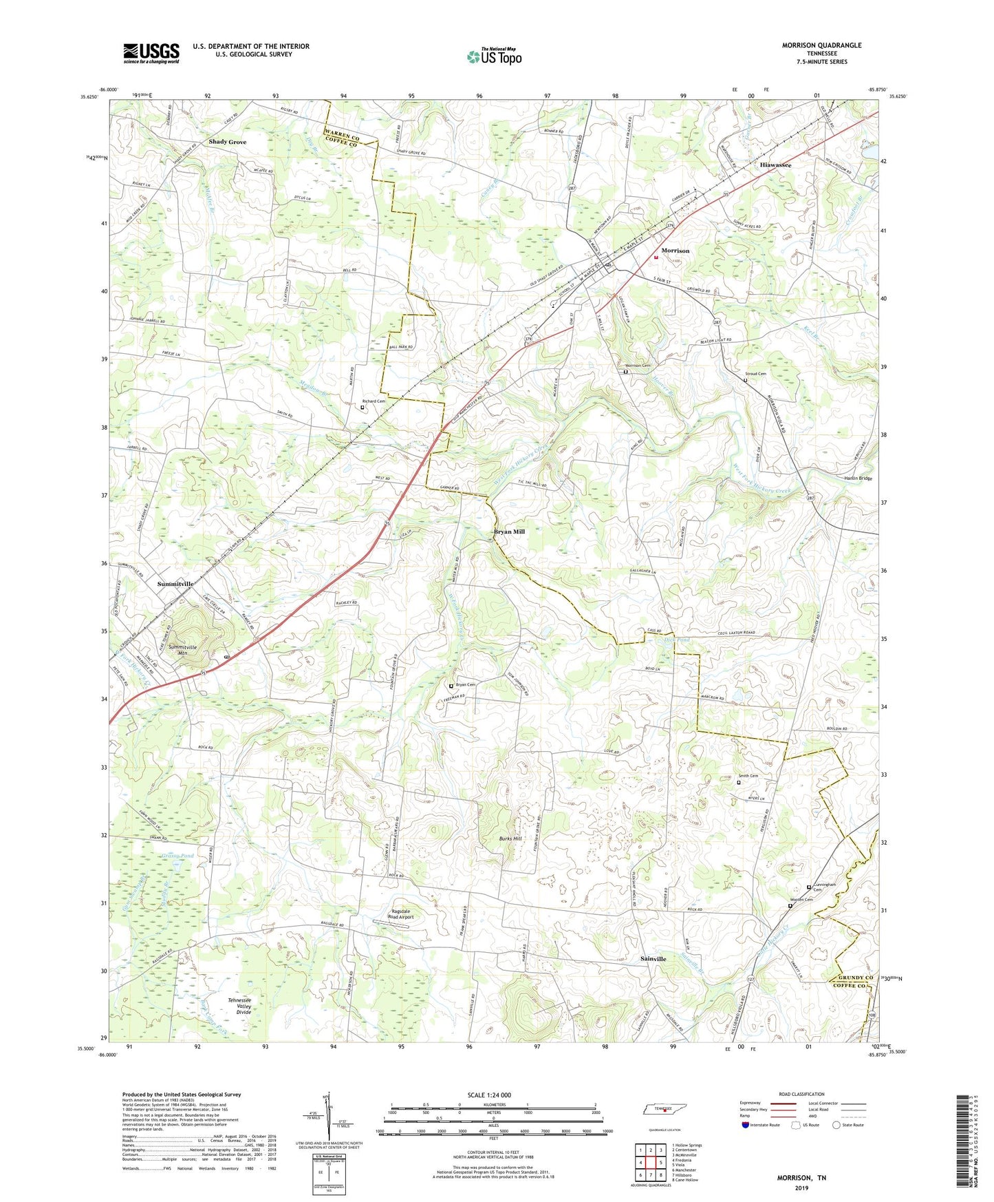
2019 topographic map quadrangle Morrison in the state of Tennessee. Scale: 1:24000. Based on the newly updated USGS 7.5' US Topo map series, this map is in the following counties: Coffee, Warren, Grundy. The map contains contour data, water features, and other items you are used to seeing on USGS maps, but also has updated roads and other features. This is the next generation of topographic maps. Printed on high-quality waterproof paper with UV fade-resistant inks.
Quads adjacent to this one:
West: Fredonia
Northwest: Hollow Springs
North: Centertown
Northeast: McMinnville
East: Viola
Southeast: Cane Hollow
South: Hillsboro
Southwest: Manchester
Contains the following named places: Bark Camp Fork, Black Pond, Bryan Cemetery, Bryan Mill, Burks Hill, Commissioner District 7, Commissioner District 9, Cunningham Cemetery, Dawn, Dick Pond, Fountain Grove, Fountain Grove Church, Grassy Pond, Hanlan, Hanlin Bridge, Hiawassee, Hiawassee Church of Christ, Hickory Grove Church, Hickory Grove School, Hiwasse School, Hoover Branch, Meadow Branch, Morrison, Morrison Cemetery, Morrison Elementary School, Morrison Fire Rescue Department Station 2, Morrison First Baptist Church, Morrison Post Office, Mount Carmel Church, Muddy Branch, Ninth Model, Ninth Model School, Old Well Crossing, Pleasant Knoll Church, Ragsdale Road Airport, Richard Cemetery, Sainville, Sainville Branch, Shady Grove, Shady Grove School, Smith Cemetery, Stroud Cemetery, Summitville, Summitville Baptist Church, Summitville Division, Summitville Methodist Church, Summitville Mountain, Summitville Post Office, Summitville School, Summitville Trailer Park, Town of Morrison, Wesley Chapel, Wesley Chapel School, Wooten Cemetery, ZIP Code: 37357