MyTopo
Palmer Tennessee US Topo Map
Couldn't load pickup availability
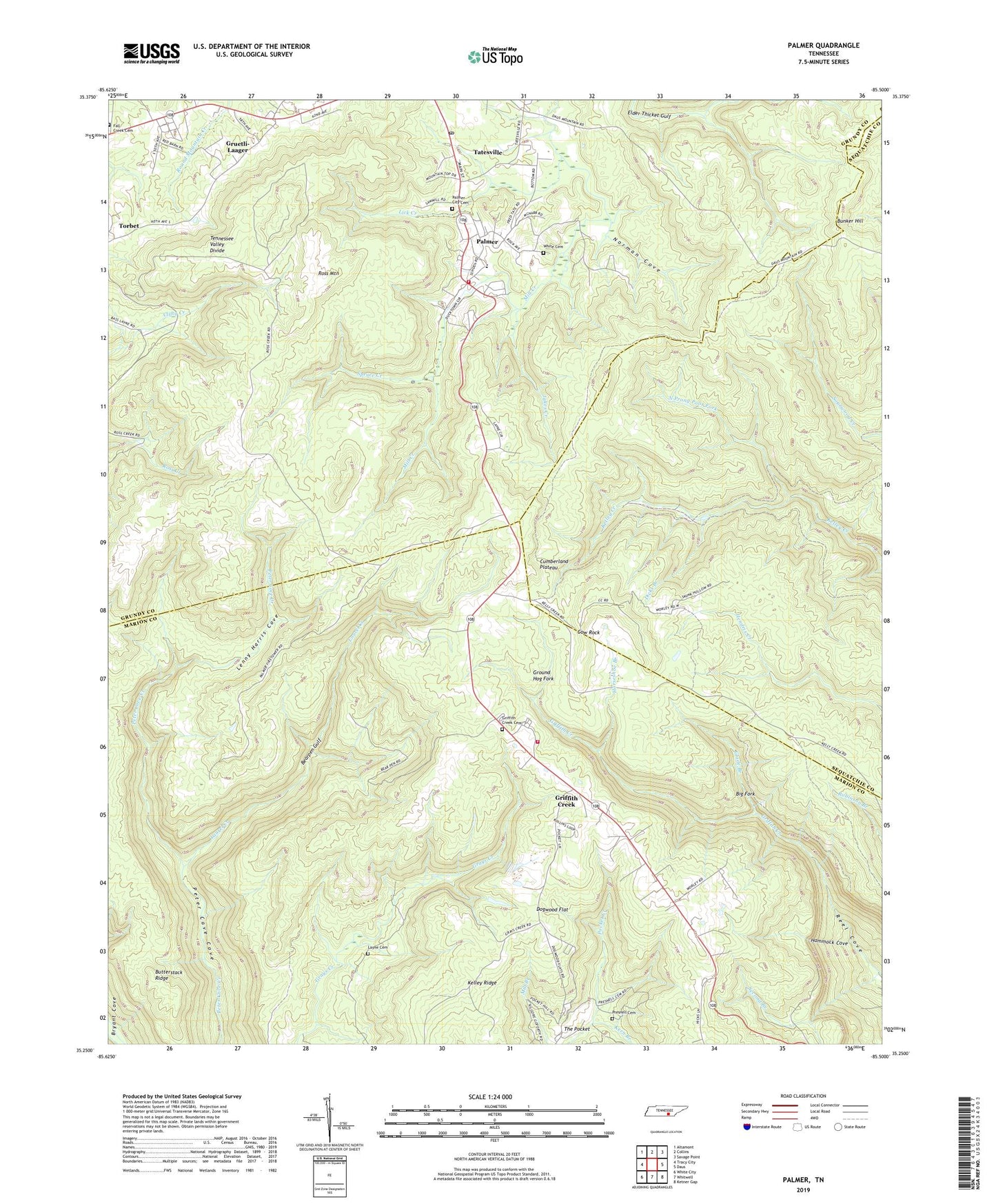
2019 topographic map quadrangle Palmer in the state of Tennessee. Scale: 1:24000. Based on the newly updated USGS 7.5' US Topo map series, this map is in the following counties: Marion, Grundy, Sequatchie. The map contains contour data, water features, and other items you are used to seeing on USGS maps, but also has updated roads and other features. This is the next generation of topographic maps. Printed on high-quality waterproof paper with UV fade-resistant inks.
Quads adjacent to this one:
West: Tracy City
Northwest: Altamont
North: Collins
Northeast: Savage Point
East: Daus
Southeast: Ketner Gap
South: Whitwell
Southwest: White City
Contains the following named places: Bearpen Gulf, Big Fork, Bunker Hill, Butterstack Ridge, Coal Valley Mine, Commissioner District 2, Cow Rock, Dicks Branch, Dogwood Flat, First Branch, Glade Branch, Griffith Creek, Griffith Creek Cemetery, Griffith Creek Census Designated Place, Griffith Creek Church, Griffith Creek School, Ground Hog Fork, Gruetli-Laager, Hammock Cove, Horseshoe Branch, Jakes Creek, Kelley Ridge, Kern Branch, Laager, Laurel Creek, Layne Cemetery, Lenny Harris Cove, Lick Creek, Norman Cove, North Prong Poor Fork, Palmer, Palmer City Cemetery, Palmer Division, Palmer Elementary School, Palmer Fire and Rescue, Palmer Fire Tower, Palmer Mine, Palmer Post Office, Poor Fork, Presnell Cemetery, Reel Cove Mine, Ross Mountain, Second Branch, South Prong Poor Fork, Spruce Creek, Tatesville, Tatesville School, Town of Palmer, White Cemetery, Whitwell Mountain Fire and Rescue