MyTopo
Collins Tennessee US Topo Map
Couldn't load pickup availability
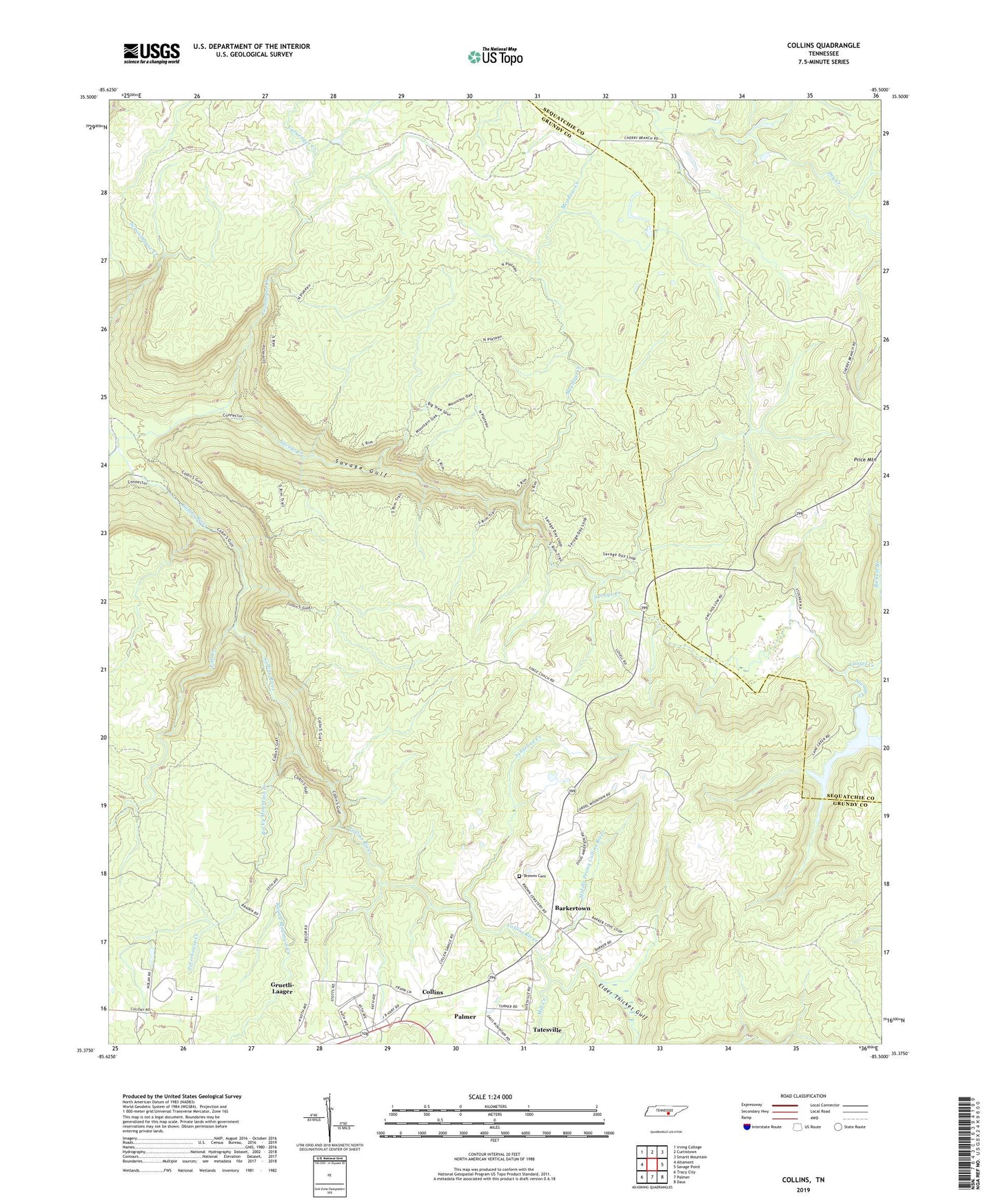
2022 topographic map quadrangle Collins in the state of Tennessee. Scale: 1:24000. Based on the newly updated USGS 7.5' US Topo map series, this map is in the following counties: Grundy, Sequatchie. The map contains contour data, water features, and other items you are used to seeing on USGS maps, but also has updated roads and other features. This is the next generation of topographic maps. Printed on high-quality waterproof paper with UV fade-resistant inks.
Quads adjacent to this one:
West: Altamont
Northwest: Irving College
North: Curtistown
Northeast: Smartt Mountain
East: Savage Point
Southeast: Daus
South: Palmer
Southwest: Tracy City
This map covers the same area as the classic USGS quad with code o35085d5.
Contains the following named places: Barker School, Barkertown, Big Creek, Browns Chapel, Browns Chapel Cemetery, Caruenger Creek, Coffeeville Church, Collins, Collins School, Dunaway Creek, Elder Thicket Gulf, Fairview Church, Fall Creek, Jonathan Creek, Laurel Creek, Meadow Creek, Middle Prong Collins River, Mill Creek, Perry Creek, Peterhouse Creek, Price Mountain, Rocky Mountain Creek, Round Mountain Creek, S K Johnson Lake, S K Johnson Lake Dam, Savage Creek, Savage Gulf, Savage Gulf State Natural Area, South Cumberland Recreation Area, Swiss Elementary School, Walker Branch, ZIP Code: 37365