
MyTopo
Purdy Tennessee US Topo Map
Couldn't load pickup availability
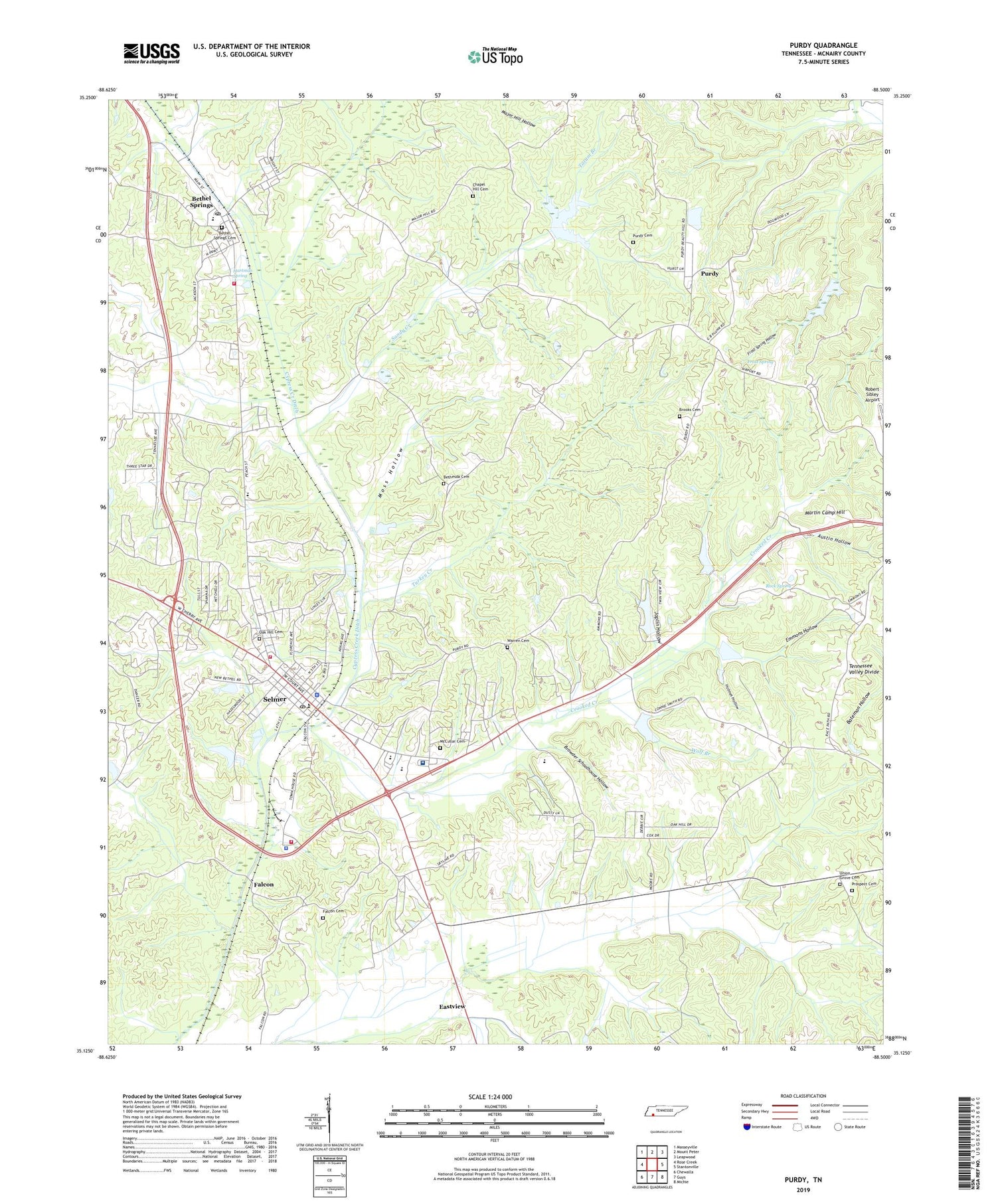
2019 topographic map quadrangle Purdy in the state of Tennessee. Scale: 1:24000. Based on the newly updated USGS 7.5' US Topo map series, this map is in the following counties: McNairy. The map contains contour data, water features, and other items you are used to seeing on USGS maps, but also has updated roads and other features. This is the next generation of topographic maps. Printed on high-quality waterproof paper with UV fade-resistant inks.
Quads adjacent to this one:
West: Rose Creek
Northwest: Masseyville
North: Mount Peter
Northeast: Leapwood
East: Stantonville
Southeast: Michie
South: Guys
Southwest: Chewalla
Contains the following named places: Austin Hollow, Bethel Springs, Bethel Springs Cemetery, Bethel Springs Elementary School, Bethel Springs Fire Department, Bethel Springs First Baptist Church, Bethel Springs Post Office, Bethesda Cemetery, Bethesda Church, Brooks Cemetery, Browder Schoolhouse Hollow, Bull Branch, Chapel Hill Cemetery, Commissioner District 6, Crooked Creek, Emmons Hollow, Factory Branch, Falcon, Falcon Cemetery, Falcon Church, Frost Spring, Frost Spring Hollow, Hartman Spring, Hendrix Branch, Holmes Hollow, Joplin Hollow, Martin Camp Hill, McCullar Cemetery, McNairy Central High School, McNairy County, McNairy County Farm, McNairy County Landfill, McNairy County Sheriff's Department, McNairy Cypress Watershed Dam Number Seventeen, McNairy Regional EMS, McNairy Regional Hospital, Moss Hollow, Mount Zion Church, North Fork Oxford Creek, Oak Hill Cemetery, Prospect Cemetery, Prospect Church, Purdy, Purdy Cemetery, Purdy School, Robert Sibley Airport, Rock Spring, Sandy Creek, Selmer, Selmer Church, Selmer Division, Selmer Elementary School, Selmer Fire Department Main Station, Selmer Fire Department North Station, Selmer Middle School, Selmer Police Department, Selmer Post Office, Sibley Branch, Simpson Branch, South Fork Oxford Creek, Sulphur Branch, Tacker Creek, Tanyard Branch, Tatum Branch, Town of Bethel Springs, Town of Selmer, Turkey Creek, Twin Springs Dam, Twin Springs Lake, Union Grove Cemetery, Union Grove Church, Warren Cemetery, WDTM-AM (Selmer), Wolf Branch, ZIP Code: 38375


