MyTopo
Guys Tennessee US Topo Map
Couldn't load pickup availability
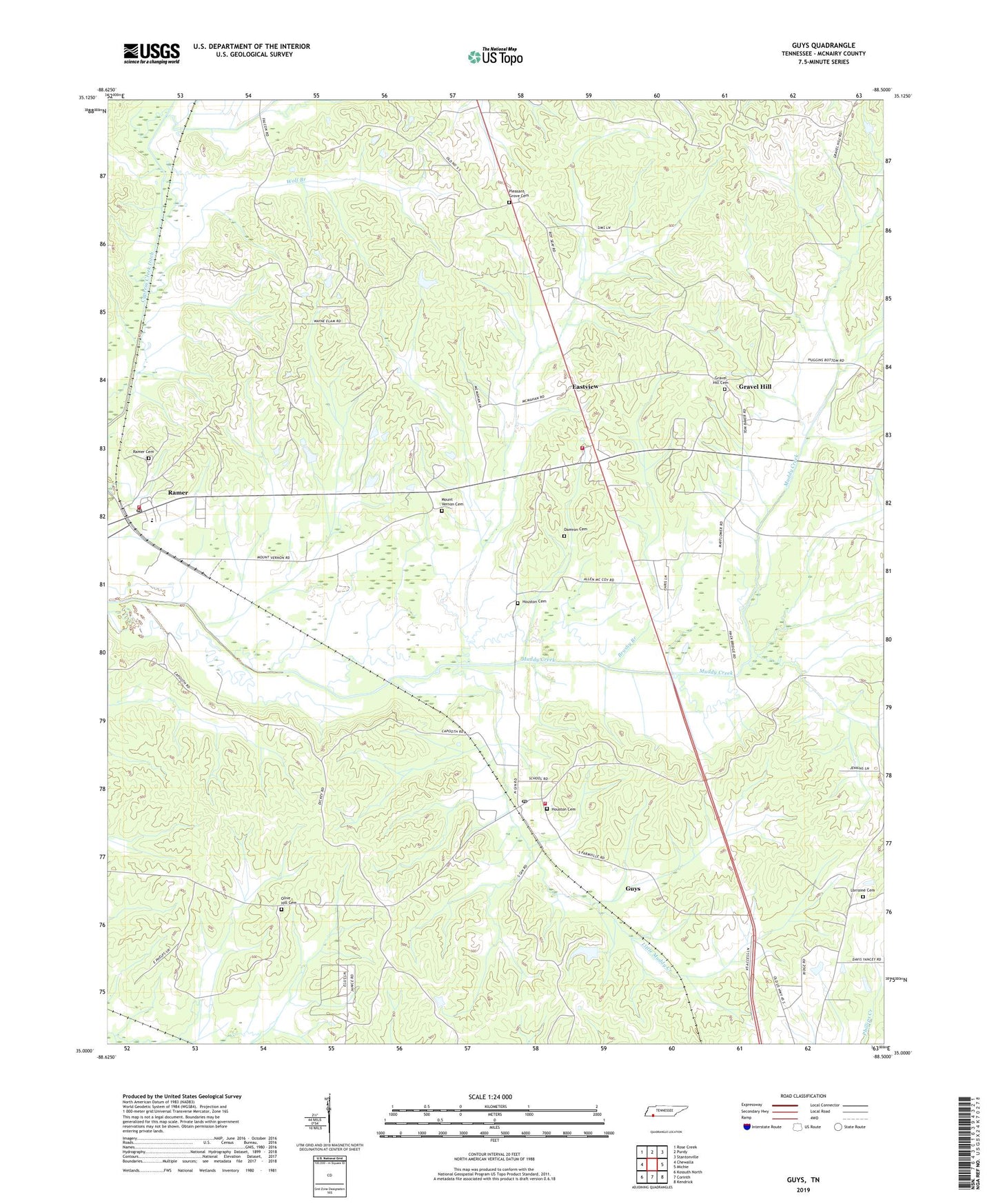
2022 topographic map quadrangle Guys in the state of Tennessee. Scale: 1:24000. Based on the newly updated USGS 7.5' US Topo map series, this map is in the following counties: McNairy. The map contains contour data, water features, and other items you are used to seeing on USGS maps, but also has updated roads and other features. This is the next generation of topographic maps. Printed on high-quality waterproof paper with UV fade-resistant inks.
Quads adjacent to this one:
West: Chewalla
Northwest: Rose Creek
North: Purdy
Northeast: Stantonville
East: Michie
Southeast: Kendrick
South: Corinth
Southwest: Kossuth North
This map covers the same area as the classic USGS quad with code o35088a5.
Contains the following named places: Adams Chapel School, Berua Church, Brushy Branch, City of Ramer, Damron Cemetery, Eastview, Eastview Volunteer Fire Department, Eastview-Ramer Division, Gravel Hill, Gravel Hill Baptist Church, Gravel Hill Cemetery, Gravel Hill School, Guys, Guys Post Office, Guys School, Guys Volunteer Fire Department, Houston Cemetery, Little Muddy Creek, Lorraine Cemetery, Lorraine Church, Mount Olive Church, Mount Vernon Cemetery, Mount Vernon Church, Olive Hill Cemetery, Olive Hill Church, Oxford Creek, Pleasant Grove Cemetery, Prairie Branch, Ramer, Ramer Baptist Church, Ramer Cemetery, Ramer Elementary School, Ramer Fire Department, Ramer Post Office, Roland Creek, Rosenwald School, Saint Rest Church, Saint Rest School, Town of Eastview, Town of Guys, Wades Chapel, Wolf Branch, ZIP Codes: 38339, 38367