MyTopo
Michie Tennessee US Topo Map
Couldn't load pickup availability
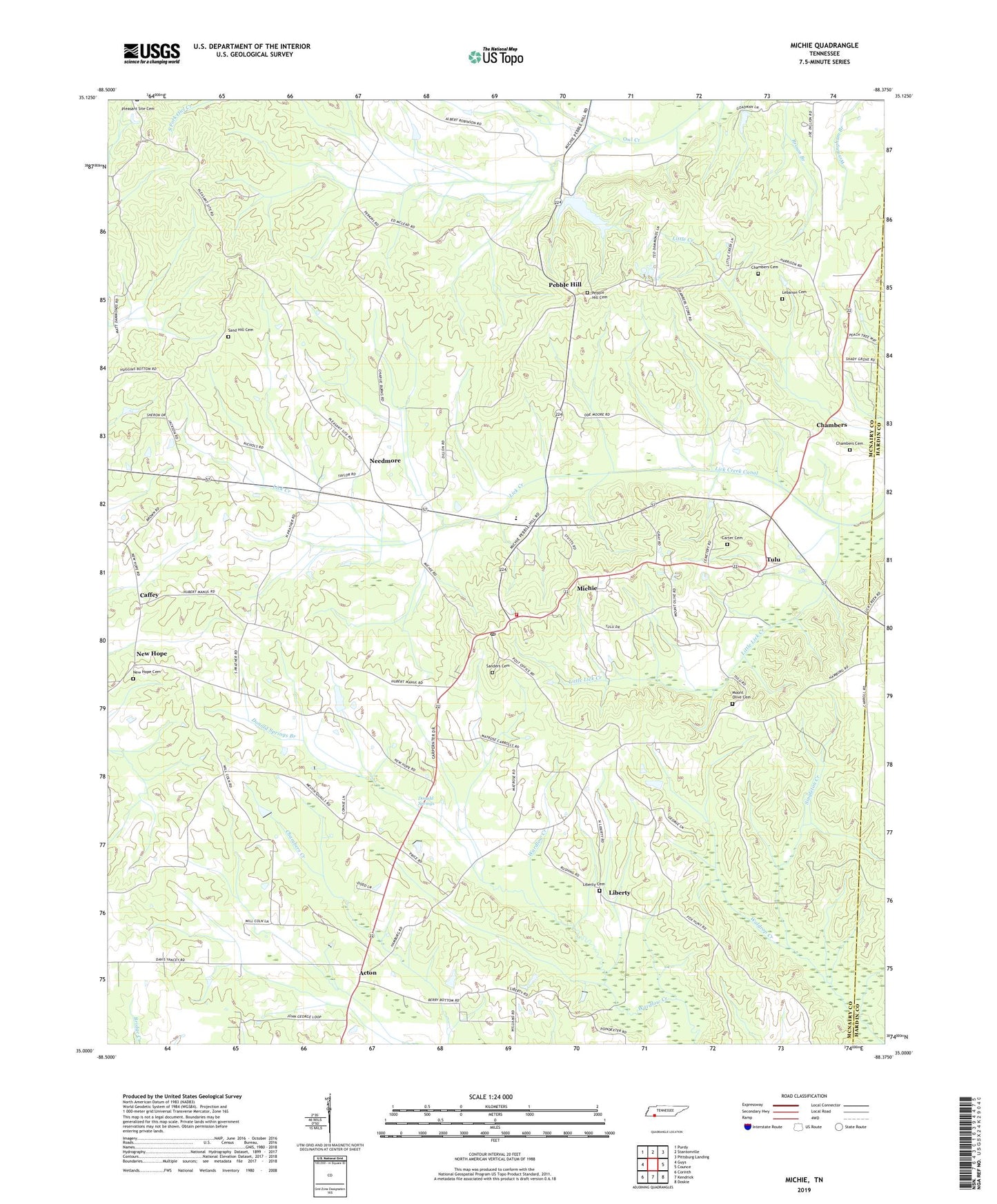
2022 topographic map quadrangle Michie in the state of Tennessee. Scale: 1:24000. Based on the newly updated USGS 7.5' US Topo map series, this map is in the following counties: McNairy, Hardin. The map contains contour data, water features, and other items you are used to seeing on USGS maps, but also has updated roads and other features. This is the next generation of topographic maps. Printed on high-quality waterproof paper with UV fade-resistant inks.
Quads adjacent to this one:
West: Guys
Northwest: Purdy
North: Stantonville
Northeast: Pittsburg Landing
East: Counce
Southeast: Doskie
South: Kendrick
Southwest: Corinth
This map covers the same area as the classic USGS quad with code o35088a4.
Contains the following named places: Acton, Acton Church of Christ, Atkins Mill, Brooks School, Caffey, Carter Cemetery, Chambers, Chambers Cemetery, Church of God of Prophecy, Commissioner District 7, Donald Springs, Donald Springs Branch, Lebanon Cemetery, Lebanon Church, Liberty, Liberty Branch, Liberty Cemetery, Liberty Church, Liberty School, Little Lick Creek, Little Owl Creek, McCullar Church, Michie, Michie Division, Michie Elementary School, Michie First Baptist Church, Michie Post Office, Michie Volunteer Fire and Rescue Department, Moore School, Mount Olive Cemetery, Mount Olivet Church, Needmore, New Hope, New Hope Cemetery, New Hope Church, New Hope School, Pebble Hill, Pebble Hill Cemetery, Pebble Hill Church, Pebble Hill School, Rushing School, Sand Hill Cemetery, Sand Hill Church, Sand Hill School, Sanders Cemetery, Sharp Branch, Singleton Creek, Spring Branch, Town of Michie, Tulu, Wyatt Branch, ZIP Code: 38357