MyTopo
Rose Creek Tennessee US Topo Map
Couldn't load pickup availability
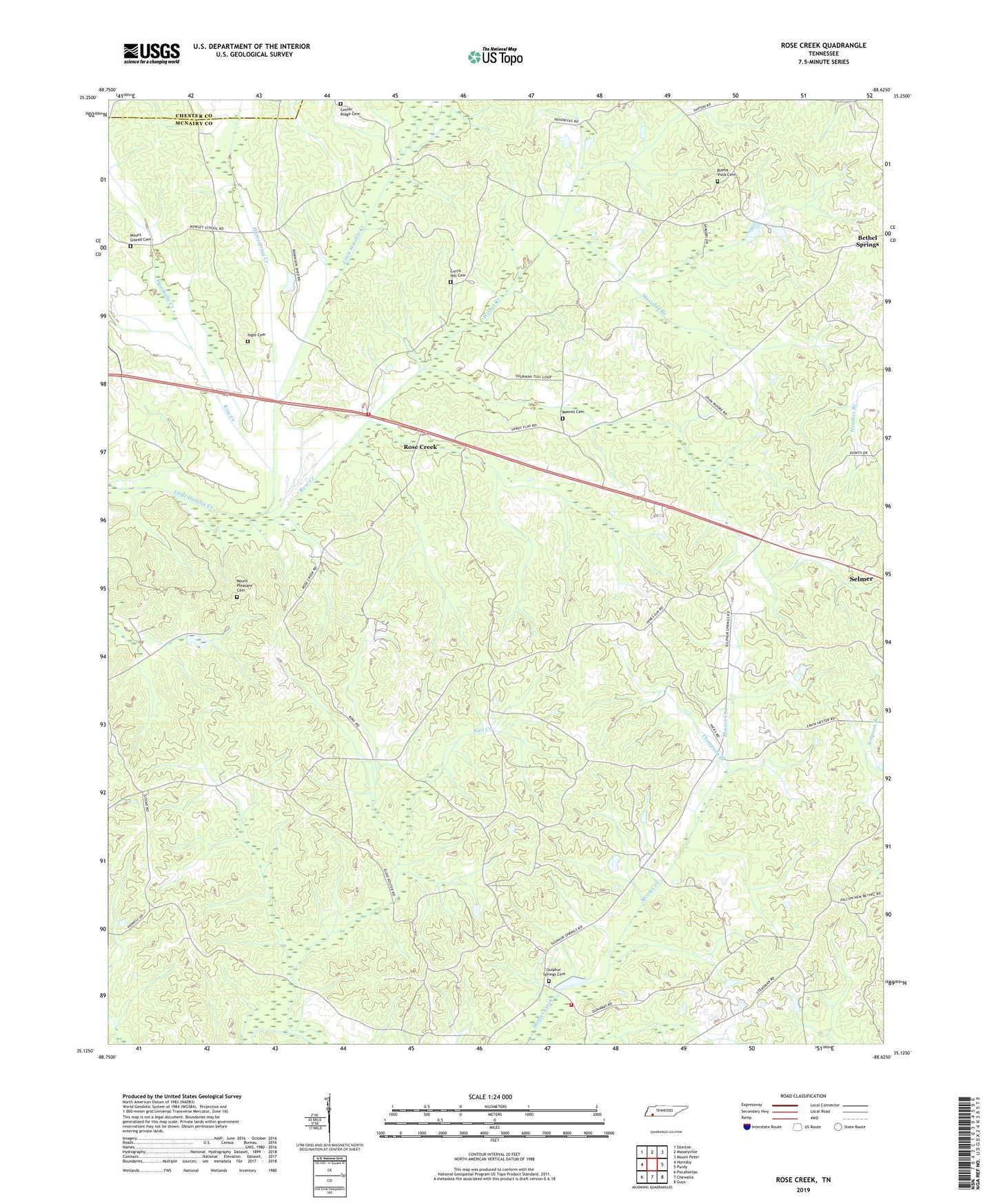
2019 topographic map quadrangle Rose Creek in the state of Tennessee. Scale: 1:24000. Based on the newly updated USGS 7.5' US Topo map series, this map is in the following counties: McNairy, Chester. The map contains contour data, water features, and other items you are used to seeing on USGS maps, but also has updated roads and other features. This is the next generation of topographic maps. Printed on high-quality waterproof paper with UV fade-resistant inks.
Quads adjacent to this one:
West: Hornsby
Northwest: Silerton
North: Masseyville
Northeast: Mount Peter
East: Purdy
Southeast: Guys
South: Chewalla
Southwest: Pocahontas
Contains the following named places: Abernathy Branch, Bethel Springs Division, Buena Vista Cemetery, Buena Vista Church, Center Ridge Cemetery, Center Ridge Church, Chapel Branch, Commissioner District 4, Curtis Hill Cemetery, Curtis Hill Church, Gilmore Branch, Goodrun Branch, Hamestring Creek, Hendrix Branch, Hodger Branch, Ingle Cemetery, Keith Branch, Kise Creek, Maxedon Branch, McNairy County Fire Department Station 41 Sulphur Springs Fire Department, McNairy County Fire Department Station 43 Rose Creek Fire Department, Moores Cemetery, Moores Church, Moores School, Mount Gilead Cemetery, Mount Gilead Church, Mount Pleasant Cemetery, Mount Pleasant Church, Nail Creek, Nail Creek Branch, New Bethel Church, Piney Grove Church, Prices Chapel, Red Oak School, Rose Creek, Rose Creek School, Sandy Flat Church, Sulphur Springs, Sulphur Springs Cemetery, Sulphur Springs School, Thompson Branch, Whitehurst Airport, Wilson Creek, Woodville Creek