MyTopo
Saulsbury Tennessee US Topo Map
Couldn't load pickup availability
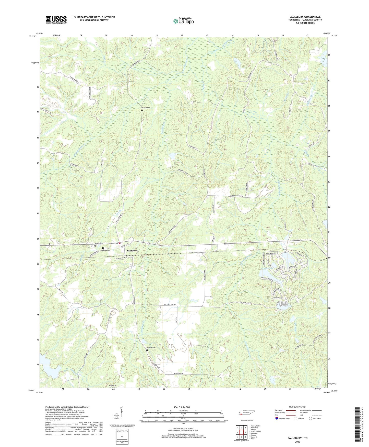
2019 topographic map quadrangle Saulsbury in the state of Tennessee. Scale: 1:24000. Based on the newly updated USGS 7.5' US Topo map series, this map is in the following counties: Hardeman. The map contains contour data, water features, and other items you are used to seeing on USGS maps, but also has updated roads and other features. This is the next generation of topographic maps. Printed on high-quality waterproof paper with UV fade-resistant inks.
Quads adjacent to this one:
West: Grand Junction
Northwest: Hickory Valley
North: Middleburg
Northeast: Hebron
East: Middleton
Southeast: Walnut
South: Camp Hill
Southwest: Canaan
Contains the following named places: Antioch Cemetery, Candlewood Dam, Candlewood Lake, Cash Creek, Chancellor and Son Dam, Chancellor and Son Lake, Click Branch, Commissioner District 5, Crystal Lake, Crystal Lake Dam, Dry Branch, East Fork Spring Creek, Elliots Chapel, Fortune Branch, Frese Pond, Grand Junction Division, Indian Creek Watershed Number Seven Lake, Kellyham Branch, Landis Dam, Landis Lake, Old Hickory Dam, Old Hickory Lake, Optimist Club Lake, Optimist Club Lake Dam, Pleasant Grove Missionary Baptist Church, Pleasant Grove School, Pleasant Hill School, Porters Creek Dam Number Nine, Porters Creek Lake Number Nine, Pruette Cemetery, Ramah Church, Rocky Springs Church, Saulsbury, Saulsbury Baptist Church, Saulsbury Cemetery, Saulsbury Creek, Saulsbury Fire Department, Saulsbury Post Office, Saulsbury School, Spring Lake, Spring Lake Dam, Town of Saulsbury, West Fork Spring Creek, West Memorial Church, Wright Cemetery, ZIP Code: 38067