MyTopo
Sinking Cove Tennessee US Topo Map
Couldn't load pickup availability
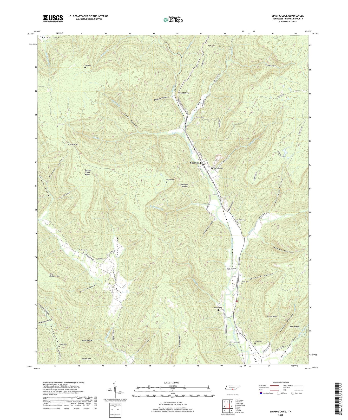
2019 topographic map quadrangle Sinking Cove in the state of Tennessee. Scale: 1:24000. Based on the newly updated USGS 7.5' US Topo map series, this map is in the following counties: Franklin. The map contains contour data, water features, and other items you are used to seeing on USGS maps, but also has updated roads and other features. This is the next generation of topographic maps. Printed on high-quality waterproof paper with UV fade-resistant inks.
Quads adjacent to this one:
West: Pitcher Ridge
Northwest: Winchester
North: Sewanee
Northeast: Monteagle
East: Orme
Southeast: Doran Cove
South: Eureka
Southwest: Hytop
Contains the following named places: Anderson School, Apps Hollow, Barnes Point, Bear Hollow, Bee Cliff Hollow, Brush Creek, Buck Creek, Burned Stand Ridge, Cane Hollow, Cedar Ridge, Clark Branch Creek, Commissioner District 5, Crabtree Hollow, Cross Creek, Crow Creek Valley Volunteer Fire Department, Crow Creek Valley Volunteer Fire Department Station 1, Crownover Cemetery, Custard Hollow, Dry Creek, Dry Creek School, Garner Cemetery, Gass Cemetery, Gonce Cemetery, Hamp Hollow, Holly Flat Cove, Hoosier Cemetery, Jackson Cemetery, Lick Hollow, Long Hollow, Los Cove, Lynch Cemetery, Mandy Hollow, Mister and Mrs Larry Lee Carter Natural Area, Mokay Hollow, Morris Cemetery, Narrows Hollow, No Business Creek, Presley Cemetery, Pumplog Hollow, Red Hill Cemetery, Round Cove, Rush Creek, Sherwood, Sherwood Cemetery, Sherwood Census Designated Place, Sherwood Division, Sherwood Elementary School, Sherwood Post Office, Sinking Cove, Sinking Cove School, Stubblefield Hollow, Tantallon, The Narrows, The Spur, Tom Pack Hollow, Vaughn Hollow, Vine Branch, Wilkinson Hollow, Wilkson Hollow, Willard Cemetery, Winding Stairs, Youngs Creek, ZIP Code: 37376