MyTopo
Pitcher Ridge Tennessee US Topo Map
Couldn't load pickup availability
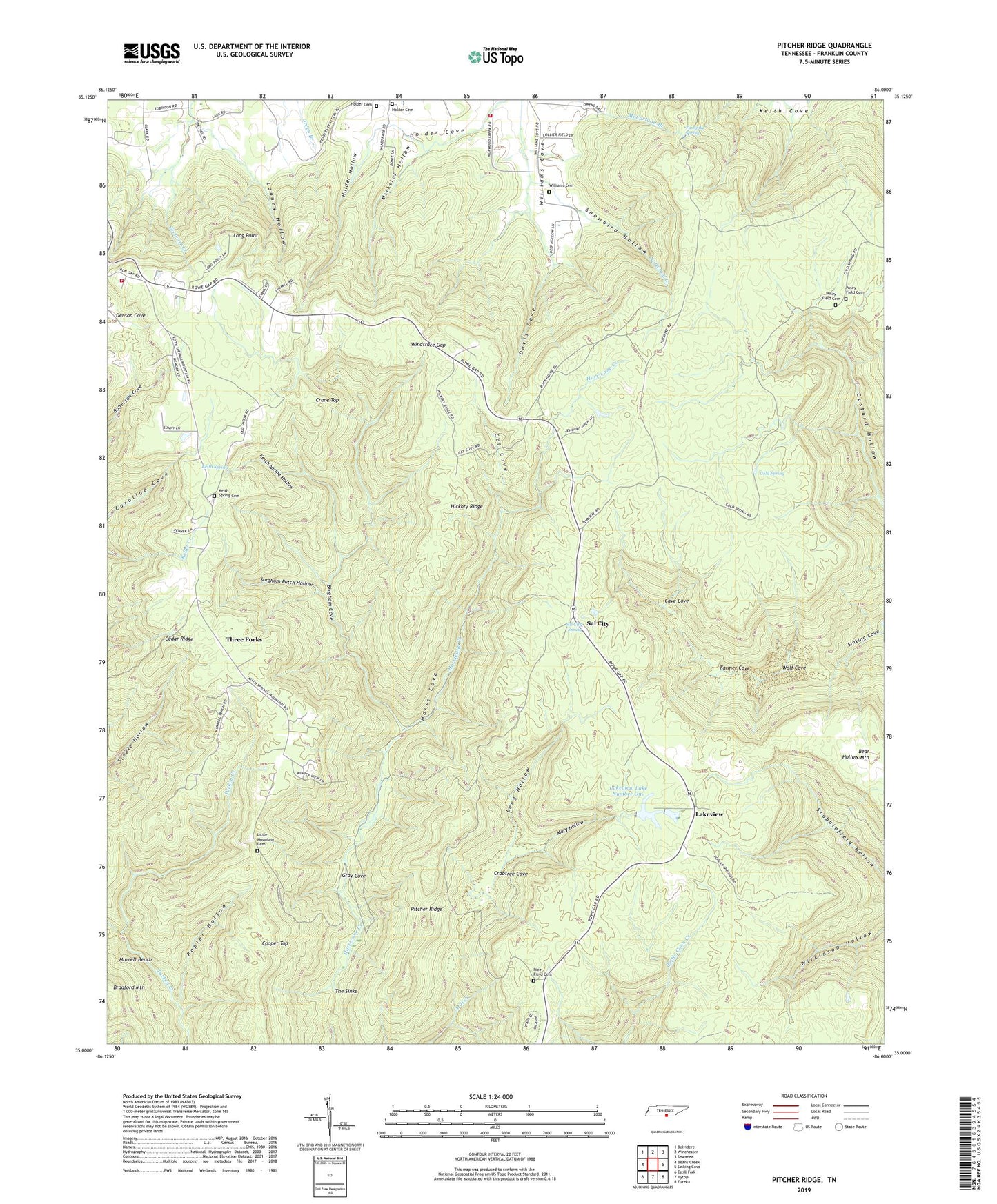
2022 topographic map quadrangle Pitcher Ridge in the state of Tennessee. Scale: 1:24000. Based on the newly updated USGS 7.5' US Topo map series, this map is in the following counties: Franklin. The map contains contour data, water features, and other items you are used to seeing on USGS maps, but also has updated roads and other features. This is the next generation of topographic maps. Printed on high-quality waterproof paper with UV fade-resistant inks.
Quads adjacent to this one:
West: Beans Creek
Northwest: Belvidere
North: Winchester
Northeast: Sewanee
East: Sinking Cove
Southeast: Eureka
South: Hytop
Southwest: Estill Fork
This map covers the same area as the classic USGS quad with code o35086a1.
Contains the following named places: Bear Hollow Mountain, Bingham Cove, Brierfield School, Cal Place, Cat Cove, Cave Cove, Cedar Ridge, Cold Spring, Cooper Top, Crabtree Cove, Crabtree Cove School, Crane Top, Davis Cove, Denson Cove, Farmer Cove, Franklin County 4th District Volunteer Fire Department, Gray Cove, Hickory Ridge, Hickory Ridge Point, Holder Cemetery, Holder Cove, Holder Hollow, Horse Cove, Keith Spring, Keith Spring Cemetery, Keith Spring Church, Keith Spring Hollow, Keith Springs, Keith Springs School, Keith Springs Volunteer Fire Department, Lakeview, Lakeview Lake Number One, Lakeview Lake Number One Dam, Little Mountain Cemetery, Little Mountain School, Long Hollow, Long Point, Looney Hollow, Mary Hollow, Milksick Hollow, Murrell Bench, Pitcher Ridge, Poplar Hollow, Posey Field, Posey Field Cemetery, Rice Field, Rice Field Cemetery, Rowe Gap Church, Sal City, Sal City Spring, Salt Lick, Snowbird Hollow, Sorghum Patch Hollow, The Sinks, Three Forks, Turnpike Spring, Williams Cemetery, Windtrace Gap, Wolf Cove