
MyTopo
Taft Tennessee US Topo Map
Couldn't load pickup availability
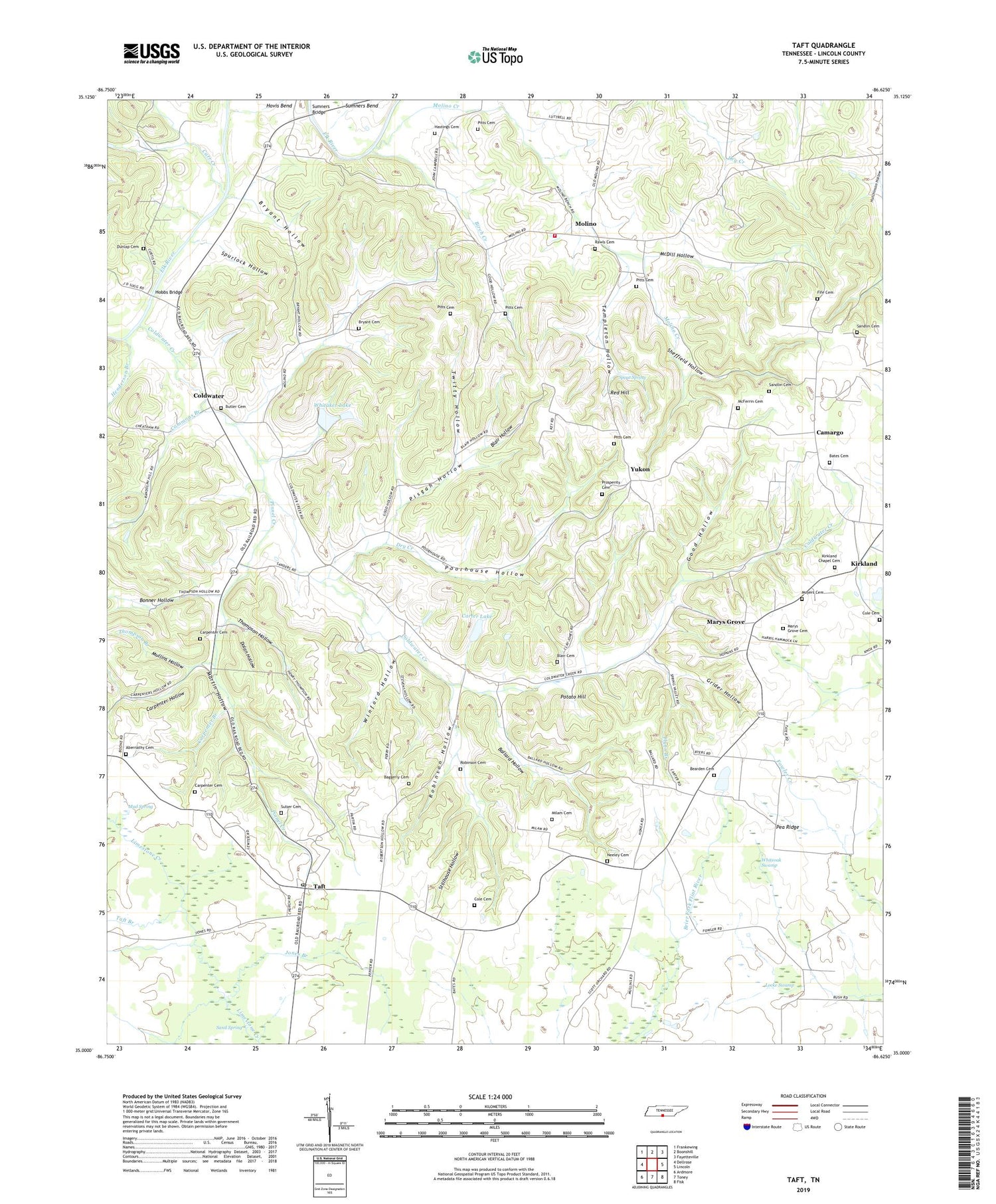
2019 topographic map quadrangle Taft in the state of Tennessee. Scale: 1:24000. Based on the newly updated USGS 7.5' US Topo map series, this map is in the following counties: Lincoln. The map contains contour data, water features, and other items you are used to seeing on USGS maps, but also has updated roads and other features. This is the next generation of topographic maps. Printed on high-quality waterproof paper with UV fade-resistant inks.
Quads adjacent to this one:
West: Dellrose
Northwest: Frankewing
North: Boonshill
Northeast: Fayetteville
East: Lincoln
Southeast: Fisk
South: Toney
Southwest: Ardmore
Contains the following named places: Abernathy Cemetery, Baggerly Cemetery, Ballard Hollow, Bates Cemetery, Bearden Cemetery, Birch Creek, Blair Cemetery, Blair Hollow, Bonner Hollow, Boureois Farm, Bryant Cemetery, Bryant Hollow, Butler Cemetery, Camargo, Camargo Church, Camargo School, Carpenter Branch, Carpenter Cemetery, Carpenter Hollow, Carr Creek, Carter Lake, Carter Lake Dam, Cash Point-Blanche Division, Coldwater, Coldwater Creek, Coldwater Farms, Coldwater School, Cole Cemetery, Commissioner District 1, Commons Branch, Coneflower Farm, Cumberland Church, Dolan Hollow, Double J Farms, Dragonfly Farm, Dry Creek, Dunlap Cemetery, Fife Cemetery, Flynn Branch, Good Hollow, Graham Farms, Grider Hollow, Hastings Cemetery, Henderson Branch, Hobbs Bridge, Jones Branch, Kirkland, Kirkland Chapel, Kirkland Chapel Cemetery, Laue Farm, Lincoln County Farm, Locke Swamp, Louis Lake, Louis Lake Dam, Martin Hollow, Marys Grove, Marys Grove Cemetery, Marys Grove School, McDill Hollow, McFerrin Cemetery, Milam Cemetery, Mineral Springs Farm, Molino, Molino Creek, Molino Fire and Rescue, Molino School, Motlow Farms, Moyers Cemetery, Mud Spring, Mud Spring Branch, Mullins Hollow, Neeley Cemetery, Nickle Creek Sod Farm, Pinnel Creek, Pisgah Hollow, Pitts Cemetery, Poorhouse Hollow, Potato Hill, Prosperity Cemetery, Prosperity Church, Rawls Cemetery, Red Hill, Robinson Cemetery, Robinson Hollow, Sand Spring, Sandlin Cemetery, Sheffield Hollow, Shields Gin, Smith Chapel, Spout Spring, Spurlock Hollow, Stillhouse Hollow, Sulser Cemetery, Sumners Bend, Sumners Bridge, Taft, Taft Branch, Taft Census Designated Place, Taft Post Office, Taft School, Templeton Hollow, Thompson Branch, Thompson Hollow, Tucker Pond, Twitty Hollow, Unity Church, Whitaker Lake, Whitaker Lake Dam, Whiteoak Swamp, Willow Springs Farm, Winford Hollow, Yukon, ZIP Code: 38488


