MyTopo
Anna Texas US Topo Map
Couldn't load pickup availability
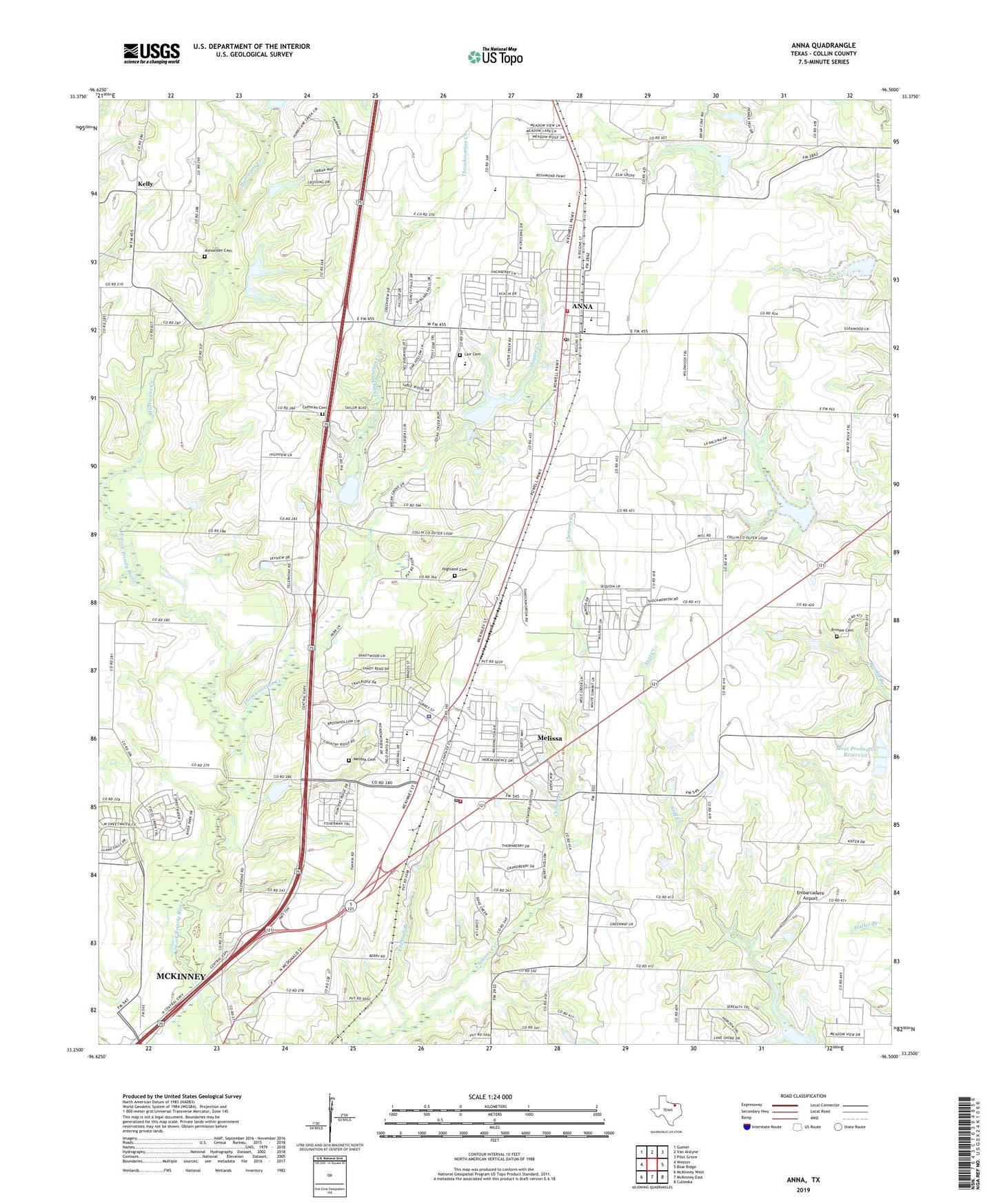
2019 topographic map quadrangle Anna in the state of Texas. Scale: 1:24000. Based on the newly updated USGS 7.5' US Topo map series, this map is in the following counties: Collin. The map contains contour data, water features, and other items you are used to seeing on USGS maps, but also has updated roads and other features. This is the next generation of topographic maps. Printed on high-quality waterproof paper with UV fade-resistant inks.
Quads adjacent to this one:
West: Weston
Northwest: Gunter
North: Van Alstyne
Northeast: Pilot Grove
East: Blue Ridge
Southeast: Culleoka
South: McKinney East
Southwest: McKinney West
Contains the following named places: Alexander Cemetery, American Medical Response, Anna, Anna City Hall, Anna Division, Anna Fire Department, Anna High School, Anna Middle School, Anna Post Office, Brinlee Cemetery, City of Anna, City of Melissa, Coffman Cemetery, Embarcadero Airport, First Baptist Church Melissa, Fitzhugh Branch, Highland Cemetery, Hurricane Creek, Independent School, Kelly, KSSA-FM (McKinney), Lair Cemetery, Meat Producers Dam, Meat Producers Reservoir, Melissa, Melissa Cemetery, Melissa City Hall, Melissa Fire Department, Melissa Police Department, Melissa Post Office, Melissa Ridge Elementary School, Melyissa Junior High School, Parris, Rosamond Church, Slayer Creek Wastewater Treatment Plant, Slayter Creek, Soil Conservation Service Site 43 Dam, Soil Conservation Service Site 43 Reservoir, Soil Conservation Service Site 44 Dam, Soil Conservation Service Site 44 Reservoir, Soil Conservation Service Site 45 Dam, Soil Conservation Service Site 45 Reservoir, Soil Conservation Service Site 46 Dam, Soil Conservation Service Site 46 Reservoir, Soil Conservation Service Site 47 Dam, Soil Conservation Service Site 47 Reservoir, Soil Conservation Service Site 48 Dam, Soil Conservation Service Site 48 Reservoir, Soil Conservation Service Site 6 Dam, Soil Conservation Service Site 6 Reservoir, Soil Conservation Service Site 7 Dam, Soil Conservation Service Site 7 Reservoir, Soil Conservation Service Site 8 Dam, Soil Conservation Service Site 8 Reservoir, Soil Conservation Service Site 9 Dam, Soil Conservation Service Site 9 Reservoir, Throckmorton Creek, White Rock Church, ZIP Codes: 75409, 75454