MyTopo
Blue Ridge Texas US Topo Map
Couldn't load pickup availability
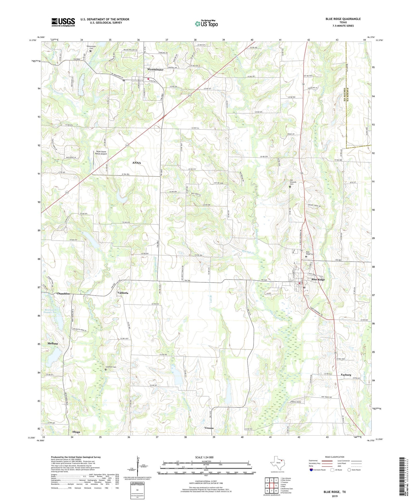
2022 topographic map quadrangle Blue Ridge in the state of Texas. Scale: 1:24000. Based on the newly updated USGS 7.5' US Topo map series, this map is in the following counties: Collin, Fannin. The map contains contour data, water features, and other items you are used to seeing on USGS maps, but also has updated roads and other features. This is the next generation of topographic maps. Printed on high-quality waterproof paper with UV fade-resistant inks.
Quads adjacent to this one:
West: Anna
Northwest: Van Alstyne
North: Pilot Grove
Northeast: Trenton
East: Pike
Southeast: Farmersville
South: Culleoka
Southwest: McKinney East
This map covers the same area as the classic USGS quad with code o33096c4.
Contains the following named places: Blue Ridge, Blue Ridge Airport, Blue Ridge Cemetery, Blue Ridge City Hall, Blue Ridge Division, Blue Ridge Elementary School, Blue Ridge High School, Blue Ridge Middle School, Blue Ridge Police Department, Blue Ridge Post Office, Blue Ridge Volunteer Fire Department, Brinlee Branch, Chambliss, City of Blue Ridge, City of Blue Ridge Wastewater Treatment Plant, City of Westminster, Coleman Cemetery, Desert Creek, Elm Grove Cemetery, Elm Grove Creek, Fayburg, Hatler Branch, Old Grounds Cemetery, Red Oak Creek, Reservoir Number Eleven, Reservoir Number Ten, Snow Hill, Snow Hill Church, Soil Conservation Service Site 10 Dam, Soil Conservation Service Site 10 Reservoir, Soil Conservation Service Site 11 Dam, Soil Conservation Service Site 14 Dam, Soil Conservation Service Site 14 Reservoir, Soil Conservation Service Site 15 Dam, Soil Conservation Service Site 15 Reservoir, Soil Conservation Service Site 16 Dam, Soil Conservation Service Site 16 Reservoir, Soil Conservation Service Site 17 Dam, Soil Conservation Service Site 17 Reservoir, Soil Conservation Service Site 28 Dam, Soil Conservation Service Site 28 Reservoir, Soil Conservation Service Site 29 Dam, Soil Conservation Service Site 29 Reservoir, Soil Conservation Service Site 33 Dam, Soil Conservation Service Site 33 Reservoir, Stoney Point Cemetery, Stony Point Church, Tejas Stone Ranch Airport, Valdasta, Verona, Westminster, Westminster Census Designated Place, Westminster Post Office, Westminster Volunteer Fire Department, Wolf Run Creek, ZIP Code: 75424